

Visit Us
Wetland management districts offer us all a chance to unplug from the stresses of daily life and connect with our natural surroundings. A visit to a waterfowl production area waterfowl production area
Waterfowl production areas are small natural wetlands and grasslands within the National Wildlife Refuge System that provide breeding, resting and nesting habitat for millions of waterfowl, shorebirds, grassland birds and other wildlife. Virtually all waterfowl production areas are in the Prairie Pothole Region states of Iowa, Minnesota, Montana, North Dakota and South Dakota.
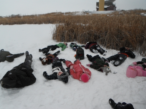
Learn more about waterfowl production area can be a brief and refreshing break from travelling on Interstate 94, stretching your legs while watching swooping swallows and listening to bubbly purple martins. It can mean chaperoning your child’s field trip exploration, discovering zippy water bugs and laying back in towering soft grasses together. It can mean a hunting adventure with friends as you sweep across prairie hills or huddle in the cattails. Whether you come to hunt, fish, view wildlife, participate in educational and interpretive programs, volunteer with conservation activities or photograph nature, Fergus Falls Wetland Management District provides outdoor recreation activities for all ages, abilities and backgrounds. We welcome you to join us in enjoying and caring for this spectacular landscape. We hope you visit as regularly and often as possible, because each experience holds unexpected mysteries, wonders and joys to delight your heart and mind and connect you to land and sky, water and wildlife.
Fergus Falls Wetland Management District is situated in western Minnesota on the eastern edge of North America’s prairie pothole region, also known as the duck factory. About 118 million acres in size, the prairie pothole region produces more than 50 percent of the continent’s waterfowl due to the matrix of its historically highest density of wetlands and associated upland prairie. These wetlands of varying sizes and depths skirted by short, mixed and tallgrass prairies are places unlike any other. They still provide nesting habitat for a rich variety of dabbling and diving ducks despite a landscape-scale conversion to agriculture in the breadbasket of the world. Here, trumpeter swans glide gracefully across the water as their haunting calls echo under an expansive sky and the earthy smell of wetland reeds and clean water drift through the air.
The Prairie Wetlands Learning Center
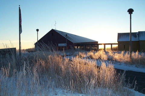
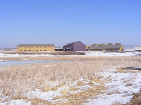
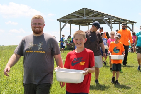
Fergus Falls Wetland Management District provides quality environmental education and other outdoor opportunities for the public at the Prairie Wetlands Learning Center. It is the only residential environmental education facility in the National Wildlife Refuge System.
The Prairie Wetlands Learning Center is located on State Hwy 210, one mile east of Exit 57 off of Interstate 94. The center houses interpretive exhibits and offers educational programs for both the general public and organized groups. Nearly four miles of trails provide opportunities for wildlife watching, hiking and cross-country skiing. The center is the origin of two established birding trails: the Minnesota River Birding Trail, leading southward through the state; and the northbound Pine-to-Prairie Birding Trail. It is also a Prairie Passage site.
The lands of the Prairie Wetlands Learning Center, within the Townsend Waterfowl Production Area, are open to wildlife observation, environmental education and interpretation, photography, hiking and cross-country skiing. It is not open for hunting, fishing or trapping. Pets and bicycles are not allowed at the Prairie Wetlands Learning Center.
Driving Directions
To the Fergus Falls Wetland Management District headquarters office located at 18965 County Highway 82, Fergus Falls: Take Interstate 94 to Otter Tail County Road 82 (Exit 61) and travel north two and a half miles to the headquarters on the left side of the road.
To the Prairie Wetlands Learning Center located at 602 State Highway 210E, Fergus Falls: Take Interstate 94 to State Highway 210 East (Exit 57) and travel north for one mile. The center entrance is on the right side of the road. Look for brown and white directional signs on Interstate 94 and on Highway 210.
Fees
There is no charge to visit.
Restrooms
Public restrooms are available inside the Prairie Wetlands Learning Center visitor center during regular hours. An outdoor restroom is also available next to the barn.
Points of Interest
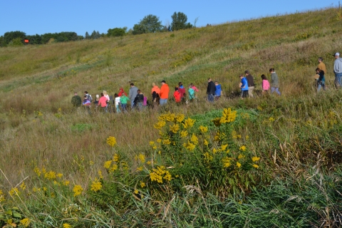
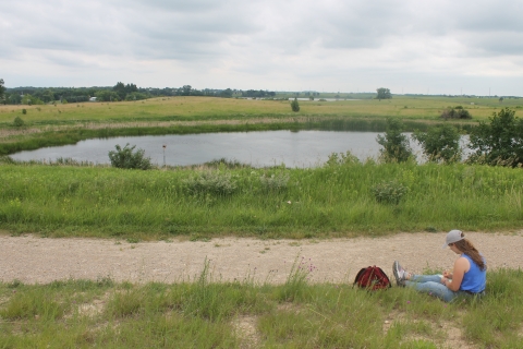
Explore 330 acres of rolling grassy hills and 28 wetlands via three and a half miles of hiking trails. Trails include an amphitheater, butterfly garden, floating bridge, floating dock, oak savanna and lake.
The Prairie Wetlands Learning Center is just the beginning. Sample our district by visiting more waterfowl production areas in our five-county area.
The following waterfowl production areas represent different aspects of our district for visitors to enjoy:
- Rabbit River Waterfowl Production Area is a 614 acre unit located in Western Township of Otter Tail County. Rabbit River is known for its abundant waterfowl, prairie chickens and scenic prairie vistas. Waterfowl and pheasant hunting are great activities to participate in on this unit.
- Tenhoff Waterfowl Production Area is a 360 acre unit in Osakis Township of Douglas County. Tenhoff is known for a vibrant and lively marsh that covers a large portion of this unit. The marsh can be easily enjoyed from the road for those who are unable to walk long distances.
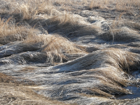
Waves of frosty frozen grasses at Ridgeway Waterfowl Production Area Ridgeway Waterfowl Production Area is a 1,133 acre unit in Orwell Township of Otter Tail County. Ridgeway is known for an excellent complex of wetlands especially temporary and seasonal wetlands as well as spectacular prairie scenery. Its size alone makes it an impressive waterfowl production area. Wildlife observation as well as pheasant, waterfowl and deer hunting are some of the activities available here.
- Fabian Waterfowl Production Area is a 57 acre unit in Aastad Township of Otter Tail County. Fabian is a sleeper among waterfowl production areas. It is a small unit, but it has a native prairie with the most diverse mix of prairie plants and wildflowers anywhere in our district. This is a great place to photograph wildflowers during the summer.
- Meadows Waterfowl Production Area is a 1,233 acre unit in Meadows and Manston Townships of Wilkin County. Meadows is our largest waterfowl production area. Birding here in the spring is superb. The shallow water that covers this expansive prairie attracts a huge diversity of migrating waterfowl, shorebirds, prairie songbirds, and waterbirds. This unit provides a landscape perspective of what the prairie in this area used to look like.
- Agassiz‐Beachline Waterfowl Production Area is a 680 acre unit in Carlisle Township of Otter Tail County. Agassiz has the largest tract of unbroken prairie in our district at 207 acres in size and has a total of 359 acres of unbroken native prairie. We have photographs of the native prairie on this unit being hayed using draft horses which reminds us of what prairie life was like for the settlers of this area. Wildlife observation and photography are excellent on this unit.
- Odens Waterfowl Production Area is a 520 acre waterfowl production area in Lund Township of Douglas County. Odens has a history of heavy waterfowl use due to the excellent quality, quantity, and diversity of wetlands on this tract. The rolling prairie hills on this unit also contain a large tract of oak savannah. Waterfowl and deer hunting are great activities on this tract.
- Heinola Waterfowl Production Area is 360 acre unit in Newton Township of Otter Tail County. Heinola has a great diversity of wetland types and sizes as well as some healthy stands of timber. This is great a great place to enjoy rolling prairie, a diverse wetland community, and woodland plants.
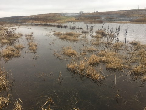
A peaceful winter wetland at Nicholson Waterfowl Production Area Spink Waterfowl Production Area is a 750 acre unit in Delaware and Lien Townships of Grant County. Spink is also known for heavy waterfowl use. Spink surrounds a shallow alkali lake called Hibrooten Lake. Hibrooten Lake provides excellent habitat for diving ducks, and unique species like Wilson's phalarope have been seen here during migration. Waterfowl and deer hunting as well as wildlife observation will be impressive here.
- Nicholson Waterfowl Production Area is a 1,165 acre unit in Tumili Township of Otter Tail County. Nicholson is our second largest waterfowl production area and is known for its diversity of habitats including wetlands, prairie, woods and the Pomme de Terre river bottom. The large marsh on the north end of the waterfowl production area is known for heavy waterfowl use, and bald eagles nest just west of this marsh each summer. The stand of timber on this tract has a good diversity of woodland plants.
What To Do
If you have 15 minutes at the Prairie Wetlands Learning Center
- Check out the view from the deck and use the spotting scope to search for birds and muskrats on Mallard Marsh
- Take a quick walk on the Parking Lot Trail Loop, to the Butterfly Garden or to the bridge on Mallard Marsh
If you have one hour at the Prairie Wetlands Learning Center
- Enjoy a stroll around Mallard Marsh or hang out on the bridge or on the dock at Adams Pond
- Take a brisk hike on the Tatanka Trail
If you have half a day or more at the Prairie Wetlands Learning Center or in the Fergus Falls Wetland Management District
- Trek to the south end to see Tungseth Lake at the Prairie Wetlands Learning Center
- Explore other waterfowl production areas
Know Before You Go
When planning a trip to the district, it is important to wear sturdy shoes for land excursions and to dress for the weather. Consider bringing water, snacks, binoculars, field guides, a hat, sunscreen, insect repellent and anything else that might make the outdoor experience more enjoyable, especially your sense of wonder. Leave pets and bikes at home.
Accessibility Information
Buildings
Prairie Wetlands Learning Center buildings are generally accessible to people with disabilities. The visitor center and dorm each have an elevator. The barn is a single-level building. The water fountains and restrooms are accessible.
Trails
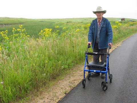
Trails near the parking lot and buildings are level, paved asphalt and sometimes uneven due to weeds growing through the surface. These trails or sidewalks are kept clear of snow in the winter during regular business hours. Remaining trails are not cleared so that visitors can cross-country ski and snowshoe. Remaining trails are crushed gravel and mowed and either level or with significant slopes in varying directions due to the hilly terrain.
Educational Programs
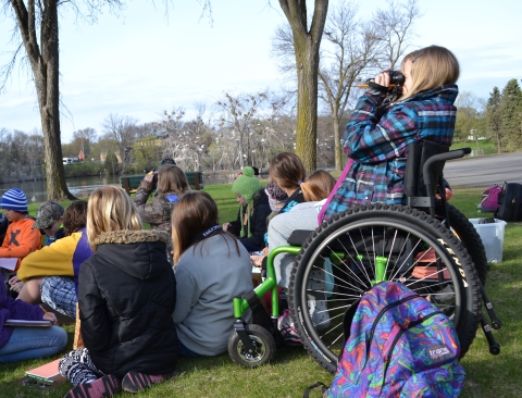
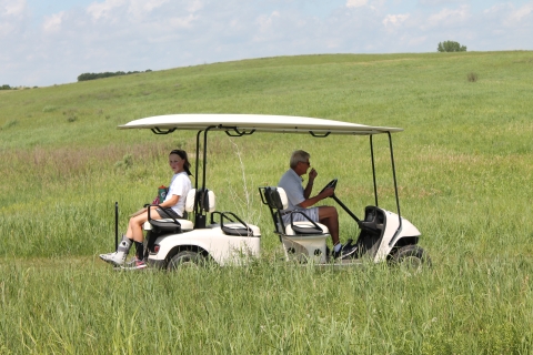
If you need alternative transportation due to a physical disability, several options are available. Prairie Wetlands Learning Center has a manual outdoor wheelchair, a sled for winter/snow, and a golf cart for summer. If you anticipate needing to use them or have other special needs that staff should be aware of to ensure maximum participation, please let us know when booking your reservation or when registering.
Visitor Tips
The best times of day to observe wildlife depends upon the season and weather. In spring and fall, with migration in constant flow, just about any time is worthwhile. In hot summer weather, relatively cooler temperatures in early morning and late evening often make for the best viewing opportunities. In winter, air temps usually increase and peak in the afternoon for more activity and warmth of wildlife and people.
Waterfowl production areas are typically most visited by people on weekends in fall during waterfowl and deer hunting seasons. Prairie Wetlands Learning Center, within the Townsend Waterfowl Production Area, is busiest on weekdays during the school year. Remember to leave pets and bikes at home.
Activities
Wetland management districts are for wildlife and people! Wildlife comes first on all lands within the National Wildlife Refuge System. Human activities must be compatible with the needs of wildlife. Six priority uses are encouraged when appropriate: hunting, fishing, wildlife observation, photography, environmental education and interpretation. Fergus Falls Wetland Management District offers all of these opportunities and more.
Recreational opportunities abound on over 220 units called waterfowl production areas, nearly 50,000 acres of land in the Fergus Falls Wetland Management. Our district lands two major biomes in Minnesota, offering beautiful prairie scenery in the west and hardwood forests in the east. Most waterfowl production areas offer many recreational activities including hunting, wildlife observation, photography, hiking, fishing, cross-country skiing and berry-picking. All of them are open to the public except for several that are posted "closed."
All uses are subject to federal and state laws, including hunting and trapping. Trapping is not allowed on Northern Tallgrass Prairie National Wildlife Refuge tracts.
Trails
Prairie Wetlands Learning Center trails are configured in a series of lengthening, overlapping loops extending from the north end of the property to the south end. They mainly weave through open prairie and past numerous wetlands and one lake, although one trail passes over a wetland with a bridge and another through a shady oak savanna. Two trails have short spurs, one leading uphill to a prairie overlook and the other to a dock. The North Country National Scenic Trail overlays the Wetland Way Trail providing connections to the south side of Fergus Falls and to DeLagoon Park on the edge of town. An open shelter is located on the far south end near Tungseth Lake. Benches are located periodically on each trail. Peek at mergansers and wood ducks using the nesting boxes and mallards in the cylindrical hen houses -- bring binoculars for added detail.
Parking Lot Loop
Open season: All
Length: 0.25 mile
Location of trail: Loops from parking lot, past visitor center, dorm, amphitheater and barn, back to the parking lot
Surface: Asphalt, wood deck, wood steps
Difficulty: Easy. Level ground. Kept clear of snow in winter.
Information: ADA compliant except for the stairs when the visitor center or dorm are closed. Elevators are located inside each building, available when buildings are open to the public. Passes Gentian Ponds and Center Pond, which is also viewed from above on the deck. Relax on several benches on the deck or in the amphitheater near the barn. A rich variety of prairie wildflowers and grasses bloom from early spring through mid-fall, peaking in mid-summer. Watch for four different species of nesting swallows: barn swallows under the deck, cliff swallows on the barn and silo, purple martins in the white gourds and tree swallows and eastern bluebirds in the wooden boxes.

Mallard Marsh Trail
Open season: All
Length: 0.5 mile from parking lot and back
Location of trail: Loops around west Mallard Marsh
Surface: Mostly asphalt. Grassy spur. Wooden bridge.
Difficulty: Easy. Level ground and ADA compliant except for moderately sloped spur uphill to a prairie overlook.
Information: Overlaps with loop from the Parking Lot Loop. Passes the education wing and greenhouse, connects with spur to Butterfly Garden and scenic view, connects to Chickadee Woods, crosses Mallard Marsh on floating wooden bridge, connects to the Tatanka Trail, loops around West Mallard Marsh and reconnects to the Tatanka Trail near the barn and amphitheater. A rich variety of prairie wildflowers and grasses bloom from early spring through mid-fall, peaking in mid-summer. Wildflower identification booklets available for free loan in the visitor center to use on this trail.
Tatanka Trail
Open season: All
Length: One-mile from parking lot and back
Location of trail: Connects with Mallard Marsh Trail south of the bridge and loops back around to the Wetland Way Trail just south of the barn Surface Packed gravel with mowed grass edges
Difficulty: Mostly easy to moderate due to length and one slope
Information: Loops through the Mallard Oaks, an oak savanna on the south side of east Mallard Marsh. Continues past Prairie Pothole, a true pothole with no connectivity to other water bodies and out into the open prairie. Connects to the Wetland Way Trail at a Y-intersection southwest of Prairie Pothole. Travels past Deer Pond, a shallow, grassy wetland, then the trail switches back and forth downhill, passing Frog Pond, a spur to the Adams Pond floating dock, and on to Wetland Way Trail which leads back to the barn and Parking Lot Loop. Listen and watch for displaying bobolinks in spring and summer and coyote tracks in the snow.

Wetland Way Trail
Open season: All
Length: Two miles from parking lot and back
Location of trail: In the heart of the Prairie Wetlands Learning Center trail system, south of the Tatanka Trail, connecting with it on the east side of the center near Muskrat Marsh and on the north side near Gentian Ponds, just south of the barn.
Surface: Packed gravel with mowed grass edges
Difficulty: Mostly easy to moderate due to length
Information: Connects to the Tatanka Trail at the Y-intersection southeast of Prairie Pothole. Continues downhill past Hidden Pond and Muskrat Marsh, then connects with the Tintah Trail at a Y-intersection and the North Country National Scenic Trail. Passes by Dakota Pond and a 3-way intersection where it joins the other end of the Tintah Trail. Continues past Tintah Slough and weaves through Snail Shell Marsh, Cattail Marsh and Golden Valley Pond. Connects with the North Country National Scenic Trail on the west side of the Prairie Wetlands Learning Center, near State Highway 210. Travels around Adams Pond where it joins the Tatanka Trail near the barn.
Tintah Trail
Open season: All
Length: Three miles from parking lot and back
Location of trail: The southern-most trail, located on the southeast side of the Prairie Wetlands Learning Center, south of the Wetland Way Trail.
Surface: Packed gravel with mowed grass edges
Difficulty: Mostly easy to moderate due to length
Information: Connects to the Wetland Way Trail at the Y-intersection southeast of Muskrat Marsh. The North Country National Scenic Trail splits off to the east, Goose Drive, DeLagoon Park and the Central Lakes Trail. Meanders between Willow Wetland and L.C. Wetland and skirts Tungseth Lake. Passes by Eggshell Marsh, then heads north past Muggs Marsh, connecting with the Wetland Way Trail between Dakota Pond and Tintah Slough.
Other Facilities in the Complex
While not technically considered a complex, three U.S. Fish and Wildlife Service offices are co-located in Fergus Falls, Minnesota, at our district headquarters office building:
- Fergus Falls Wetland Management District, part of the National Wildlife Refuge System
- Fergus Falls Wetlands Acquisition Office, a field office of the Midwest Region, Division of Realty
- Habitat and Population Evaluation Team, part of the Division of Migratory Birds
Rules and Policies
Hunting, fishing and trapping seasons generally follow state seasons and regulations.
To ensure your safety and protect wildlife and habitat, please be aware of district regulations. When in doubt, contact district staff and if needed, obtain a special use permit. We appreciate your desire to appreciate and protect our valuable wild places and wild things.
Locations
Fergus Falls Wetland Management District lands are located in five counties: Wilkin, Otter Tail, Grant, Wadena, and Douglas.
Two main sites provide information for visitors, the Fergus Falls Wetland Management District headquarters office and the Prairie Wetlands Learning Center.
The district headquarters houses U.S. Fish and Wildlife Service staff who perform prairie and wetland management, restorations, maintenance, and law enforcement. They work on waterfowl production areas as well as easements and habitat projects on privately owned lands within the district. Stop by this office if you need assistance with the Partners for Fish and Wildlife program, law enforcement, or conservation easements.
To Visit the Fergus Falls Wetland Management District Headquarters
Take Interstate 94 to Otter Tail County Road 82 (Exit 61) and travel north two and a half miles to the headquarters.
Fergus Falls Wetland Management District lands are located in five counties: Wilkin, Otter Tail, Grant, Wadena, and Douglas.
Two main sites provide information for visitors, the Fergus Falls Wetland Management District headquarters office and the Prairie Wetlands Learning Center.
The Prairie Wetlands Learning Center serves as the main visitor contact station for the district and offers a visitor center, dormitory, hiking trails, educational and interpretive programming, and volunteer activities. It is the home of the Friends of the Prairie Wetlands Learning Center and the Prairie Science Class partnership.
Nearly four miles of trails provide opportunities for wildlife-dependent recreation. The Prairie Wetlands Learning Center is the origin of two established birding trails: the Minnesota River Birding Trail, leading southward through the state; and the northbound Pine-to-Prairie Birding Trail. It is also a Prairie Passage site. The North Country National Scenic Trail makes its southern most route through the hiking trails at the Prairie Wetlands Learning Center.
To Visit the Prairie Wetlands Learning Center
Take Interstate 94 to State Highway 210 East (Exit 57) and travel north for one mile. The entrance is on the right side of the road. Look for brown and white directional signs on Interstate 94 and on Highway 210.