


Temporary Closures:
Wilkie segment of the Minnesota Valley State Trail
The Wilkie segment of the Minnesota Valley State Trail will be closed to all public access between Shakopee and Bloomington under U.S. Highway 169 beginning Monday, July 6th, and is expected to reopen at the end of August. Contractors will be reconstructing the asphalt trail surface and taking steps to mitigate risk of future flooding. For visitor safety, please respect all signs throughout the closure period.
The Old Cedar Avenue boardwalk is being replaced beginning July 20th, with work concluding in mid-October. Throughout this project, the following closures and access limitations are in place:
- Boardwalk: Closed
- Old Cedar Avenue parking lot: Reduced parking capacity
- Bluff Trail west of Old Cedar Avenue parking lot: Closed Monday - Friday, 7 am to 6 pm
Visit our trails page for more information.
Habitat Restoration - Goats on the Refuge
Over the summer season, visitors may see a team of goats grazing to clear invasive plants near the North Hunter Lot on our Rapids Lake Unit. We ask visitors to enjoy the goats from a distance, respecting the herd and their work by staying on trail and outside of the fence, and do not attempt to feed or pet them. Learn more about Invasive Species Work on the refuge.
Contact the Bloomington Education and Visitor Center with questions at: 952-854-5900.
Visit Us
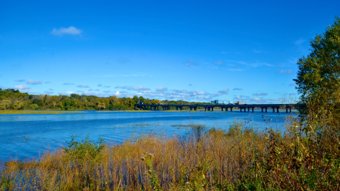
National wildlife refuges offer us all a chance to unplug from the stresses of daily life and reconnect with our natural surroundings. With more than 45 miles of trails open to hiking, biking, snowshoeing and cross-country skiing, you can easily find a trailhead within minutes of Bloomington, Burnsville, Shakopee, Chaska, Carver, Jordan and Henderson, Minnesota. The Minnesota River valley unfolds in front of you, and moments later you can find safe, quiet and beautiful lands filled with wildlife. Visitors can easily find opportunities to try out fishing in ponds, lakes and the Minnesota River, and there are also portions of the refuge open for hunting.
Menu
Fees What To Do Know Before You Go Visitor Tips Restrooms Activities Trails Rules and Policies
Fees
There is no charge to visit.
What To Do If You Have…
30 Minutes
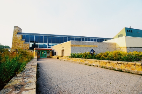
- Visit the Bloomington Education and Visitor Center at Bloomington:
- Bird watch at the bird feeders and catch a sunset at the overlook
- Chat with a volunteer, explore the exhibits, watch our film in the auditorium and find local artists’ work in the Confluence Gallery
- Take a walk along the Hillside Trail to reach the wetlands
- Visit the Rapids Lake Education and Visitor Center at Carver:
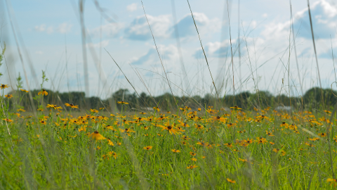
- View a vast array of native flowers blooming in the prairie in summer
- Visitor center offers historical and nature exhibits
- View the historic Gehl-Mittelstead homestead along the riverbank
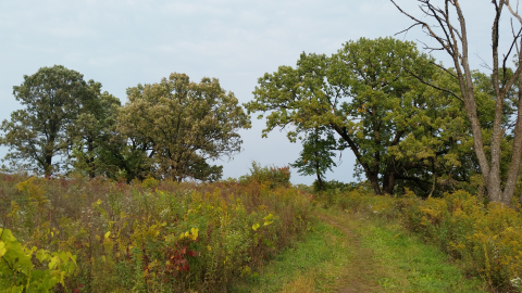
- Hike through oak and hickory forest at the Forest Loop Trail
1-2 Hours
- Go fishing along the Long Meadow Lake or fishing dock at Bass Ponds in Bloomington
- Enjoy an afternoon of free play and picnicking at the Nature Play Area at Old Cedar Trailhead in Bloomington
- Bike along the Minnesota River on the River Bottoms Trail - departing from Sorenson Landing in Bloomington
- Hike to the glacial erratic at Louisville Swamp starting from the Middle Road Trail parking spot
- Hike the Rapids Lake Trail to walk through scenic bottomland forests and along the Minnesota River valley. When water levels are low you can view river rapids.
2+ Hours
- Explore the paved trail via bike or stroller along the Minnesota River Greenway Trail in Burnsville. This is a great spot for fishing too!
- Explore the marshes of the Blue Lake Trail a nesting and resting area for waterfowl year-round.
- Hike through the Mazomani Trail to see wetlands and upland forests to encounter historic sites at the Louisville Swamp Unit
Know Before You Go
Bring the following with you:
- Refuge Maps - Intersections are well marked but will not make sense without a map. Maps are available at trail heads, both visitor centers and online for download. We are also found on Avenza Maps.
- Water - No potable water is available on the trails. Bottle filling stations are available inside the visitor centers during open hours.
- Protective Clothing - Weather can change quickly and biting insects can be abundant.
Plan on fishing? The Minnesota fish consumption guidelines advise all persons do not eat any fish from Bass Ponds and Long Meadow Lake on the refuge. We encourage all anglers review the fish consumption guidance from the Minnesota Department of Health prior to consuming any fish.
Plan to pack out what you pack in. Trash receptacles are only available at a few trailheads, and we ask that you practice Leave No Trace ethics while visiting the refuge.
Bringing your dog? Bring up to a 6-foot leash and bags for packing out dog waste with you when you leave.
Be aware, some areas may be closed during peak bird migration or due to maintenance or management activities. Trails are also prone to seasonal flooding. You can check conditions on our Trails section of the website, at the visitor centers, watch for closure and warning signs at trail heads or call us at 952-854-5900 from 9 a.m. to 5 p.m.
Visitor Tips
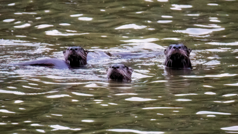
You can discover hundreds of species of birds, numerous plants, mammals, reptiles and insects during your visit. Seasons bring different opportunities to experience nearby nature, and every time you visit can bring a new discovery.
Wildlife viewing is best in the morning, or in the evening before dusk. Be aware that trailhead parking is limited and becomes very busy on weekends.
We have a variety of items available as part of our free outdoor equipment lending program. Binoculars, snowshoes and explorer backpacks are available at both visitor centers during operating hours.
- April - May is a great time for a hike and a special time to see migrating song birds just before the leaves pop out. You might even find morel mushrooms as the weather warms.
- June - August is perfect for fishing and biking. Make a list of wildflowers and enjoy identifying native plants in our prairies.
- September - November is cooler and provides enjoyable hikes with fewer biting insects.
- December - March provides snow for a snowshoe hike and view trumpeter swans and eagles near wetlands.
Restrooms
- Bloomington Education and Visitor Center at the Long Meadow Lake Unit in Bloomington
- Indoor bathrooms available during open hours
- Rapids Lake Education and Visitor Center at the Rapids Lake Unit in Carver
- Indoor bathrooms available during open hours
- Outdoor heated restroom open daily
- Old Cedar Avenue Trailhead at the Long Meadow Lake Unit in Bloomington
- Restroom facility with running water in partnership with the City of Bloomington, open from May – October 15
- Outdoor portable restroom open when flush toilets are not available
- Vault toilets are available at:
- Bass Ponds lower trailhead at the Long Meadow Lake Unit in Bloomington
- Jonathon Carver Parkway North Hunter parking lot at the Rapids Lake Unit in Carver
- Louisville Swamp North Trailhead parking lot at the Louisville Swamp Unit in Shakopee
Activities
There are many ways to enjoy the refuge! Visitors can explore more than 45 miles of trails on foot or by bicycle year-round, find a multitude of birds and other wildlife to watch or photograph, shore fish for native Minnesota freshwater species, hunt in select areas of the refuge or take part in free educational programs about nature.
Trails
Minnesota Valley National Wildlife Refuge offers close to 50 miles of trails along the Minnesota River from Bloomington to Henderson.
Learn more about the trails and current conditions below. Download one of the following trail maps to print or save to your device.
Downloadable Trail Maps
- Long Meadow Lake and Black Dog Lake Units trail map at Bloomington and Burnsville
- Bloomington Ferry and Wilkie Units trail map at Bloomington and Shakopee
- Rapids Lake, Chaska and Louisville Swamp Units trail map at Chaska, Carver and Jordan
Georeferenced Trail Maps
Download a georeferenced trail map to use on apps like Avenza, to track your location without using internet or network connection. Directions to download and add to your mobile device when you click any of the following trail maps.
- Long Meadow Lake and Black Dog Lake Units trail map at Bloomington and Burnsville
- Bloomington Ferry and Wilkie Units trail map at Bloomington and Shakopee
- Rapids Lake, Chaska and Louisville Swamp Units trail map at Chaska, Carver and Jordan
Trail and Hiking Related News (last updated 7/10/2026):
Closures and Updates:
- Louisville Swamp: Construction is underway for the Merriam Junction Regional Trail. This project will not impact public access to refuge lands. Please exercise caution near construction sites. Learn more about this project at Merriam Junction Regional Trail.
- Minnesota Valley State Trail (DNR)
- The Wilkie segment of the Minnesota Valley State Trail will be closed between Shakopee and Bloomington under U.S. Highway 169 beginning Monday, July 6th, and is expected to reopen at the end of August. Contractors will be reconstructing the asphalt trail surface and taking steps to mitigate risk of future flooding. For visitor safety, please respect all signs throughout the closure period.
- This trail is managed by the Minnesota Department of Natural Resources. Please visit their webpage for the latest updates on additional closures.
- Old Cedar Avenue: The Old Cedar Avenue boardwalk is being replaced beginning July 20th, with work concluding in mid-October. Throughout this project, the following closures and access limitations are in place:
- Boardwalk: Closed
- Old Cedar Avenue parking lot: Reduced parking capacity
- Bluff Trail west of Old Cedar Avenue parking lot: Closed Monday - Friday, 7 am to 6 pm
- River Bottoms Trail
- Visitors should use the new entrance of the trail from the Bloomington Ferry Kiosk.
- The trail going east from the Bloomington Ferry Trailhead is an out and back segment. A trail continues to Lyndale/Sorensen Landing in the Long Meadow Lake Unit, crossing privately owned and City of Bloomington property for an additional distance of about 4 miles. The refuge does not promote entering private property. At this time, there is not an alternative route for a through trail.
- State Access Trail: Trail will be closed to public access for repairs beginning July 13th. For visitor safety, please follow all marked closures. We anticipate reopening the trail by July 25th. The Louisville Swamp parking lot and all other trails will remain open during this time.
Other Facilities in the Complex

Rules and Policies
Refuges are first and foremost national treasures for the conservation of wildlife. Through careful planning, consistent refuge system-wide application of regulations and policies, diligent monitoring of the impacts of uses on wildlife resources and preventing or eliminating uses not appropriate to the refuge system, we can achieve the refuge system conservation mission while also providing the public with lasting opportunities to enjoy quality, compatible, wildlife-dependent recreation.
To help make your visit safe and enjoyable, read the Refuge Rules and Policies below for details about permitted and prohibited activities with additional site-specific regulations. Please consult the Wildlife Refuge Specialist at 952-854-5900 if you have questions.
Locations
Construction Updates:
As construction projects continue near the visitor center, please follow all detour signs during closure period.
From Interstate 494:
Exit 34th Ave and head south. At the stop light on American Blvd. East, proceed east for 1/4 mile around the bend and up a small rise to find the entrance on the right.
Metro Transit Blue Line Train:
Exit at American Blvd Station and cross 34th Avenue to the east. Proceed east on American Blvd East and follow the sidewalk 1/4 mile around the bend and up a small rise to find the entrance on the right.

Construction Updates:
As construction projects continue near the visitor center, please follow all detour signs during closure period.
From Hwy 169 in Jordan:
Proceed north 3.5 miles on County Road 9 across the Minnesota River bridge (where it becomes County Road 11) to Carver Highlands Drive and turn right. Continue onto Rapids Lake Road, winding down into the river valley to the visitor center.
From Hwy 212:
Exit on Jonathan Carver Parkway (County Road 11) and head south. Proceed 2.5 miles, continuing on County Road 11 by turning left. Proceed 1.9 miles and turn left on Carver Highlands Drive. Continue onto Rapids Lake Road, winding down into the river valley to the visitor center.