Minnesota Valley National Wildlife Refuge is host to over 46 miles of trails! Many trail heads are moments from public transit, and providing you with safe, convenient, and nearby nature experiences
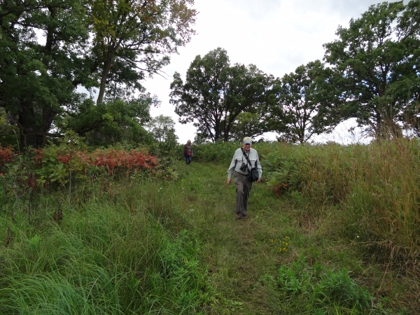
Many multi-purpose trails are open to runners and joggers as well as walkers. Hiking offers a chance to explore the Refuge and we have a mix of popular well maintained trails and rustic secluded trails, all along the Minnesota River from Bloomington to Carver. Whether you are looking for a short, convenient place to walk on a lunch break, or to spend a day exploring the nearby nature the Refuge provides, there are plenty of options to consider.
Be aware, some areas may be closed during peak bird migration, or due to maintenance or management activities. Trails are also prone to seasonal flooding, and you can check conditions at the visitor centers, call us at 952-854-5900 from 9 a.m. to 4 p.m., check our Trail Report page, or watch for closure and warning signs at trail heads.
Things to remember:
- Minnesota Valley NWR is located within the floodplain of the Minnesota River and as a result, many of our trails are subject to flooding. Check trail conditions before you head out.
- Visitors are welcome to hike anywhere on the Refuge unless otherwise posted or they may choose one of the many trails the Refuge has to offer.
- Hiking is permitted during hunting seasons. Please respect hunters by keeping your distance and for your safety wear orange or bright pink. Hiking or biking off trail during hunting season is prohibited. Learn more about areas where hunting occurs by visiting our hunting page.
- Dogs are welcome but must be leashed. Be a pet warrior and pick up their poo, then remember to plan to pack it out with you.
- For a list of all Refuge regulations see the Rules and Regulations page.
What to take with you:
- Refuge Map - intersections are well marked but will not make sense without a map. Maps are available at trail heads or the Refuge visitor centers, and can be viewed or downloaded below.
- Water - no potable water is available on the trails.
- Protective Clothing - weather can change quickly and biting insects can be abundant.
- Bringing your dog? Up to a 6-foot leash, and bags for packing out dog waste.
- Bug spray
- Sun screen