


What We Do
Our Services
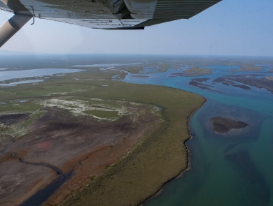
We produce and distribute maps and other geospatial data on American wetland and deepwater habitats, as well as monitor changes in these habitats through time. This information is available to the public through two resources: the Wetlands Geospatial Dataset and Wetlands Status and Trends reports. These provide complementary information on wetland and deepwater habitat type, location, and trends to support decision makers.
Our Mandates

The Emergency Wetlands Resources Act of 1986 requires the Secretary of the Interior, through the Director of the U.S. Fish and Wildlife Service, to map the nation's wetlands. It further requires the Secretary to produce national wetlands status and trends reports to Congress.
The Geospatial Data Act of 2018 requires the U.S. Department of Interior (DOI) to work with partners to effectively collect, produce, maintain, and disseminate the national Wetlands Data Layer. The Service is responsible for producing and maintaining the Wetlands Layer of the National Spatial Data Infrastructure (NSDI), which is an important component of the DOI geospatial portfolio and identified as a National Geospatial Data Asset (NGDA) by the FGDC.
Other relevant mandates include the Fish and Wildlife Coordination Act which authorized the Secretary of the Interior to provide assistance to, and cooperate with federal, state, and public or private agencies and organizations in the protection of all species of wildlife and their habitats and to make surveys of U.S. lands and waters and to accept funds for purposes covered in the Act.
Wetlands Geospatial Data

The Wetlands Mapper fulfills the U.S. Fish and Wildlife Service’s responsibility to collect and disseminate wetlands data to the public. It provides easy-to-use, map-like views of the nation’s wetland and deepwater resources and allows users to view, query, download and print wetlands data. It spatially integrates National Wetlands Inventory data with additional natural resource information and political boundaries to produce a robust decision support tool.
Status and Trends
Our Status and Trends reports provide estimates of U.S. wetland extent, type, and change specific to different time periods, ranging from the 1700s to 2019. Produced on a decadal basis, these reports inform decision-makers and the public on the status of the nation's wetlands as well as potential causes and implications of wetland change.
Latest Stories and Topics


Our Library

Whether you are looking for more information about the National Wetlands Inventory, wetland status and trend reports, or the classification of wetlands and deepwater habitats, you can find it in our library.