


Activities
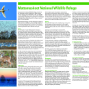
Mattamuskeet NWR is a popular place for visitors to enjoy a variety of wildlife-dependent recreation. During fall and winter, concentrations of swan, geese, and ducks are a delight to both wildlife observers and photographers. Visitors are welcome to walk or bicycle throughout the refuge; however, visitors are cautioned to review the corresponding map and observe refuge regulatory signs, as some areas are closed to the public during the winter. The refuge’s canals, marshes, and Lake Mattamuskeet are frequented by anglers catching largemouth bass, striped bass, catfish, crappie, and other species. The refuge also hosts special white-tailed deer and waterfowl hunts.
Trails
The refuge has three easy trails that provide wildlife viewing opportunities, passing through cypress groves, wetlands, and pine forests.
The New Holland Trail passes through cypress groves and wetlands and is the ideal place for connecting with nature. The Outfall Trail provides excellent views of the historic Mattamuskeet Lodge and passes through pine woods. The Photo Blind Trail is lined with tall grasses on the path to a blind for photography located on the bank of Lake Mattamuskeet.
The Outfall Trail is a grass-surface trail, 0.25mi round trip trail .ocated just inside the gate off New Holland/Mattamuskeet Road. The trail begins at the bridge by the New Holland Pumphouse/Mattamuskeet Lodge historic building parking area and picnic grounds. Traverse along the pond created by the outfall canal, where it is easy to watch great egret and great blue heron. The trail is not marked but there are two peaceful habitat viewing benches.
Related Documents
Other Facilities in the Complex
The refuge is managed as part of the Coastal North Carolina National Wildlife Refuge Complex. A National Wildlife Refuge Complex is an administrative grouping of two or more refuges, wildlife management areas or other refuge conservation areas that are primarily managed from a central office location. Refuges are grouped into a complex structure because they occur in a similar ecological region, such as a watershed or specific habitat type, and have a related purpose and management needs.
There are 9 national wildlife refuges in the Coastal North Carolina National Wildlife Refuges Complex. The Project Leader for the Complex supervises the Refuge Managers who are responsible for managing these refuges. However, there are five distinct and separate administrative offices. Alligator River and Pea Island National Wildlife Refuges are administered from the Alligator River National Wildlife Refuge Headquarters in Manteo, NC. An administrative office at the Mackay Island National Wildlife Refuge Headquarters in Knotts Island, NC manages both Mackay Island and Currituck National Wildlife Refuges. An office at Mattamuskeet National Wildlife Refuge administers Mattamuskeet, Swanquarter, and Cedar Island National Wildlife Refuges. Pocosin Lakes National Wildlife Refuge, Roanoke River National Wildlife Refuge, Great Dismal Swamp National Wildlife Refuge, Back Bay National Wildlife Refuge, and Edenton National Fish Hatchery each have separate administrative offices.
All of the Coastal North Carolina National Wildlife Refuges, Great Dismal Swamp National Wildlife Refuge, Back Bay National Wildlife Refuge, and Edenton National Fish Hatchery are open to public visits for nature-based recreational enjoyment. Priority public uses are hunting, fishing, wildlife observation, wildlife photography, environmental education, and interpretation.


Rules and Policies
Prohibited Activities
- Camping
- Littering
- Air boating
- Jet skiing
- All-terrain vehicles
- Swimming
- Sailing
- Sailboarding
- Molesting wildlife
- Collecting plants, flowers, nuts or berries
- All boating is prohibited from November 1 - February 28, except for permitted waterfowl hunters
Locations
The refuge is located approximately 70 miles east of Washington, North Carolina. The headquarters entrance road is located off Highway 94, 1.5 miles north of U.S. 264 between Swan Quarter and Engelhard.
Detailed directions to the Mattamuskeet National Wildlife Refuge Visitor Center:
Driving south from Columbia, NC: Start out going south on S Broad St/Alligator River Route/NC-94 toward Branning St. Continue to follow Alligator River Route/NC-94. In 33.4 miles turn left onto Mattamuskeet Refuge Rd. In 1.39 miles, the Visitor Center is on the left.
Driving east from Belhaven, NC: Start out going northwest on W Main St/US-264 Bus W toward Quidley Ln. Take the 3rd right onto US Highway 264 Byp/Pamlico Scenic Byway/US-264 E. Continue to follow Pamlico Scenic Byway/US-264 E. In 33.57 miles turn left onto NC Highway 94/Alligator River Route/NC-94. In 1.5 miles turn right onto Mattamuskeet Refuge Rd. In 1.39 miles Visitor Center is on the left.
Driving west or north starting from Engelhard, NC: Start out going west on US Highway 264/Pamlico Scenic Byway/US-264 W toward Roper Ln. In 11.83 miles turn right onto New Holland Rd. New Holland Rd becomes Mattamuskeet Refuge Rd. Visitor Center is on the left.