


Updates are posted here as new information is received. If the 'last-updated' timestamp is a few days old, it is because conditions have not changed since that time. Last updated 7/12/2026 11:19am*
Temporary Closures:
- Packer Unit Boat Launch (Sacramento River NWR): due to a downed tree across the boat launch, visitors will not be able to launch boats into Packer Lake until staff are able to move or remove the downed tree.
- Ord Bend Unit (Sacramento River NWR): Due to a pipe replacement project, the west side of the Main Hiking Trail will be closed where it crosses the levee. For your safety, please avoid the construction zone and heed all signage and flagging. The other Ord Bend Unit trails remain open.
All other refuges and refuge units are open. Check out seasonal recreation opportunities on our Auto Tours, Trails & Bicycling page or our Maps, Directions & Brochures page.
*Before calling the refuge for updates, please review this section of our website or our social media pages. Any new information will be posted here and to our Facebook and Instagram promptly. Areas are subject to closure without notice. Please use extreme caution when driving the refuges, as flooding can occur without warning and road shoulders are soft and will not support your vehicle.
Visit Us
Welcome to Sacramento River National Wildlife Refuge!
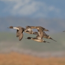
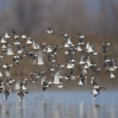
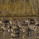
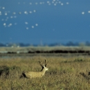
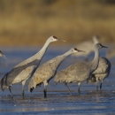
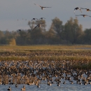
Sacramento River NWR offers a variety of recreational activities for visitors across its 24 units that are open to the public: hunting, fishing, hiking, photography, and wildlife viewing.
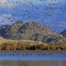
There are LOTS of recreational opportunities on the other refuges of the Complex, including Visitor Areas, Auto Tours, trails, bicycling, photography, and hunting.
Sacramento River National Wildlife is one of the 5 National Wildlife Refuges and 3 Wildlife Management Areas that make up the Sacramento National Wildlife Refuge Complex:
- Sacramento NWR
- Delevan NWR
- Colusa NWR
- Sutter NWR
- Sacramento River NWR
- Llano Seco Unit (STNCV WMA)
- Butte Sink WMA
- Willow Creek-Lurline WMA
Use the table below to navigate to the information that's most helpful for you:
Check out our VISIT US! page = a one-stop place for all your visiting questions, including: | ||
|---|---|---|
| Activities | Information | Directions |
| ||
Trails
Please visit our Auto Tours, Trails & Bicycles page for current maps and information.
Other Facilities in the Complex
The Sacramento River NWR is part of the Sacramento National Wildlife Refuge Complex. The Complex is comprised of 5 National Wildlife Refuges (Sacramento, Delevan, Colusa, Sutter and Sacramento River NWRs) and 3 Wildlife Management Areas (Willow Creek-Lurline, Butte Sink and Steve Thompson North Central Valley WMAs). Sacramento NWR, located near Willows, CA, serves as the headquarters for the Complex. Find out more about each Refuge or Wildlife Management Area below.

Locations
For Hours, Directions and Contact Information, please see our Visit Us page