

Updates are posted here as new information is received. If the 'last-updated' timestamp is a few days old, it is because conditions have not changed since that time. Last updated 7/12/2026 11:19am*
Temporary Closures:
- Packer Unit Boat Launch (Sacramento River NWR): due to a downed tree across the boat launch, visitors will not be able to launch boats into Packer Lake until staff are able to move or remove the downed tree.
- Ord Bend Unit (Sacramento River NWR): Due to a pipe replacement project, the west side of the Main Hiking Trail will be closed where it crosses the levee. For your safety, please avoid the construction zone and heed all signage and flagging. The other Ord Bend Unit trails remain open.
All other refuges and refuge units are open. Check out seasonal recreation opportunities on our Auto Tours, Trails & Bicycling page or our Maps, Directions & Brochures page.
*Before calling the refuge for updates, please review this section of our website or our social media pages. Any new information will be posted here and to our Facebook and Instagram promptly. Areas are subject to closure without notice. Please use extreme caution when driving the refuges, as flooding can occur without warning and road shoulders are soft and will not support your vehicle.
Visit Us
Welcome to Butte Sink Wildlife Management Area!
Butte Sink WMA primarily consists of properties that are privately-owned and under conservation easement conservation easement
A conservation easement is a voluntary legal agreement between a landowner and a government agency or qualified conservation organization that restricts the type and amount of development that may take place on a property in the future. Conservation easements aim to protect habitat for birds, fish and other wildlife by limiting residential, industrial or commercial development. Contracts may prohibit alteration of the natural topography, conversion of native grassland to cropland, drainage of wetland and establishment of game farms. Easement land remains in private ownership.
Learn more about conservation easement , and therefore DOES NOT HAVE ANY LANDS OPEN TO THE PUBLIC. Although the Butte Sink WMA is not open to the public, you can take a quick virtual tour to learn about what makes it special: Click here to view images, maps, and information about Butte Sink Wildlife Management Area.
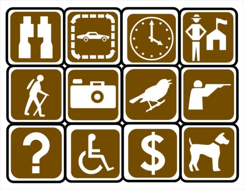
There are LOTS of recreational opportunities across the Complex, including a Visitor Center, Auto Tours, trails, bicycling, photography, hunting and environmental education.
Butte Sink Wildlife Management Area is one of the 5 National Wildlife Refuges and 3 Wildlife Management Areas that make up the Sacramento National Wildlife Refuge Complex:
- Sacramento NWR
- Delevan NWR
- Colusa NWR
- Sutter NWR
- Sacramento River NWR
- Llano Seco Unit (STNCV WMA)
- Butte Sink WMA
- Willow Creek-Lurline WMA
Use the table (below), the left menu (computer), or the top right hamburger menu (three lines on mobile device) to navigate to the information that's most helpful for you:
Check out our VISIT US! page = a one-stop place for all your visiting questions, including: | ||
|---|---|---|
| Activities | Information | Directions |
| ||
Location and Contact Information
About Us
The Butte Sink Wildlife Management Area is part of the Sacramento National Wildlife Refuge Complex. It is located west of the Sutter Buttes and east of the Sacramento River in Butte, Colusa, and Sutter counties. It consists primarily of conservation easements on privately-owned wetlands, but also includes on 733 acre fee-title property known as the Butte Sink Unit.
Click on the link below to learn more about us!
What We Do
- Resource Management
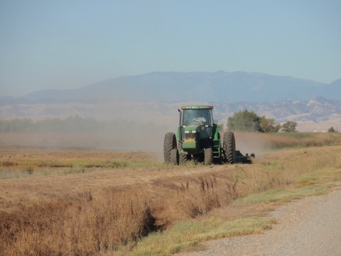
To help plants and wildlife, Refuge staff uses a variety of habitat management techniques to maintain, recover or enhance plant and wildlife values. Refuge staff carefully consider any management techniques and employ them in varying degrees according to the situation.
- Conservation and Partnerships
The Complex is involved in many conservation endeavors, including Comprehensive Conservation Plans, Private Landowner Programs, and the National Wildlife Refuge System Improvement Act.
Click on the link below to learn more about what we do!
Our Species
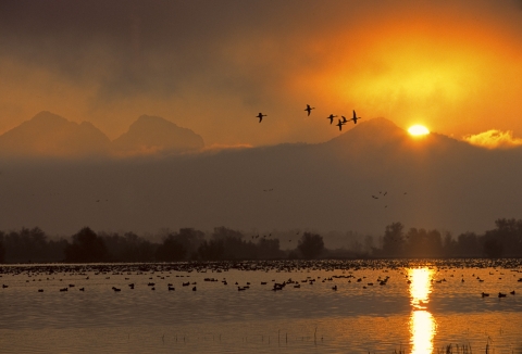
The Butte Sink WMA represents the largest contiguous block of wetlands in the Sacramento Valley and typically supports up to 2 million wintering waterfowl and large numbers of the State-listed as threatened greater sandhill crane. These wetlands also support significant populations of breeding herons, egrets, and other waterbirds.
Click on the link below to learn more about our Seasons of Wildlife, Wildlife Checklist, Wildlife Surveys, and Our Species....