About Us
The Sacramento River NWR was established in 1989 by the authority provided under the Endangered Species Act, Emergency Wetlands Resources Act, and the Fish and Wildlife Act. Units are located along both sides of the river and serve to protect and provide a wide variety of riparian riparian
Definition of riparian habitat or riparian areas.
Learn more about riparian habitats for birds, fish, and other wildlife.
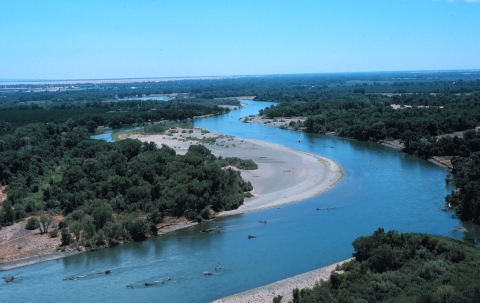
The Sacramento Valley is an extensive agricultural area that was once characterized by diverse types of natural vegetation that provided habitat for a great number of plant and animal species. There has been an 85 percent reduction of riparian vegetation throughout the Sacramento Valley and foothills region, and probably in excess of a 95 percent reduction along this area. The refuge is one of many partners protecting and restoring riparian habitat along the Sacramento River and its watershed.
The refuge is managed to maintain, enhance and restore habitats. Refuge lands comprise 10,353 acres of riparian habitat, wetlands, uplands, and intensively managed walnut orchards. Many of the units have been restored by converting flood-prone agricultural lands into riparian habitats in cooperation with The Nature Conservancy, River Partners, and many other cooperating partners. Riparian habitats on the refuge can be broken down into several different specific types including grassland/savannahs, forests, scrub, oxbow wetlands, and gravel bars.
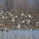
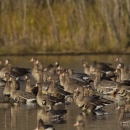
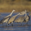
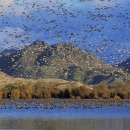
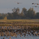
The riparian habitat along the Sacramento River is critically important for fish, migratory birds, plants, and river system health. It provides shelter for many songbirds and water-associated animals, including the river otter, turtles, beaver, American pelicans, ospreys, and migratory songbirds. Several threatened, endangered, and sensitive species can be found on the refuge including Chinook salmon, Valley elderberry longhorn beetle, yellow-billed cuckoos, Swainson's hawks, and bank swallows.
Twenty-four of the units are partially or entirely open for the public. Each unit has various public access and recreational uses. Check the unit's brochure or specific boundaries, rules, and regulations. Seven of the units have access from parking areas and hiking trails (Rio Vista, Pine Creek, Capay, Ord Bend, Sul Norte, Drumheller, and Packer). One unit (Bogg's Bend) has access via a parking area on adjacent California Department of Fish and Wildlife property. During the spring (March, April, and May), riparian areas can be abundant with migratory songbirds. Twenty-one of the units are open for hunting. The Packer Unit has an access point for bank fishing and small boat access to Packer Lake.
Each of the refuge's 30 units varies in its visitor opportunities. Seven units are accessible by vehicle and offer maintained hiking trails, fourteen units are accessible only by boat, and seven units are closed to public use. Those units that are open to public use are for day use only, and are open 2 hours before sunrise to 1 1/2 hours after sunset. Hunting and fishing are permitted under specific regulations on some of the units. Click here for maps and Visitor Information on the Sacramento River NWR Units.
Our Mission

The mission of the National Wildlife Refuge System is to administer a national network of lands and waters for the conservation, management and, where appropriate, restoration of the fish, wildlife and plant resources and their habitats within the United States for the benefit of present and future generations of Americans.
Other Facilities in this Complex
The Sacramento River NWR is part of the Sacramento National Wildlife Refuge Complex. The Complex is comprised of 5 National Wildlife Refuges (Sacramento, Delevan, Colusa, Sutter and Sacramento River NWRs) and 3 Wildlife Management Areas (Willow Creek-Lurline, Butte Sink and Steve Thompson North Central Valley WMAs). Sacramento NWR, located near Willows, CA, serves as the headquarters for the Complex. Find out more about each Refuge or Wildlife Management Area below.