Trails
Pedestrian Only Trails (hiking/walking and pets on a leash)
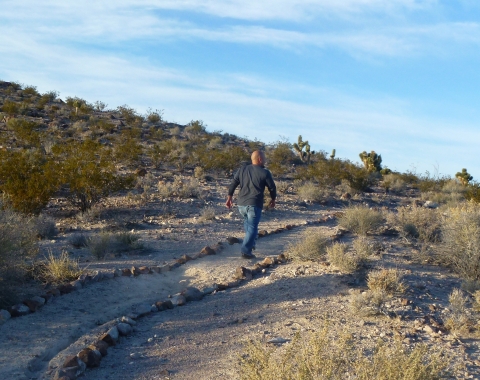
Davenport Trail
Open Season: Open year-round
Length: 1.7 miles one way
Location of trail: Trail leaves from the Visitor Center parking lot and connects to the Upper Lake Trail.
Surface: Packed gravel/dirt
Difficulty: Moderately challenging
Information: On this moderately challenging 1.7-mile trail that leaves from the Visitor Center parking lot you will climb to an upland desert that offers spectacular views of Upper Pahranagat Lake. You will then descend towards the lake and connect with the Upper Lake Trail.
Pahranagat Loop
Open Season: Open year-round
Length: 0.4-mile loop
Location of trail: Trailhead can be found just behind the Visitor Center.
Surface: Packed gravel, ADA accessible
Difficulty: Easy
Information: This loop trail begins outside the main Entrance to the Visitor Center just over the bridge. Along the trail you’ll find interactive interpretative signs about the local flora and fauna. Throughout the trail you will see Cottonwood and Willow trees as well as other native flora which is some of the best songbird habitat on the refuge. Take a moment to stop and sit quietly to see how many songbirds you can hear.
Cabin Trail
Open Season: Open year-round
Length: 0.4 miles one way, 0.8 miles round trip
Location of trail: Trailhead can be found just behind the Visitor Center.
Surface: Packed gravel, ADA accessible
Difficulty: Easy
Information: This trail begins outside the Main Entrance to the Visitor Center just over the bridge and concludes at two historic cabins built by early settlers in the Pahranagat Valley. Make sure to stop and read the interpretative signs by each cabin!
Pedestrian and Bike-Friendly Trails (hiking/walking, pets on a leash, and biking)
Upper Lake Trail
Open Season: Open year-round
Length: 1.4 miles as marked, or travel along the campground road to make it a 3-mile loop
Location of trail: Trailhead can be found at the Pahranagat Upper Lake Day Use Area. Enter via vehicle at the Upper Pahranagat Lake Entrance off Hwy 93. Travel down the gravel road towards the campground where you will find a small parking lot and the day use area.
Surface: Packed gravel/dirt
Difficulty: Easy
Information: This trail provides an excellent opportunity to see waterfowl and other migratory birds throughout the year, including Bald Eagles in the winter. Along the trail you will experience riparian riparian
Definition of riparian habitat or riparian areas.
Learn more about riparian habitat on one side of the trail and desert upland on the other, making it a unique trail to travel. You will have the opportunity to stop at two different overlooks where you can sit and enjoy the native flora and fauna. Make sure you check out the interactive interpretative signs found along the trails. Bring your binoculars to observe wildlife from a safe distance and remember early morning and evening are the best times to see wildlife.
Waterway Trail
Open Season: Open year-round
Length: 0.8 miles one way, 1.6 round trip
Location of trail: Trailhead is 0.4 miles from the Visitor Center parking lot and is marked by a yellow gate. This trail connects you to the campground road/Upper Lake Trail.
Surface: Packed gravel
Difficulty: Easy
Information: This easy trail follows the foliage lined water supply ditch which provides excellent coverage for birds. Make sure to take your time and keep an eye out for wildlife! This trail will connect you from the Visitor Center parking lot to the campground road and the Upper Lake Trail.
Walkable Access Routes (hiking/walking and pets on a leash)
Cottonwood Springs
Open Season: Open year-round, however this trail is located in the seasonal hunting area and active hunters can be found here Tuesdays, Thursdays, and Saturdays during hunt season.
Length: 2.2 miles round trip
Location of trail: Trailhead can be found at the junction for Alamo Road and is marked by a metal gate.
Surface: Rough and unmaintained that is occasionally soft/muddy
Difficulty: Moderate
Information: This trail is not for the faint of heart as it cuts through some of the most secluded parts of the refuge offering great solitude. It offers a changing landscape from upland desert to marsh land. Be careful as sometimes the trail is soft or muddy.
Dove Dike
Open Season: Open year-round, however this trail is in the seasonal hunting area and active hunters can be found here Tuesdays, Thursdays, and Saturdays during hunt season.
Length: 0.7 miles one way, 1.4 round trip
Location of trail: Trailhead can be found along the Middle Marsh gravel road (off of HWY 93) near Lower Pahranagat Lake. It is the first parking lot that you see along the road.
Surface: Packed gravel/dirt
Difficulty: Easy
Information: This trail crosses the upper part of Middle Marsh. Dense stands of showy milkweed make this a great spot to look for monarch butterflies in the summer and tall wild sunflowers fill the meadow with color during the fall. Remember that this trail is located in the seasonal hunting area so active hunters can be found here on Tuesdays, Thursdays, and Saturdays during hunt season.
WHIN Dike
Open Season: Open year-round, however this trail is in the seasonal hunting area and active hunters can be found here Tuesdays, Thursdays, and Saturdays during hunt season.
Length: 0.7 miles one way, 1.4 miles round trip
Location of trail: Trailhead can be found along the Middle Marsh gravel road (off of HWY 93) near Lower Pahranagat Lake. It is the second parking lot that you see along the road.
Surface: Packed gravel/dirt
Difficulty: Easy
Information: WHIN short for Wildlife Habitat Improvement of Nevada this trail is an excellent place to observe shorebirds that love the Middle Marsh here at the Refuge. Remember that this trail is located in the seasonal hunting area so active hunters can be found here on Tuesdays, Thursdays, and Saturdays during hunt season.
Middle Marsh Dike
Open Season: Open year-round, however this trail is in the seasonal hunting area and active hunters can be found here Tuesdays, Thursdays, and Saturdays during hunt season.
Length: 0.2 miles one way, 0.4 miles round trip
Location of trail: Trailhead can be found along the Middle Marsh gravel road (off of HWY 93) near Lower Pahranagat Lake. It is the third parking lot located at the end of the road.
Surface: Packed gravel/dirt
Difficulty: Easy
Information: This trail crosses the lower part of Middle Marsh. Many species of wildlife can be seen here enjoying the shallow water and tall willow trees that grow along the dike. Remember that this trail is located in the seasonal hunting area so active hunters can be found here on Tuesdays, Thursdays, and Saturdays during hunt season.
Backcountry Roads (4WD/high clearance vehicles, hiking/walking, and biking)
Medsger Pass
Open Season: Open year-round
Length: 22 miles one way, 44 miles round trip
Location of trail: Located off of HWY 93 about 3 miles before the Entrance to Upper Pahranagat Lake.
Surface: Unmaintained backcountry gravel and dirt road
Difficulty: Difficult, high clearance/4WD required for vehicles
Information: After 22 miles of rough road this road leads to the base of Tikaboo peak, which is the closest legally accessible vantage point to Area 51. There are no services along this road and there is limited cell phone reception. A high clearance/4WD vehicle is required. Make sure to bring extra water and emergency supplies.
Alamo Road
Open Season: Open year-round
Length: 72 miles to the Corn Creek Field Station at Desert National Wildlife Refuge
Location of trail: Located off of the Visitor Center parking lot
Surface: Unmaintained backcountry gravel and dirt road
Difficulty: Difficult, high clearance/4WD required for vehicles
Information: After 72 miles of rough road, you will reach the Corn Creek Field Station at Desert National Wildlife Refuge. There are no services along this road and there is limited cell phone reception. A high clearance/4WD vehicles is required. Bring extra water and emergency supplies.