About Us
J. Clark Salyer National Wildlife Refuge was originally named the Lower Souris Refuge. The name "Souris" is French for "mouse". Before 1800, French explorers found the local Indian tribes calling the stream "the mouse river" because of the great number of mice found in the meadows on the banks of the river. In 1967, the Refuge was re-named after John Clark Salyer II, the former Chief of the Division of Wildlife Refuges for the Bureau of Biological Survey from 1934 to 1961. Salyer has become known as the "Father of the National Wildlife Refuge System". Under his direction, the system rose in acreage from 1.5 million acres in the mid-1930's to nearly 29 million acres upon his retirement.
Interesting Facts about J. Clark Salyer National Wildlife Refuge
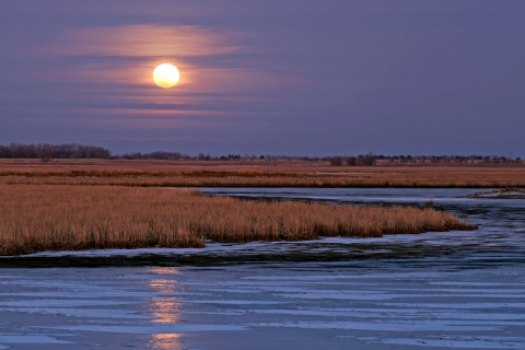
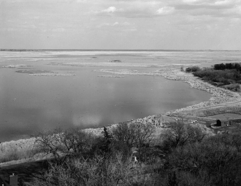
- There are five main dikes with water control structures on the Refuge, impounding over 23,000 acres of wetlands. Additionally, there are about 36,000 acres of upland which includes wooded river bottoms, native prairie grasslands, floodplain meadows, and seeded native or tame grasses.
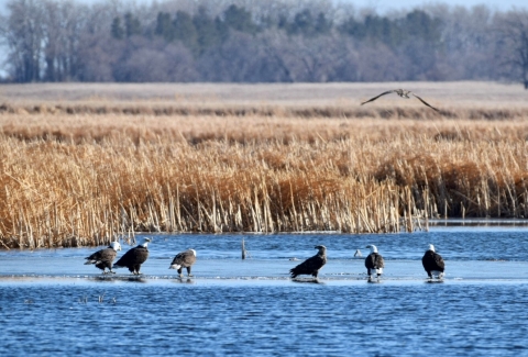
- Over 270 bird species have been found on the Refuge and over 160 species nest here. The diversity of habitats and its location in the transition zone between the eastern and western United States makes the Refuge one of the best birdwatching areas in North Dakota, if not the entire country. Birdwatchers from all over the United States and other countries come to take advantage of the opportunities here.
- One of the first attempts to re-establish the Giant Canada geese as nesting birds in North Dakota began here in 1937. Now, these birds are found in every county of the State.
- Two special designations were received in 2001: The Western Hemisphere Shorebird Reserve Network designated the Refuge as a regional site, critically important for shorebirds, and the American Bird Conservancy named the Refuge one of the first 100 “Globally Important Bird Areas". These designations serve to point out the importance this Refuge has to migratory birds.
- The North Dakota Natural Heritage Inventory lists the Refuge as one of only two intact ecological landscapes remaining in North Dakota.
- J. Clark Salyer National Wildlife Refuge is one of only ten refuges, from a Refuge System of over 565 refuges, that were featured in a Refuge System centennial exhibit at the Smithsonian National Museum of Natural History during 2003-2004.
Our Mission
Each unit of the National Wildlife Refuge System is established to serve a statutory purpose that targets the conservation of native species dependent on it's lands and waters. All activities on those acres are reviewed for compatibility with this statutory purpose.
Our History
In the early 1900's, plummeting waterfowl populations prompted the establishment of a number of national wildlife refuges, including J. Clark Salyer National Wildlife Refuge.

Established in 1935, the Refuge was originally called Lower Souris Refuge. In 1967, the Refuge was re-named to honor John Clark Slayer II, the former Chief of the Division of Wildlife Refuges for the Bureau of Biological Survey from 1934 to 1961. Salyer has become known as the "Father of the National Wildlife Refuge System". Under his direction, the system rose in acreage from 1.5 million acres in the mid-1930's to nearly 29 million acres upon his retirement.
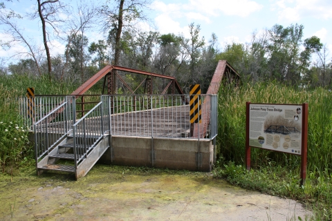
American Indian tribes hunted this area for bison, waterfowl, and other wildlife. The historic End of Woods Trail, which crosses the southern part of the Refuge, was long used by American Indians, fur traders, and explorers. During the early 1900s, European- American settlers developed farms and ranches in this area, plowing native prairie and lowland meadows, and draining wetlands along the river with hopes of growing crops. When the drought of the 1930s hit the west, it had devastating effects on both wildlife and agriculture.
To restore waterfowl habitat on the Refuge, the Civilian Conservation Corps (CCC) built a series of low dikes and water control structures along the river. As the waters of the Souris River slowly inundated the valley, aquatic plants were planted to enhance marsh development.
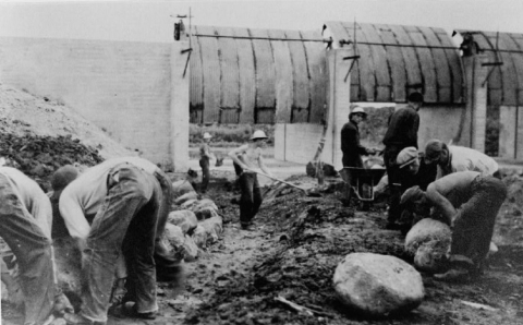
The original water control structures still remain at J. Clark Salyer National Wildlife Refuge. They have been improved and expanded over the years to better manage the water levels and wildlife habitat.
Learn more about J. Clark Salyer, II and the history of the National Wildlife Refuge System. Or visit one of the preserved historically significant sites at the refuge.