Trails
Souris River Canoe Trail
Designated as a National Recreation Trail National Recreation Trail
A National Recreation Trail is a land-based or water-based trail that provides an outdoor recreation opportunity on federal, state, tribal or local public land. National Recreation Trails were established by the National Trails System Act of 1968 (Public Law 90-543), which authorized creation of a national trails system composed of National Recreation Trails, National Scenic Trails and National Historic Trails. Whereas National Scenic Trails and National Historic Trails may be designated only by an act of Congress, National Recreation Trails may be designated by the Secretary of the Interior or the Secretary of Agriculture to recognize exemplary trails of local and regional significance.
Learn more about National Recreation Trail , the Souris River Canoe Trail provides wonderful opportunities for wildlife viewing, passing through unique bottomland hardwood forests rich in beauty, woodlands, and wildlife.
The canoe trail can be paddled as a 5.5-mile or 13-mile trip. The 5.5-mile route travels from Johnson Bridge launch to Thompson Well launch and takes 2-3 hours. The 13-mile route travels from Johnson Bridge launch to Dam 1 take out and takes 5-7 hours. Numbered markers are located at each mile along the river if you want to track your travel.
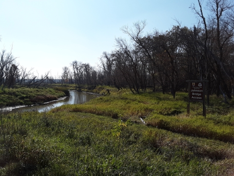
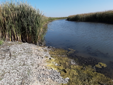
The canoe route starts at Johnson Bridge where a trail used by Native Americans crosses the river. The river flows northwest toward Canada, meandering in great bends across its flood plain, leaving numerous oxbows along the way. Oxbows are created as the course of a river changes and erodes new channels. Eventually, the former channel is cut off from the main flow and becomes standing water. Oxbows offer good opportunities to view waterfowl and wildlife. The river corridor is lined with willow, elm, ash, box elder, and cattails.
Sandhills Slough, located between river mile markers 3 and 4, is a river oxbow and a favorite spot for tree nesting ducks such as wood ducks and hooded mergansers. Feel free to explore this oxbow and its wildlife.
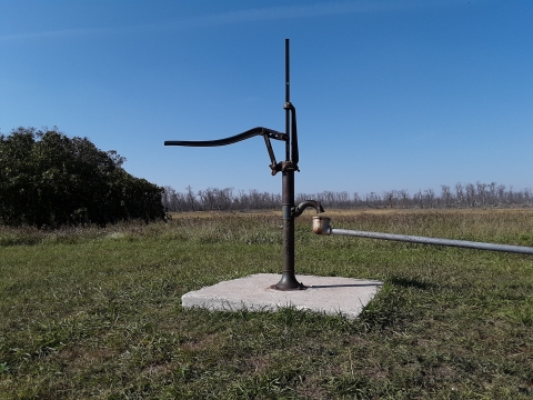
Thompson Well is located at river mile marker 5.5 and is a former homestead site.
A boat ramp, rest room, hand water pump, picnic tables, and parking area are available here. A great place to stop in and enjoy the scenery and fill up your water bottles.
Near river mile marker 6, Willow Creek enters the Souris River. This tree-lined corridor is a good place to view porcupine, deer, and moose.
Two more unnamed oxbows are located between river mile marker 12 and Dam 1, offering more waterfowl and wildlife viewing opportunities.
The canoe trail ends at Dam 1, and a boat ramp and a parking area are located here.

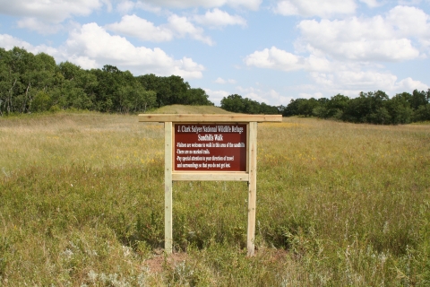
The Sandhills Walk is an unmarked trail where visitors can explore trees, shrubs, wildflowers, and wildlife. The blue three-petaled spiderwort and prairie wild rose, state flower of North Dakota, are common. The tiny ball cactus can be seen if you look closely at the ground. Watch out for poison ivy; this three-leaved creeping plant is found mainly beneath trees and shrubs.
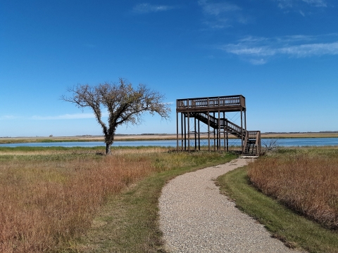
J. Clark Salyer National Wildlife Refuge Wildlife Observation Walk
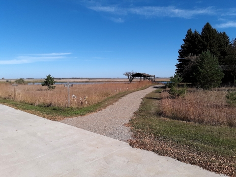
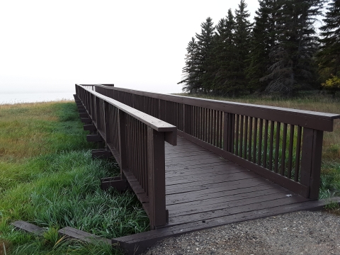
The Wildlife Observation Walk is an accessible trail. The entrance to the trail is located at the J. Clark Salyer National Wildlife Refuge office. This trail is 0.13 miles long and is rated as an easy hike that includes an accessible wildlife viewing platform adjacent to the larger tower. A wildlife observation blind is also available for visitors to use during hours of operation and is located along the dam 326 road. If you are interested in accessing these sites and have any questions, please contact Refuge staff during the hours of operation.
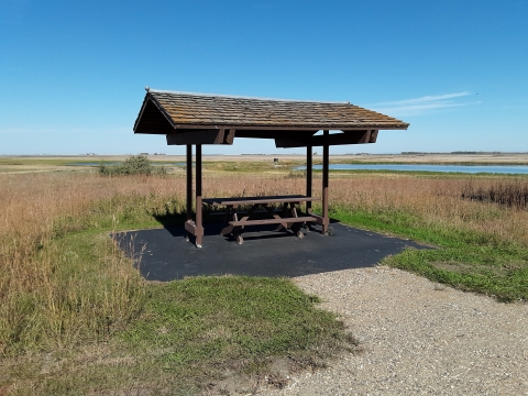
Along the trail you will find several covered picnic areas and a public restroom, each of these having a paved platform for easy access.
This is a great area to stop in for a picnic and perhaps see some of the Refuges many species of waterfowl, raptors and songbirds.
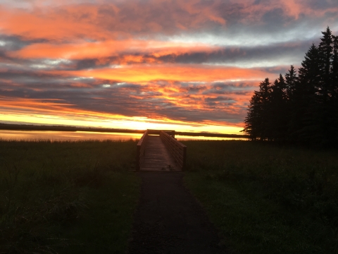
Whether just passing through or making J. Clark Salyer National Wildlife Refuge your next exploration destination, be sure to catch the spectacular sunset over the Souris River at the Wildlife Viewing Platform.