

About Us
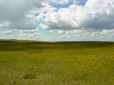
The Bowdoin Wetland Management District was established in 1973 after the U.S. Fish and Wildlife Service began protecting small wetland areas and grasslands. The District includes ten Waterfowl Production Areas (WPAs), four satellite refuges, and over 150 grassland and/or wetland easements spread over a four-county area.
Our Mission
Refuge Purpose
Each unit of the National Wildlife Refuge System is established to serve a statutory purpose that targets the conservation of native species dependent on its land and waters. All activities on those acres are reviewed for compatibility with this statutory purpose.
Bowdoin Wetland Management District was established to protect grasslands and wetlands for waterfowl.
Other Facilities in this Complex
From the money produced from the sale of Federal Duck Stamps, the Bowdoin Wetland Management Districtwas created.
Beaver Creek Waterfowl Production Area is located next to the Bowdoin National Wildlife Refuge, the waterfowl production area waterfowl production area
Waterfowl production areas are small natural wetlands and grasslands within the National Wildlife Refuge System that provide breeding, resting and nesting habitat for millions of waterfowl, shorebirds, grassland birds and other wildlife. Virtually all waterfowl production areas are in the Prairie Pothole Region states of Iowa, Minnesota, Montana, North Dakota and South Dakota.
Learn more about waterfowl production area was purchased in 1992 and added two new tracts in 2000 and 2003. This 2,125 acre area consists of wetlands, riparian riparian
Definition of riparian habitat or riparian areas.
Learn more about riparian areas, DNC (dense nesting cover), and native prairie.
Black Coulee Waterfowl Production Area lies within the Executive boundary of the Black Coulee National Wildlife Refuge. It is a 184 acre area acquired in 1982 and contains wetlands and native prairie.
Dyrdahl Waterfowl Production Area is 8 miles northwest of Loring in Phillips County, Montana. It is a 1,327 acre area acquired in 1985 and contains wetlands, DNC, and native grassland.
Hammond Waterfowl Production Area is located adjacent to McNeil Slough Waterfowl Production Area and borders the Milk River. The 242 acre area was acquired in 2014 and contains grassland, wetland, and riparian habitats.
Hewitt Lake Waterfowl Production Area lies within the Executive boundary of Hewitt Lake National Wildlife Refuge. Purchased in 1992, the 320 acre area contains wetlands and native prairie.
Holm Waterfowl Production Area was the first waterfowl production area to be acquired in 1977 and is the only waterfowl production area in the district that is closed to hunting. The property was sold to the Service by the three Holm brothers who wished to have their farm (located north of Chinook) preserved as a sanctuary for Canada geese. The 2,250 acre area contains wetlands (natural, constructed or enhanced, and prairie stream), DNC, and native prairie.
Korsbeck Waterfowl Production Area is 12 miles south of Dodson in Phillips County, Montana. It was acquired in 1990. The 1,041 acre area consists of wetlands, DNC, and native praire. The Service also holds a State of Montana grazing lease on 320 acres of native prairie, which is managed as part of the waterfowl production area.
McNeil Slough Waterfowl Production Area borders the Milk River for 4 miles along its north boundary, Big McNeil Slough to the south and Hewitt Lake Refuge to the west. A purchase of an inholding in 2008 was added to the original lands acquired in 1992. The 1,339 acre area contains wetland, DNC, and native prairie grassland.
Pearce Waterfowl Production Area, purchased in 1977, is adjacent to the northeastern boundary of Bowdoin National Wildlife Refuge. The 438 acre area contains wetlands, DNC, and native grasslands.
Webb Waterfowl Production Area is 1 mile north of Dyrdahl Waterfowl Production Areaand was acquired in 1978. The 476 acre area contains wetlands, DNC, and native praire.


