

Collaboration for Aquatic Connectivity
The Southeast Aquatic Resources Partnership (SARP) is a regional collaboration aimed at addressing aquatic resource conservation issues in the southeastern United States. SARP focuses on various aquatic habitats, including rivers, streams, wetlands, and estuaries. Its mission involves fostering partnerships among government agencies, non-profit organizations, industry representatives, and other stakeholders to enhance the health and sustainability of aquatic ecosystems in the southeastern region.
The U.S. Fish and Wildlife Service (USFWS) is a committed member in the Partnership and continues to support data collection for addressing threats to aquatic biodiversity and implementation of restoration projects to promote conservation of aquatic habitats and their species in the Southeast.
A significant priority for the USFWS Panama City Fish and Wildlife Conservation Office (FWCO) is conservation of federally protected species. Recovery of target species is often reliant on habitat restoration projects carried out on both public and private lands. The Panama City FWCO supports a dynamic aquatic restoration program that addresses limiting factors for species using a threats assessment road map to prioritize key life history bottlenecks, target critical locations, and identify restoration actions for important aquatic resources.
Surveying Watershed Threats in the Ochlockonee River
Biologists Katie Ayers and Andy Hartzog at the Panama City FWCO are utilizing three survey protocols to assess threats to aquatic species and fish passage fish passage
Fish passage is the ability of fish or other aquatic species to move freely throughout their life to find food, reproduce, and complete their natural migration cycles. Millions of barriers to fish passage across the country are fragmenting habitat and leading to species declines. The U.S. Fish and Wildlife Service's National Fish Passage Program is working to reconnect watersheds to benefit both wildlife and people.
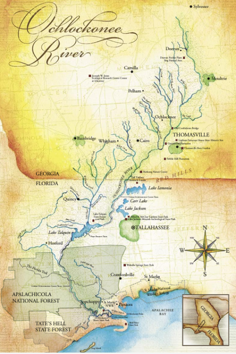
Learn more about fish passage barriers at road-stream crossings in the Ochlockonee River watershed, where it begins in southwest Georgia and flows south through the Florida panhandle before emptying into the Gulf of Mexico. Data is collected using the "Southeast Aquatic Connectivity Program's Stream Crossing Survey" for aquatic organism passage at paved and unpaved road crossings. The survey was originally developed by Alex Abbott and Scott Jackson as part of the North Atlantic Aquatic Connectivity Collaborative and adapted for the Southeast region by SARP. Data collected using ArcGIS Field Maps is compiled into the National Aquatic Barrier Inventory, a comprehensive spatial database used for gathering and mapping data on various aquatic barriers such as dams, evaluated road-stream crossings, and waterfalls. For more information on this prioritization tool, check out this story.

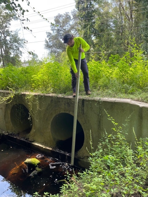
A "Sediment Risk Index" survey prepared by Panama City FWCO Project Leader Chris Metcalf and derived from several field guides for unpaved road-stream crossings in northwest Florida is used to gather data on waterway conditions and roadside soil erosion features. In additional to evaluating crossings, a "Bank Hazard Erosion Index" survey collects valuable information for assessing habitat conditions in vulnerable stream reaches.
A multitude of metrics, such as road condition, culvert size, bank erosion, riparian riparian
Definition of riparian habitat or riparian areas.
Learn more about riparian vegetation, streambed substrate, floodplain connectivity, man-made and natural barriers, channel alteration, and livestock access are all critical pieces of the puzzle needed to identify problem sites and target resources for restoration.
Data-Driven Prioritization for Habitat Restoration
Biologists at the Panama City FWCO intend to use SARP'S National Aquatic Barrier Inventory and other survey data to develop priority hotspot maps within the Ochlockonee River watershed. Illustrative communication such as this will aid in effective communication to stakeholders when justifying project selection. It is our hope that these collaborative partnerships will facilitate project development that encourages innovative solutions to fish passage barrier removal and recovery of threatened and endangered species.

