


Trails
Download Our Trails Brochure: English / Español
Visit our homepage to view any current alerts, including trail closures.
Please note, dogs are not allowed on any refuge trails. See specific trail descriptions for bicycle allowances.
----------------------------------------------------------------------------------------------------------------------------------------------
East Hills Trails
Willapa Art Trail

Difficulty: Easy, Boardwalk, Accessible
Length (one-way): 0.25 mi
Trailhead Location: Cutthroat Creek near milepost 24 on State Route 101. Trail starts through the green pedestrian gate in the southwest corner of parking area
Note: Boardwalk can be slippery when wet or icy. Please use caution during winter months.
Commemorating the restoration of the small stream, art pieces are placed along the curving boardwalk to tell the stories of the waterway and the many species that live there. Students from the University of Washington Public Arts Program designed, constructed, and installed the artwork for the trail under the direction of professors John Young, Ian Robertson, and Jim Nicholls.
Cutthroat Climb
Difficulty: Hard, steep stairs
Length (round-trip): 1 mi Loop
Trailhead Location: leaves from the Willapa Art Trail
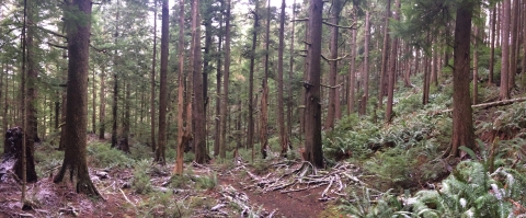
Artist Becca Weiss's birds are your companion as the trail rises - and then falls - steeply through the deep-woods of old-growth hemlocks and ferns. The trail has some wooden steps. Be sure to watch you footing as the trail may be slippery and tree roots may cause tripping hazards.
Along the trail are interactive signs with the tracks of forest inhabitants and silhouettes of aquatic life to challenge your wild knowledge.
Teal Slough
Difficulty: Easy
Length (one-way): 0.5 mi
Trailhead Location: 1.6 mi north of the refuge headquarters office on State Route 101. Parking is available on the south side of the road in a pullout in front of a gate. Please do not block gate access. The trail follows the old road behind the gate for ~300 ft where a small sign directs you to the east traveling trail.
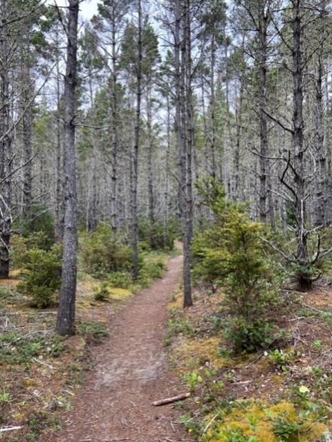
Although this remnant coastal old-growth forest is home to marbled murrelets, and Dunn’s and Van Dyke’s salamanders, they are rarely viewed by the casual observer.
This trail is also located with a hunting area (typically September- January, check regulations for specific dates).
Greenhead Slough Trail
Difficulty: Easy
Length (one-way): 0.5 mi
Trailhead Location: Highway 101 between Bear River Bridge and Greenhead Slough Bridge near mile marker 20. Turn east at the bridge on the east side of the highway and drive into parking area. Enter trail past gate to the east of the parking area.
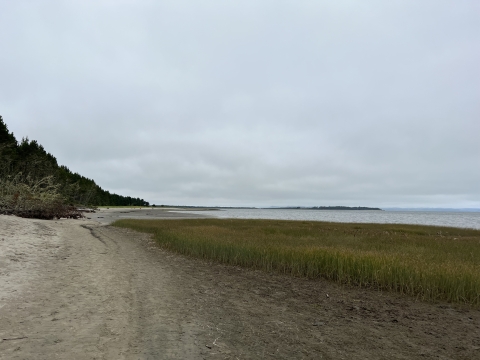
This trail through the coastal forest offers views of restoring estuary, freshwater streams and wetlands. Years of habitat restoration and fish barrier removal projects have restored 150 acres of estuary and opened ten miles of freshwater streams for spawning and rearing by coho and chum salmon, cutthroat trout, and brook lamprey. A variety of songbirds, raptors and waterfowl can be seen. Access is by foot and bicycle only.
Note: This trail ends after 0.5 miles. Look for refuge boundary signs that mark the end of the trail and do not proceed further onto private property. This trail is also located with a hunting area (typically September- January, check regulations for specific dates).
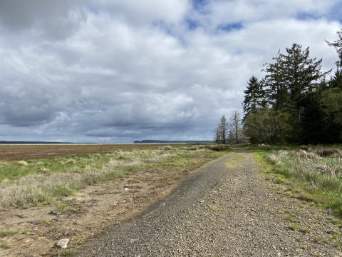
South Bay Trails
South Bay Trail

Difficulty: Easy
Length (one-way): 0.6 mi
Trailhead Location: Follow 95th Street east from Sandridge Rd to parking area. Enter trail through the gate south of parking area.
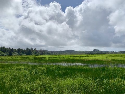
The South Bay Trail winds through grasslands, coastal forests, freshwater and estuary wetland habitats and offers unparalleled views of Willapa Bay, one of the West Coast’s most pristine water bodies and important migratory bird habitats. The overlook at the end of the trail is a great place to see large flocks of migratory waterfowl and shorebirds, as well as bald eagles. Lucky visitors may spot river otters, elk, and black bear. Access is by foot only.
The South Bay Trail Overlook was made possible by the Friends of Willapa National Wildlife Refuge, Templin Foundation, National Fish & Wildlife Foundation, Commission for Environmental Cooperation, Brothers Concrete, Inc., Willapa Bay Tile, Quatrefoil, Inc., Timberdoodle Studio, dedicated volunteers and refuge staff.
Tarlatt Slough Trail
Difficulty: Easy
Length (one-way): 0.7 mi
Trailhead Location: Follow 95th Street east from Sandridge Rd to parking area. Enter trail through the gate south of parking area. (*Note: Parking at 85th St is no longer available).
The trail has views of seasonal wetlands, open fields and young coastal forests, and coastal prairie restoration areas. Raptors, sparrows, waterfowl and the occasional elk, deer and black bear can be viewed from here. Barn, tree and violet green swallows are abundant in the summer. Access is by foot only.
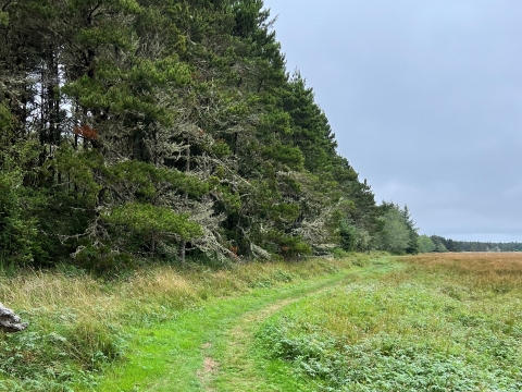
Porter Point Loop
Difficulty: Moderate, some elevation gain
Length (round-trip): 2.4 mi Loop
Trailhead Location: Follow 67th Place east from Sandridge Road to end. Parking area is located on the south side of road. Enter trail through gate north of 67th Place, headed north.
Restoration activities to reestablish the natural tidal cycles and increase habitat for estuary dependent species have recently been completed. Tremendous views of Willapa Bay and large flocks of migratory shorebirds and waterfowl can be viewed on the bayside of the trail. This trail now forms a loop, entering a serene cedar swamp before climbing to and then descending from the ridgetop above Porter Point, ending back at the parking lot. Forest mammals are a rare but treasured sight, and raptors including bald eagles, northern harriers and American kestrels can also be seen.
Note: This trail can flood at high tides. Check tidal charts before entering the area. Portions of this trail are also adjacent to hunting areas (typically September-January, check regulations for specific dates). Access is by foot only.
Parker Slough Trail - *portion of trail closed Oct 1 - Feb 10

Difficulty: Easy
Length (one-way): 1.5 mi
Trailhead Location: Follow 67th Place east from Sandridge Road to end. Parking area is located on the south side of road. Enter trail through pedestrian gate to the east.
Restoration activities to restore the natural tidal cycles and increase habitat for estuary dependent species have recently been completed. Tremendous views of Willapa Bay and large flocks of migratory shorebirds and waterfowl can be viewed from this trail. Bald eagles, northern harriers and American kestrels may also be seen along with the occasional river otter, elk, and black bear.
*Note: A portion of this trail is closed during waterfowl hunting season, October 1 - February 10. Access is by foot only.
Long Island Trails - only accessible by boat
Explore 8+ miles of trails with access to beaches, meadows and forest. Access by boat only. Public ramp at Cutthroat Creek by MP 24 on US Hwy 101.
- No water on the island, bring your own
- Carry or consult a tide table
- Dogs prohibited on the island
- Bicycles allowed
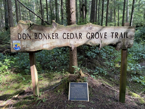
Don Bonker Cedar Grove Trail
Difficulty: Moderate
Length (round-trip): 1 mi Loop
Trailhead Location: Near the center of the island. Land your boat at the old ferry landing (1/4mi from launch) on the southern tip of Long Island and follow the center road trail north, the trail to the Cedar Grove is ~2.5 mi from the landing. Alternatively, take a longer route (3 2/3mi from launch) and land your boat at Smoky Hollow Campground on the west side of the island, the trail to the Cedar Grove is ~1mi.
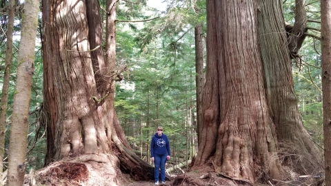
Take a stroll through an old growth cedar grove, viewing some of the largest cedar trees in the PNW as well as remnants of cedars (stumps left behind from the logging industry).
Center Road Trail
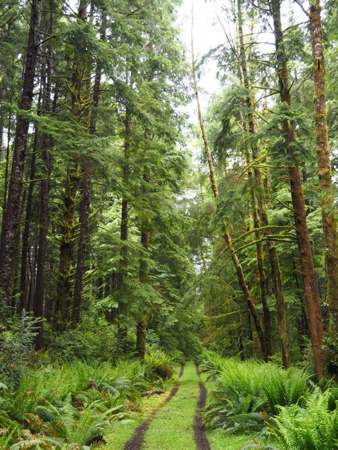
Difficulty: Easy
Length (one-way): 3.7mi
Trailhead Location: Southern tip of the island at the old ferry landing. Trail can also be accessed by trails from each campground except Lewis.
***Caution: Tides and adverse weather conditions can make boating on Willapa Bay dangerous. These trails are also located within a hunting area (typically September- January, check regulations for specific dates).
Leadbetter Point Trails
Explore trails that wind along the bay and through shorepine forest on the northern tip of the beautiful Long Beach Peninsula.
- Trails often flooded from Oct - May
- Critical Bird Nesting Area, please obey posted signage for closed areas
- Carry or consult a tide table
- A Washington State Discover Pass is required for parking
- All trails accessed by the Leadbetter Point Parking Area at the end of Stackpole Road
- Trails located within hunting area (typically September - January)
Note: The Dune Forest Loop Trail and Martha Jordan Birding Trail are located in Leadbetter Point State Park, managed by Washington State Parks.
Bearberry Trail
Difficulty: Easy
Length (one-way): 1.3 mi
Trek across the peninsula on this easy trail to sandy beaches. Along the way look for the low-growing bearberry carpeting the forest understory.
Bay Loop
Difficulty: Easy
Length (round-trip): 1.1 mi Loop
This easy loop takes you along the scenic bay where information panels share stories about the bay's bird life and salt marsh salt marsh
Salt marshes are found in tidal areas near the coast, where freshwater mixes with saltwater.
Learn more about salt marsh habitat. The return loops through shorepine forest.
Weather Beach Trail
Difficulty: Easy
Length (one-way): 0.9 mi
From the Dune Forest Loop, stroll across the peninsula to the breaking surf. Along the way you'll see seasonal wetlands within the dunes that support life in the harsh landscape.
Beach Trail

Difficulty: Easy
Length (one-way): 0.5 mi
Linking Weather Beach to the Bearberry Trail, this beach route offers the promise of viewing hundreds of thousands of shorebirds in spring and fall. Obey signs that designate closures for nesting birds.
Note: Boardwalk can be slippery when wet or icy. Please use caution during winter months.
Art Trail
Along the trail are interactive signs with the tracks of forest inhabitants and silhouettes of aquatic life to challenge your wild knowledge.
Cutthroat Climb Trail
This trail is also located with a hunting area (typically September- January, check regulations for specific dates).
Teal Slough Trail
Note: This trail ends after 0.5 miles. Look for refuge boundary signs that mark the end of the trail and do not proceed further onto private property. This trail is also located with a hunting area (typically September- January, check regulations for specific dates).
Greenhead Slough Trail
Tarlatt Slough Trail
The South Bay Trail Overlook was made possible by the Friends of Willapa National Wildlife Refuge, Templin Foundation, National Fish & Wildlife Foundation, Commission for Environmental Cooperation, Brothers Concrete, Inc., Willapa Bay Tile, Quatrefoil, Inc., Timberdoodle Studio, dedicated volunteers and refuge staff.
South Bay Trail
Note: Portions of this trail are closed during waterfowl hunting season (typically September-January, check regulations for specific dates). Access is by foot only.
Parker Slough Trail
Note: This trail can flood at high tides. Check tidal charts before entering the area. Portions of this trail are also adjacent to hunting areas (typically September-January, check regulations for specific dates). Access is by foot only.
Porter Point Loop Trail
New Trail
Take a stroll through an old growth cedar grove, viewing some of the largest cedar trees in the PNW as well as remnants of cedars (stumps left behind from the logging industry).
***Caution: Tides and adverse weather conditions can make boating on Willapa Bay dangerous. These trails are also located within a hunting area (typically September- January, check regulations for specific dates).
Don Bonker Cedar Grove Trail
From here, after about 2 miles, you will reach the Cedar Grove Trail.
This trail is also accessible from the Pinnacle Rock, Smoky Hollow, and San Spit Campgrounds on the west side of the island, as well as the Sand Spit Campground on the east side.