

Visit Us
UL Bend National Wildlife Refuge is contained within the boundaries of Charles M. Russell National Wildlife Refuge and they are managed as one refuge. Due to the Refuge's remote location, visitors should be prepared for a variety of conditions. Temperatures can range from 100ºF in the summer to -20ºF in the winter. Many of the Refuge trails are "primitive" and require a high centered vehicle and/or four-wheel drive. During wet weather, most trails are impassable. Plan to carry water with you as it is extremely limited on the Refuge and drinking water is generally unavailable. Cell phone service is sporadic.
Activities
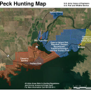
Hunting and fishing opportunities abound on UL Bend and Charles M. Russell National Wildlife Refuges. Boating is popular on the Missouri River and Fort Peck Reservoir. Camping, hiking and horseback riding are permitted.
Related Documents
If you would like a map of the refuge mailed to you, please call or email with your mailing address.
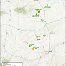
A georeferenced PDF map is available below as well as several other helpful PDF maps showing the Fort Peck area and the Charles M. Russell Wetland Management District, Waterfowl Production Areas and satellite refuges.

Other Facilities in the Complex
This Refuge is managed as part of the Charles M. Russell Complex. A National Wildlife Refuge Complex is an administrative grouping of two or more refuges, wildlife management areas or other refuge conservation areas that are primarily managed from a central office location. Refuges are grouped into a complex structure because they occur in a similar ecological region, such as a watershed or specific habitat type, and have a related purpose and management needs. Typically, a project leader or complex manager oversees the general management of all refuges within the complex and refuge managers are responsible for operations at specific refuges. Supporting staff, composed of administrative, law enforcement, refuge manager, biological, fire, visitor services, and maintenance professionals, are centrally located and support all refuges within the complex.


Locations
Coming from the south (Lewistown, Billings, etc.):
Take US-191 north toward Malta. After crossing the Missouri River on the Fred Robinson Bridge drive approximately 21 miles to mile marker 109, take the RIGHT immediately after the marker .
An information kiosk sits where the road forks. Take the left fork and head east on the Dry Fork Road for 26 miles.
Dry Fork road will “T” at old Second Creek School (white building). Turn right (south)
and stay on main road continuing to head south. Road will become rough and narrow. Drive 14.4 miles to reach the refuge boundary and Refuge Road 212.
Coming from the north (Malta) - Two Travel Options Via Hwy 191 or Via Regina Road.
Via Hwy 191 (More Pavement)
Head south from Malta on US-191 for approximately 23 miles to (between milepost 134 and 135) turn left (south) on the Midale road.
Stay on the main Midale road south (several curves working south and east - follow signs directing you toward Second Creek School and CMR) until you come to a white concrete
block building, 21 miles from HWY 191.
Turn right (south) at this building on the main road and continue south. Stay on the main road heading south, road will become rough & narrow. Drive 18 miles to reach the refuge boundary and Refuge Road 212.
Via Regina Road (More Gravel)
Head south out of Malta on Central Ave. After crossing the canal and after passing 12th Street turn left onto Highway 364. The road will turn to gravel. Continue for 4 miles to a T-intersection, turn right. After 0.4 miles the road will turn South onto Regina Road.
Continue for 30 miles and a T intersection. Turn Right and Drive 6 miles and take the road left (South) near a white concrete block building. Continue South staying on the main road heading south, road will become rough & narrow. Drive 18 miles to reach the refuge boundary and Refuge Road 212.