

About Us
Moosehorn National Wildlife Refuge was established in 1937 to protect migratory birds. The Refuge has two divisions, the 20,532-acre Baring Division about 3 miles southwest of Calais, Maine and the 8,664-acre Edmunds Division about 3 miles south of Dennysville, Maine, directly adjacent to Dennys and Whiting Bays along U.S. Highway 1.

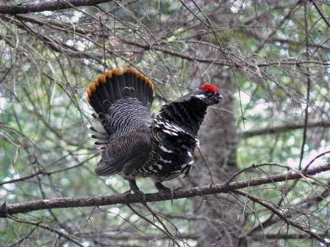
Moosehorn NWR and the surrounding region are generally characterized by rolling hills, large rock outcrops, scattered boulders, and second-growth northern hardwood-conifer forest, and some pockets of pure spruce-fir. Numerous streams, beaver flowages, bogs, marshes, and forested wetlands are imbedded within the forested landscape.
Moosehorn NWR contains over 4,500 acres of wetlands, including 28 functional impoundments or flowages that provide habitat for nesting and migrating waterfowl and marsh birds. The refuge has 18 miles of rocky shoreline along Dennys and Whiting Bays and 7 miles of shoreline on Meddybemps Lake. These small bays are part of the larger Cobscook Bay that supports the highest density of nesting bald eagles in the northeastern U.S. and has been essential to the recovery of the bald eagle in the east. The bay also provides critical migration and wintering habitat for the American black duck.
Wilderness areas
There are two designated Wilderness areas on the Refuge. Moosehorn Wilderness was established in 1970 and now comprises more than 2,700 acres. The Baring Unit Wilderness was established in 1975 and now spans more than 4,600 acres.
The Wilderness Act of 1964 created the National Wilderness Preservation System "in order to assure that an increasing population, accompanied by expanding settlement and growing mechanization, does not occupy and modify all areas in the United States, and its possession, leaving no lands designated for preservation and protection in their natural condition..."
More information on wilderness.net.
Our Mission
Each unit of the National Wildlife Refuge System is established to serve a statutory purpose that targets the conservation of native species dependent on its lands and waters. All activities on those acres are reviewed for compatibility with this statutory purpose.
The staff at Moosehorn National Wildlife Refuge manages the land to protect the Service's "trust resources" which include migratory birds, endangered species, and wetlands. By improving habitat, the Service ensures that wildlife will thrive on the refuge.
Some of the management practices employed to achieve our goals include:
- Mowing and burning of grass fields, brush, and blueberry barrens
- Mapping and Controlling Invasive Plants
- Managing water levels to encourage desirable vegetation
- Cutting trees to mimic natural disturbances in the forest and maintain early growth forests
- Maintain open waterways to permit and enhance fish passage fish passage
Fish passage is the ability of fish or other aquatic species to move freely throughout their life to find food, reproduce, and complete their natural migration cycles. Millions of barriers to fish passage across the country are fragmenting habitat and leading to species declines. The U.S. Fish and Wildlife Service's National Fish Passage Program is working to reconnect watersheds to benefit both wildlife and people.
Learn more about fish passage
Refuge staff also monitor environmental conditions and wildlife populations through surveys and studies that include:
- Local weather and air and water quality monitoring
- American woodcock and ruffed grouse surveys
- Acoustic monitoring of bat species using the refuge
- Annual surveys of vernal pool obligate amphibians
- Waterfowl, woodcock, and song bird banding
- Monitor migration of river herring
- Bald Eagle and Osprey Nest Surveys
Our History
During the establishment of the refuge the importance of the area to the American woodcock was identified as a priority consideration. Research on the biology and habitat needs of the woodcock began shortly after the refuge’s establishment and continue today. Much of the knowledge on the habitat needs of this species is based on research and management that occurred at Moosehorn. The refuge continues to serve as a research and demonstration area for a variety of wildlife habitat management techniques.
In addition to woodcock research on waterfowl, songbirds, and mammals has resulted in a number of publications. The refuge continues encourages researchers to conduct their studies on our lands.
The refuge once had an over abundance of white-tailed deer and was first opened to hunting in 1954. We continue to offer quality hunting and fishing opportunities to the public under State regulations. Limited trapping of furbearers is also permitted to manage their populations outside the Wilderness Areas.

In 1991 a pair of bald eagles began nesting on an osprey platform near US Route 1. A pair of eagles has nested in the platform within sight of the most heavily traveled roadway in Washington County. They have become a local attraction and provide many visitors an opportunity to observe our National bird.
Most of the refuge is open to visitors that may walk interpretive trails or hike, bike, snowshoe, or ski on our 40 miles of gravel service roads. An auto tour route is also open during snow free months.
Other Facilities in this Complex
The Moosehorn National Wildlife Refuge is managed as part of the Northern Maine National Wildlife Refuge Complex, along with Aroostook National Wildlife Refuge , Sunkhaze Meadows National Wildlife Refuge, and Carlton Pond Waterfowl Production Area.


