Projects and Research
Construction for Restoration Projects (Starting Summer 2026)
Dike Road/Wetland Loop Trail Restoration
Trail Closures: During construction, the trail will be closed from the gate to just before our observation tower. The gravel lot and a portion of the parking lot will be used by the construction crew to stage their equipment and materials and will also be closed to the public. The observation tower and bathrooms will remain open. Signage will be posted, clarifying the trail closure location. Water levels in the emergent wetland will be lowered for heavy equipment access. Though this portion of Wetland Loop Trail will be closed for a long length of time, we are excited to finally reinforce and strengthen the dike against future floods, and reveal the new trail, stairs, and fishing platform to our visitors. This ongoing project begun in June 2026 and is expected to take 12 - 18 months to complete.

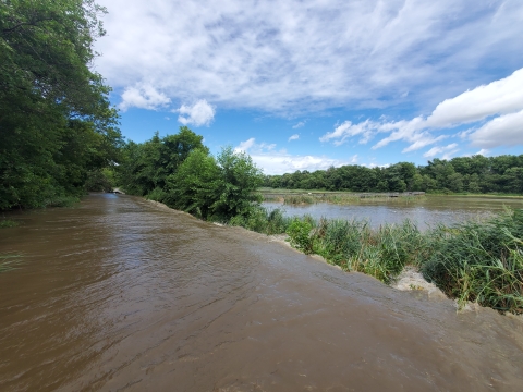
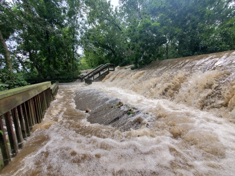
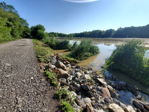
Purpose: On August 4th, 2020, Hurricane Isais swept through Philadelphia and Delaware Counties, dumping large volumes of water in the Darby Creek Watershed. Rain waters rushing down the creeks collided with a rising storm surge and high tide, spilling over the banks in the Eastwick Neighborhood of Philadelphia County and Delaware County, causing major flooding in our communities. In the refuge, flood waters overtopped Dike Toad, Trolley Bed, and parts of Haul Road, also known as Wetland Loop Trail. Flood waters caused significant erosion along Dike Road, creating dangerous conditions on the trail. Within a few weeks of the flood, we conducted emergency repairs to stabilize and make Dike Road safe, but this was only a temporary fix. This was not the first time a major flooding event damaged the dike. In 2011, back-to-back storms, Hurricanes Irene and Lee, similarly swept through Darby Creek Watershed, damaging the same section of trail.
To protect the road from overtopping and eroding during future flood events, we are conducting a permanent restoration project for the road. We will stabilize the impoundment-side slope, so in the case of similar storms, erosion of the road will not occur. The accessibility of the trail will also be repaired through this project. Our water control structure, next to our pump station, is used to control the flow of water between Darby Creek and the impoundment. This structure will be completely replaced, allowing our team to more easily manage impoundment water levels for bird migration and wildlife viewing. The damaged fishing platform along Darby Creek, next to our water control structure, will be removed. A new fishing platform will be constructed along Darby Creek across from the boardwalk, where we host our fishing events. The old set of stairs that used to lead to Big Boardwalk and were damaged during the storm will be replaced, and improvements will be made to the accessible ramp connecting the boardwalk to the trail.

Henderson Marsh Restoration Project
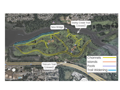
Trail Closures: During the Henderson Marsh Restoration Project, Tinicum Trail and Darby Creek Trail will be closed west of the outdoor restrooms to the Rt. 420 Parking Lot. The Woodland Loop Trail will remain open from the Rt. 420 Parking Lot. Trail maintenance is planned along Woodland Loop Trail to improve accessibility. This project will begin in September 2026 and is expected to take 12 - 18 months to complete.
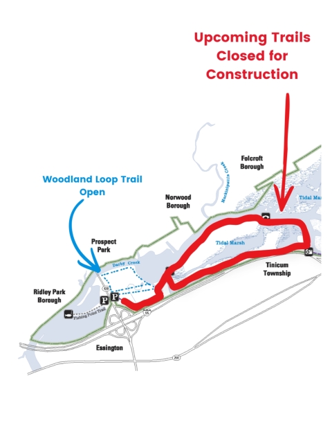
Purpose: The Henderson Marsh Restoration Project will restore 150 acres of tidal wetland and improve water recreation, wildlife viewing opportunities, and environmental education programs. Henderson Marsh is the section of marsh between Darby Creek Trail and Tinicum Trail, on the west end of John Heinz NWR. For this project, we will dredge new and existing channels in the marsh to improve water flow and tidal connectivity, enabling the marsh to store and naturally filter more water during high tides. Increased water storage will also reduce flood risk in surrounding communities. A new breach will be made in Darby Creek Trail to connect a new channel and open a new area for water to flow into the marsh. A new bridge will be placed over this breach, similar to the two existing bridges on Darby Creek Trail. Increasing tidal connectivity will also improve the quality of tidal marsh habitat used by birds, turtles, fish, and other species. More water in the marsh will also limit phragmites growth in the marsh, as phragmites grow on elevated areas high tide does not regularly reach.
Widening and creating new channels will also create more accessible space to explore the marsh by kayak and canoe. Other infrastructure improvements include a new boat launch for kayaking, a new observation tower over Henderson Marsh, and new signage on the Darby Creek Trail.