


Visit Us
National Wildlife Refuges offer us all a chance to unplug from the stresses of daily life and reconnect with our natural surroundings. The refuge offers opportunities for the public to experience nature during all seasons!
Activities
It’s a bike! It’s a boat! It’s skis and snowshoes! Whether you are searching for that secretive marsh bird, looking for tranquility in the calm of the refuge, or just trying to get some fresh air and exercise, the refuge has endless opportunities for you to recreate. The refuge is open from sunrise to sunset for your enjoyment.
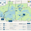
Trails
Nesting is a critical time for our wildlife. From March 1 - September 30, please stay on trails, overlooks, and in public fishing areas. All other areas of the refuge are closed to public entry.
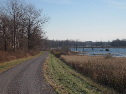
Feeder Road
Open for: Hiking, biking, snowshoeing, cross-country skiing, wildlife observation and photography.
Access: Open year-round, sunrise to sunset. Vehicles are permitted between Route 77 and the gate at the half-way point from October 1 - end of February. Please stay on the trail. Bikes and vehicles are not allowed on adjacent dikes. Access to wetland areas for hiking or walking is prohibited year round. Only service vehicles are allowed beyond the gated area.
Length: 3.5 miles one way (7 miles round trip)
Originally, this trail was made from the spoils of digging the Feeder Canal in 1823. The canal connected water from the Tonawanda Creek to Oak Orchard Creek in order to improve its flow into the Erie Canal in Medina. It is the longest hiking trail on the Refuge. In order to access the southern part of the trail, park at the Kanyoo Trail parking lot and follow the grass pathway to the west. This will lead visitors to a gravel path that goes through wetlands, forest, and grasslands. You can also access the trail from the north parking lot off of Dunlop Road. On Feeder Road, it is common to hear a wide variety of songbirds and marsh birds and to see different shorebirds, waterfowl, and bald eagles.
This trail also includes an audio guide which can be followed using the posted signs.
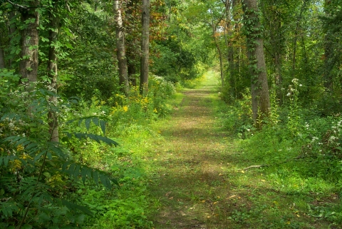
Kanyoo Nature Trail
Open: Year-round, sunrise to sunset for hiking, snowshoeing, cross-country skiing, wildlife observation and photography
Length (including a 250ft boardwalk): Yellow - .66 mile loop; Blue - 1.0 mile loop
This trail, off of Route 77, consists of two loops that are 0.66 miles (yellow markers) and 1 mile (blue markers). The pathway is made from dirt and gravel and is surrounded by wildflowers and fungi, such as trillium and turkey tail, respectively. The trail leads visitors through mixed forests and vernal wetlands. Along the yellow trail there is an observation platform that is nestled in the trees overlooking the marsh. The blue trail offers a boardwalk so you are able to walk through the marsh at the Mohawk Pool.

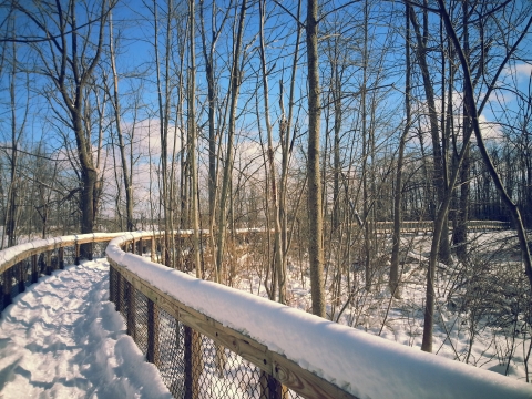
Swallow Hollow Trail
Open: Year-round, sunrise to sunset for hiking, wildlife observation, photography
Length: 1.3 mile loop (includes 2,000 foot boardwalk)
Located on Knowlesville Road, this loop trail that takes visitors through marsh, forested wetlands, and upland habitat. On the elevated boardwalk and gravel trail, you will have the opportunity to view unique wetland species that are listed on educational panels along the route. Warblers are common visitors of this path and can be seen in the late spring and summer on the trail. You also may catch a glimpse of a snapping turtle, pileated woodpecker, or white-tailed deer.
This trail also includes an audio guide which can be followed using the posted signs.
Onondaga Nature Trail
Open: Year-round, sunrise to sunset for hiking, snowshoeing, cross-country skiing, wildlife observation, photography
Length: 1.2 miles one way (2.4 miles round trip)
Off of Sour Springs Road (approach from Roberts Road), lies Onondaga Trail. This trail provides visitors with the chance to see diverse wildlife. A quiet walker will be rewarded with a variety of songbirds, waterfowl, and mammals. The dirt and gravel dike trail leads you past Onondaga Marsh and into mixed forests with evergreen plantations that predate the refuge. In the spring, wood ducks and hooded mergansers like to make their nests in provided nest boxes. A side loop offers a weaving path around a small vernal (seasonal) pool.
Vehicle access to Onondaga Trail is only from the south, off of Roberts Road.
Please note: Sour Springs Road is not maintained in the winter months and therefore this parking lot may not be accessible by vehicle. However, the trail remains open year round. Sour Springs Road is not a through road for vehicles as there is only a pedestrian/snowmobile bridge across Oak Orchard Creek.
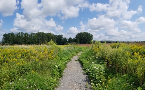
Headquarters (HQ) Nature Trail
Open: Year-round, sunrise to sunset, for hiking, wildlife observation and photography
Length: 1.1 mile loop
Headquarters trail starts at the kiosk outside the Visitor Center located off of Casey Road. At just over 1 mile, this loop trail winds its way through grasslands, forested habitat, and marshland. The gravel trail is ADA accessible and provides an easy stroll with ample opportunity for wildlife observation. You may see purple martins catching dragonflies to feed their young, a resident opossum meandering through the trees, wood ducks on the pond, and butterflies pollinating the goldenrod.
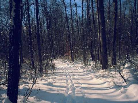
Mohawk Ski Trail
Open seasonally for: cross-country skiing and snowshoeing conditions permitting.
Length: 7.5 miles (round trip) loop.
Mohawk Ski trail is the primary means to ski on the refuge. It is a relatively flat 7.5 mile loop through the grasslands, forests, and along the dikes surrounding Mohawk Pool. The trail begins at the Visitor Center on Casey Road. Trails are not groomed regularly by staff and obstructions to the trails are to be expected. Portions of the trail run along Feeder Road and through HQ and Kanyoo Nature Trails to create the loop. Mohawk Ski Trail closes for the season on March 1st to minimize disturbances to nesting and resting wildlife.

Oak Orchard Creek Water Trail
Open: Year-round as conditions allow for canoes, kayaks, non-motorized boats.
Length: 5.5 miles (one-way); shorter routes available depending on launch point.
A unique way of enjoying the refuge is by exploring the primitive beauty of Oak Orchard Creek. The creek is open to paddlers from Knowlesville Road to Route 63 and is approximately 5.5 miles one-way (11 miles RT). We suggest launching from Knowlesville Road, but you are also able to launch at Sour Springs Road and Route 63 (be careful for passing traffic).
This waterway is not groomed regularly, so expect variable water levels and obstructions including beaver dams and downed trees as you travel through the wooded swamp.

Cayuga Overlook
This overlook, located off of Route 77 and half a mile north of the Kanyoo Trail, offers views Cayuga Pool. From the observation deck you may be able to see resident bald eagles, green winged teal, great egrets, and shorebirds. The deck can provide shelter from windy winters or the hot summer sun. There are locations to mount your scope or take a seat and enjoy the view.
Mallard Overlook
Located on Sour Springs Road, (access from Oak Orchard Ridge Road only) on the east side of Ringneck Marsh, Mallard Overlook gives a different perspective of Ringneck Marsh. This overlook boasts views of osprey and waterfowl. You can hear the song of orange crowned warblers and the pounding of downy woodpeckers which favor the trees around this quiet location.
Vehicle access to Mallard Overlook is only from the north, off of Oak Orchard Ridge Road.
Please note: Sour Springs Road is not maintained during the winter months and therefore this overlook may not be accessible by vehicle. It is, however, still open to the public by foot. Sour Springs Road is not a through road for vehicles as there is only a pedestrian/snowmobile bridge across Oak Orchard Creek.
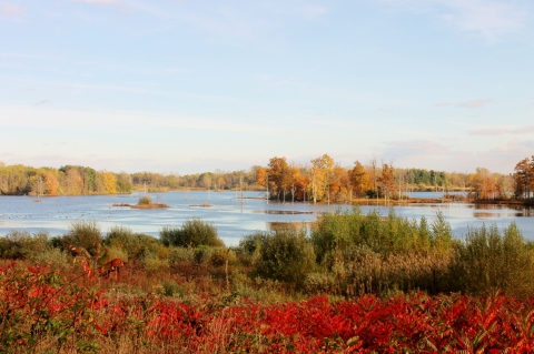
Ringneck Marsh Overlook
Just off of Oak Orchard Ridge Road and half a mile east of Route 63, Ringneck Marsh Overlook offers opportunities to see great blue herons, mallards, geese, and maybe even ringneck ducks for which the marsh is named. If lucky, in the spring you could see osprey and bald eagles battle it out for possession of the nest on the island. When viewed from the north, the marsh provides a picturesque view of its brilliant seasonal colors.
Schoolhouse Marsh Overlook
A quarter of a mile east of the Ringneck Marsh Overlook on the north side of Oak Orchard Ridge Road is a small overlook with views of Schoolhouse Marsh. Named for the schoolhouse that once existed in this location, it is a great spot to view shorebirds, American wigeon, and discreet marsh birds.
Related Documents
Rules and Policies
Refuge Regulations
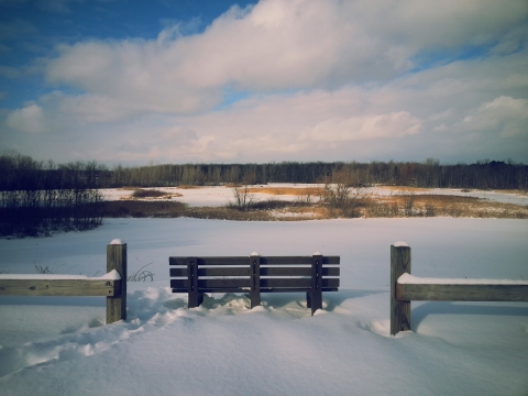
The refuge grounds are open sunrise to sunset, except when participating in scheduled, refuge authorized activities. During winter months, the trails are not cleared of snow.
From March 1st-September 30th, please stay on designated trails, overlooks, Feeder Road, Oak Orchard Creek and designated fishing areas. All other areas are closed to public access (except by Special Use Permit) to minimize disturbance to nesting and resting wildlife.
Check the specific activities pages for regulations and permitting information regarding hunting, trapping, and fishing.
Vehicles must stay on established roads marked open for vehicular travel. Vehicles must be parked off the lane of travel and not blocking gates or other access points.
Non-motorized boats such as canoes or kayaks may only be used on Oak Orchard Creek, between Knowlesville Road to Route 63. You may launch boats from Route 63, Sour Springs Road and Knowlesville Road.
The Refuge is "carry in -- carry out" and has no picnic facilities. Please take all of your litter with you to dispose of properly.
Pets must be kept under your physical control and on a leash no longer than 10 feet. As a courtesy to other visitors, please clean up after your pet.
Prohibited Activities
Overnight parking, camping, open fires, and grills.
Use of ATV's and snowmobiles
Wading or use of float devices such as inner tubes or inflatable rafts
Collecting or releasing live bait
Collecting, removing, or damaging vegetation
Geo-caching
Use of drones
Horses and horseback riding
If You See Something, Say Something
Please call our main office at 585-948-5445 to report suspicious activity or anyone that may not be following the refuge's rules and regulations.
Locations
The refuge is located between the Oak Orchard and Tonawanda State Wildlife Management Areas.
The refuge office is located at 1101 Casey Road, Basom ,NY.
From the New York State Thruway (I-90) take exit 48-A (Pembroke/Medina). Go north on Route 77 for approximately eight miles. At the four-way stop light in the town of Alabama, continue straight for one more mile to Casey Road. Turn left on Casey Road. The Visitor Center and administration office are one mile west.
When using a GPS unit or Google Maps Navigation app to guide you to the Visitor Center please ensure you are being directed to the Iroquois Refuge Admin Building. Ensure the pin is actually on Casey Road and not in the middle of the Refuge or some other road.
See our interactive map to find the best route to the Refuge for you.