


Visit Us
For maps, brochures, or answers to your questions, you can visit our office. The office is open Monday – Friday from 7:30 am until 4:00 pm. Closed on all Federal Holidays.
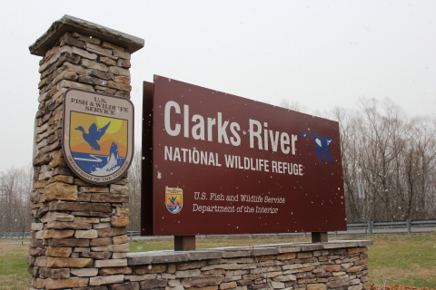
The physical address to Refuge Headquarters:
91 US Hwy 641 North
Benton KY 42025
Phone: 270-527-5770
Do NOT rely on Google Maps to get you to the Headquarters. Please use the directions or the GPS coordinates provided below.
Directions to Refuge Headquarters: From I-24, Exit 25- I-69/Purchase Parkway south; to Exit 43- Benton/Symsonia towards Benton; left on Hwy US 641 North (3rd stoplight); Clarks River NWR is ~1 mile on left on Hwy 641.
GPS Coordinates: 36.879829, -88.344359
Trails
The Environmental Education and Recreation Area (EERA) is one of the most popular locations on the refuge for hiking and wildlife viewing. The area offers paved, gravel, and dirt trails.
The physical address to the EERA:
1010 Eggner Ferry Road
Benton KY 42025
Do NOT rely on Google Maps to get you to the EERA. Please use the directions or the GPS coordinates provided below.
Directions to Environmental Education and Recreation Area: From I-69/Purchase Parkway, Exit 43- Benton/Symsonia Exit towards Benton; right on Hwy US 641 south (3rd stoplight); left on Hwy 408 east (second stoplight); Environmental Education and Recreation Area is ~ 1 mile on the right.
GPS Coordinates: 36.857111, -88.337127
Related Documents
We like to make sure our visitors have the information they need for an enjoyable visit at Clarks River National Wildlife Refuge. Here are some of our brochures to get you started.


Other Facilities in the Complex
Kentucky has two National Wildlife Refuges that are managed and located fully in the state. Both conserve and manage natural resources for future generations of outdoor enthusiasts to enjoy.

Rules and Policies
There are many interesting things to do and see during your visit to Clarks River National Wildlife Refuge, but it is our number one job to ensure wildlife and the habitat they call "home" is protected. Below are a few guidelines for visitors to help keep both you and the wildlife safe.
Refuge property is marked on the outside boundary with yellow paint hash marks and blue goose boundary signs. Landowners adjacent to the refuge may mark their boundary with blue paint hash marks and no trespassing signs. Trespassing on posted or unmarked private property is a violation of Kentucky state law.
- The Refuge is only open to the public from sunrise to sunset, with the exception of permitted hunting seasons.
- There is no camping allowed on the Refuge; campfires are also not permitted
- Refuge signs define refuge boundaries. “Area closed” signs are erected to minimize disturbance to wildlife and for public safety.
- Pets on a leash are permitted.
- Bicycling is permitted on established roads.
- Horseback riding is permitted on established roadways or trails.
- Firearms are permitted on the refuge in accordance with state and local law.
- Searching for and removal of objects of antiquity is prohibited.
- Disturbing or feeding wildlife or collecting plants is not allowed.
- ATV’s are prohibited.
- Use of artificial lights, including vehicle lights, to observe wildlife is not allowed.
- The Refuge is open during daylight hours.
- To have a special event, conduct research, etc., a Special Use Permit must be issued before participation in such activity.
For hunting and fishing regulations, please refer to our hunting brochure.
Locations
Refuge Headquarters (where the pin is located on the map) is where you can find brochures, maps, and other relevant information before you venture out on refuge lands. This location also offers interpretative opportunities in the Conservation Garden which begins just to the left, or southwest side, of the headquarters building.
The Environmental Education and Recreation Area (EERA) is one of the most popular locations on the refuge for hiking and wildlife viewing. The area offers paved, gravel, and dirt trails along with observation decks and a fishing pond. This area is located only minutes (2.3 miles) from the refuge headquarters.
Directions to Refuge Headquarters: From I-24, Exit 25- I-69/Purchase Parkway south; to Exit 43- Benton/Symsonia towards Benton; left on US HWY 641 North; Clarks River National Wildlife Refuge Office is ~1 mile on left on US HWY 641.
GPS Coordinates: 36.879829, -88.344359
Directions to Environmental Education and Recreation Area: From I-69/Purchase Parkway, Exit 43- Benton/Symsonia Exit towards Benton; right on US HWY 641 south; left on E 12th/KY-408 east; Environmental Education and Recreation Area is ~ 1 mile on the right.
From Refuge Headquarters, turn right out of the parking lot on to US HWY 641 South; left on E 12th/KY-408; Environmental Education and Recreation Area is ~ 1 mile on the right.
GPS Coordinates: 36.857111, -88.337127