
Sacramento National Wildlife Refuge Complex Visitor Center Re-Opening!
The Friends of Sacramento National Wildlife Refuge cordially invite you to the Grand Re-Opening of the Visitor Center! Come explore the newly renovated facilities, learn about local wildlife, and enjoy refreshments and activities for the whole family.
Saturday, March 7, 2026 from 9AM-3PM, with a ribbon cutting at 10AM.
Sacramento NWR Complex Visitor Center: 752 County Road 99W, Willows, CA 95988
Updates are posted here as new information is received. If 'last-updated' timestamp is a few days old, it is because conditions have NOT changed since that time. Last updated 2/19/2026 8:15am*
TEMPORARILY CLOSED:
OPEN**:
- Sacramento NWR Visitor Center and Nature Store = Limited days and hours
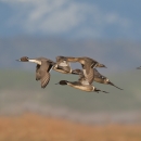
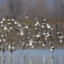
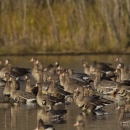
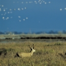
- Sacramento NWR Auto Tour + Observation Platforms, Trails
- Sacramento NWR Logan Creek Spring Trails (seasonal: open February 15-June 30)
- Colusa NWR Auto Tour
- Colusa NWR Trail, Observation Platform
- Llano Seco Unit of Steve Thompson NCV WMA – Trail, Observation Platform
- Sacramento River NWR
*Before calling the refuge for updates, please review this section of our website or our social media pages. Any new information will be posted here and to our Facebook and Instagram promptly.
**Areas are subject to closure without notice. Please use extreme caution when driving the refuges, as flooding can occur without warning and road shoulders are soft and will not support your vehicle.
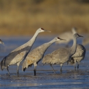
Bald Eagle Nest - Sacramento NWR
A young bald eagle pair is nesting at Sacramento NWR. To help them thrive, please stay in your vehicle and on designated roads. There’s a great alternative viewing area at the bench at Trail Marker 2 on the Wetland Walk Trail. Our Visitor Services team is available on Fridays and Saturdays (subject to change) if you need assistance during your visit. We will continue to monitor the situation and provide updates as needed. Thank you for enjoying wildlife responsibly.
Visit Us
Welcome to Sutter National Wildlife Refuge!
Sutter NWR offers limited Seasonal Trails and Hunting.
There are LOTS of recreational opportunities on the other refuges of the Complex, including Visitor Areas, Auto Tours, trails, bicycling, photography, and hunting.
Sutter National Wildlife is one of the 5 National Wildlife Refuges and 3 Wildlife Management Areas that make up the Sacramento National Wildlife Refuge Complex:
- Sacramento NWR
- Delevan NWR
- Colusa NWR
- Sutter NWR
- Sacramento River NWR
- Llano Seco Unit (STNCV WMA)
- Butte Sink WMA
- Willow Creek-Lurline WMA
Use the table below to navigate to the information that's most helpful for you:
Check out our VISIT US! page = a one-stop place for all your visiting questions, including: | ||
|---|---|---|
| Activities | Information | Directions |
| ||
Trails
Please visit our Auto Tours, Trails & Bicycles page for current maps and information.
Other Facilities in the Complex
Sutter National Wildlife Refuge is managed as part of the Sacramento National Wildlife Refuge Complex, with headquarters at Sacramento National Wildlife Refuge. The Refuge Complex is comprised of 5 National Wildlife Refuges (Sacramento, Delevan, Colusa, Sutter and Sacramento River NWRs) and 3 Wildlife Management Areas (Willow Creek-Lurline, Butte Sink and Steve Thompson North Central Valley WMAs).

Locations
For a summary of our Rules and Policies, please see our Visit Us page