
More and more people appreciate the importance of wetlands, to both wildlife and people. They provide needed habitat, clean drinking water, flood protection, and so much more.
It’s no surprise then that everyone from developers to landowners, and folks in between, use the Service’s National Wetlands Inventory (NWI) maps for all sorts of reasons.
Many states and tribes partner with NWI to map wetlands. Delaware’s Wetland Monitoring and Assessment Program (WMAP) recently unveiled its newest NWI maps, which it uses to assess the health, functions, and ecosystem benefits of Delaware’s wetlands.
A wide array of individuals and organizations use these maps to best manage and conserve wetlands. Engineers and transportation planners use wetland maps as a pre-screening tool to avoid wetland impacts with new road alignments. Consultants and developers use the data to plan new developments around sensitive wetland areas, so they can avoid impacting important habitats and speed the permitting process. Cities and towns incorporate wetland maps into conservation plans to conserve wetland benefits, like natural disaster resilience, for the future.
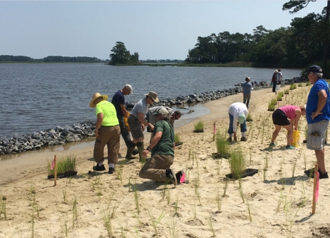
Delaware’s new wetland maps were recently used to find the right location and plants for a living shoreline project that will improve community level resilience to sea level rise.
“Wetland spatial data is by far one of the most cost-effective tools providing time and funding efficiencies for planning many types of projects”, says Mark Biddle, Delaware Environmental Program manager.
Thanks to regular updates, Delaware’s wetlands have been mapped four times since the early 1980s. The most recent effort used extremely fine spatial resolution (2 to 9 inch) aerial imagery and lidar data along with computer analysis and field reconnaissance. According to Biddle, having data from multiple years “allows for the tracking of both wetland acreage and type change, and more importantly tracking the gain or loss of a host of beneficial functions that wetlands provide naturally.”

Status and change data for the 10-year period between the last two mapping efforts (2007-2017) also helped WMAP to determine what might be causing these changes. Delaware’s latest study noted non-tidal wetland differences due to a wide variety of causes, including deforestation, development, and agriculture. Tidal wetlands primarily changed from vegetated wetland to mudflats or open water, which may indicate the effect of sea level rise and saltwater intrusion. These differences will alter how wetlands function at a landscape scale and ultimately the ecosystem benefits that are provided to the people of Delaware. This information is used to inform the citizens of Delaware and to improve upon existing education, restoration, protection, and land use planning
Mapping wetlands, including timely updates, offers incredible value and vital information to a wide range of community users. You can learn more about wetlands in your backyard by visiting the Wetlands Mapper.


