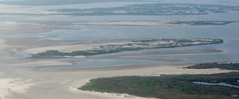
Coastal barrier islands are dynamic, constantly shifting size and shape over time. The barrier islands in Breton Sound that are now part of the Refuge start northeast of Venice, LA and extend northeast in a crescent sweep for about seventy miles to the north end of the Chandeleur Islands. These islands are a remnant of when the Mississippi River delta shifted westward about 2000 years ago, depositing the sediments that make up the landform.
Breton and the Chandeleur Islands once had trees, dunes, and higher elevations. In the late 19th century a lighthouse was built at the north end of the Chandeleurs. This structure stood until Hurricane Katrina took it out in 2005. At the turn of the 20th century Breton Island had a small fishing village, a schoolhouse, and several families inhabiting the island. In 1915 the island was evacuated prior to being destroyed by a hurricane. The settlement was never rebuilt.
Today, the refuge islands are open barrier islands composed of sand and shell beaches, overwash areas, and some marsh and dune grasses and vegetation. Nature is taking its course, washing away some parts of the islands and depositing sands in others.