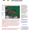
View Wetlands Data with a KML file
Keyhole Markup Language (KML) is an XML language focused on geographic visualization, including annotation of maps and images. KML files can be viewed with several software programs including ArcGIS Explorer and Google Earth*.
Please read the Disclaimer, Data Limitations, Exclusions and Precautions, and the Wetlands Geodatabase User Caution.
If using Google Earth, it is recommended that you always load the file and open Google Earth by selecting the link below to ensure that you use the latest version. Please note that Google Earth version 6.0, or higher, is required to run this file.
FWS Wetlands.kml
(last modified on January 29, 2026)
If Google Earth fails to launch automatically, the file can also be used by first launching the Google Earth application. Save the .kml file to your computer, then select the menu option File, Open, locate the previously downloaded file (WetlandsData.kml), then click the Open button.
- Click on any Places check-box to view or hide the data layer.
- If the wetland polygons and labels display with very low resolution or distorted, please try deselecting the Ocean and the 3D Buildings layers at the lower left section of Google Earth.
- To remove the Wetlands KMZ file from Google Earth, right-click on the FWS Wetlands & Riparian folder located under Places (Google Earth left panel), then select Delete.
- Digital data available on this site represent the latest, most accurate information available from the U.S. Fish and Wildlife Service's National Wetlands Inventory. These data are also available on The National Map.
- The data are also available through an OGC compliant Web Map Service.
Note: It is extremely important that U.S. Fish and Wildlife Service (Service) employees appropriately use Google mapping software and understand its limitations and uses. There are many situations where Google mapping software can be a useful and productive tool to aid our work. Service staff should understand the appropriate application and use of Google software.