


What We Do
Wildlife conservation is at the heart of the National Wildlife Refuge System. It drives everything on U.S. Fish and Wildlife Service lands and waters managed within the Refuge System, from the purposes for which a national wildlife refuge national wildlife refuge
A national wildlife refuge is typically a contiguous area of land and water managed by the U.S. Fish and Wildlife Service for the conservation and, where appropriate, restoration of fish, wildlife and plant resources and their habitats for the benefit of present and future generations of Americans.
Learn more about national wildlife refuge is established to the recreational activities offered to the resource management tools used. Using conservation best practices, the Refuge System manages Service lands and waters to help ensure the survival of native wildlife species.
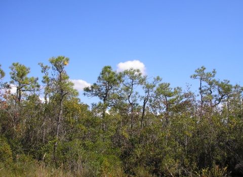
Habitat management at Pocosin Lakes NWR is greatly influenced by fire and water. The refuge’s water management keeps the peat soils moist, protecting them from destructive wildfire and restoring natural biochemical processes in the wetland. Pocosins are a fire-adapted ecosystem. Many plant communities found in pocosin wetlands require fire to persist in healthy conditions. Prescribed fire reduces the likelihood of catastrophic wildfires, releases nutrients back into the soil, removes undesirable vegetation, and stimulates growth of early successional plants that are eaten by a variety of wildlife. In addition, the cooperative farming program on the refuge allows local farmers to farm on refuge lands in exchange for leaving a portion of the crop as high-energy food for waterfowl and other wildlife.
Management and Conservation
Refuges deploy a host of scientifically sound management tools to address biological challenges. These tools span active water management to wilderness character monitoring, all aimed at ensuring a balanced conservation approach to benefit both wildlife and people. At this field station our conservation tool box includes:
Habitat Restoration
Hydrology Restoration
Previous owners of the lands that now make up the refuge installed ditches and canals to farm and harvest timber in the area. About a third of the Refuge was heavily ditched and drained. In these highly altered areas, the Refuge is reestablishing more natural hydrologic conditions by using dikes and water control structures to stop the artificial drainage of water from the soil in order to restore the pocosin wetlands. Learn more about the Pocosin Lakes NWR Hydrology Restoration.
Reforestation
Forest management and reforestation are important strategies for the habitats on Pocosin Lakes NWR. Reforestation is a tool necessary in areas where logging has been conducted and in areas where wildfire has caused severe destruction. Dr. Eric Hinesley drafted a forest management plan for Pocosin Lakes NWR in 1999. Active forest management is necessary to maintain certain habitats that will be lost through natural succession such as Atlantic white cedar (AWC) habitat and canebrake. Though the interference may seem contrary to allowing natural processes to occur, it is necessary in this area to protect these two habitats that have become scarce due to logging and development.
The 2008 Evans Road Wildfire resulted in over 25,000 acres burned on the Refuge. Within the footprint of the Evans Road Fire are suitable sites for reestablishing AWC, cypress and - if regeneration is not occurring - pond pine. AWC habitat is sensitive to numerous environmental factors making restoration complicated. Certain common characteristics seem to take priority including fire intensity and frequency, peat depth, wind throw and high water tables.
Relying on wildfires for forest management is risky and unreliable management policy. Results from unmanaged regeneration are often unpredictable. For example, habitats may convert to hardwood swamps rather than AWC stands. Where possible, disturbance must be carefully managed or controlled in order to encourage, not deter, cedar regeneration.
Cooperative Farming
The Refuge currently manages 1,250 acres of cropland through cooperative farming agreements with local farmers. Farmers plant these farmlands under Cooperative Farming Agreements with the Refuge. The typical crop rotation includes corn, soybean and winter wheat as a cover crop. Typically, 20% of the total acreage farmed is left in the field as food for wildlife. The result is 250 acres of standing corn and 200 acres of winter wheat for wintering waterfowl. Flocks of over 100,000 swans and geese forage in the Refuge farm fields.
Education & Outreach
The refuge features the Walter B. Jones, Sr. Center for the Sounds Visitor Center, a variety of interpretive signs and trails, and regular educational programs.
Fire Management
A large portion of the refuge was ditched and drained, then cleared to support farming. The altered state of the soils made the lands more susceptible to disastrous wildfires during periods of hot, dry weather. The refuge staff and its cooperators work quickly to suppress wildfires to prevent them from growing into large, catastrophic fires like ones seen in past years. The fire management program has also enhanced habitat through prescribed burning of selected areas.
While fire during times of drought can damage the organic soils of the pocosin, fire is a very useful tool for habitat management when used under appropriate weather conditions. Fire will release nutrients back into the soil, remove undesirable vegetation, and stimulate growth of early successional plants that are eaten by a variety of wildlife. It also serves as a tool to prevent large wildfires from occurring. Once a prescribed burn prescribed burn
A prescribed burn is the controlled use of fire to restore wildlife habitat, reduce wildfire risk, or achieve other habitat management goals. We have been using prescribed burn techniques to improve species habitat since the 1930s.
Learn more about prescribed burn has occurred, the fuels from the land will have burned and will not burn again, or will not burn as intensely compared to lands that were not burned.
Pocosin Lakes National Wildlife Refuge has an existing Fire Management Plan with prescriptions for where and how to manage Refuge resources through the use of prescribed fire. In addition, it explains in detail the wildfire history on the Refuge. The Refuge has experienced several catastrophic wildfires and deep ground fires due to drought conditions and artificially drier organic soils from drainage practices prior to refuge establishment.
Peatland wildfires have occurred throughout history; however, the intensity of ground fires greatly increased following the ditching and drainage of the pocosin landscape. One of the first documented catastrophic wildfires is the 1982 Bull Hill fire that burned over 15,500 acres. This was followed by the 1985 Allen Road fire that burned over 100,000 acres and, in some areas, consumed over three feet of peat soil. The third major fire occurring on the refuge was the 2008 Evans Road Wildfire. This fire burned over 42,000 acres including 28,700 acres of refuge land. The areas with drier peat conditions located on adjacent private land experienced severe ground fire resulting in losses of over five feet of peat. The refuge experienced less severe ground fire than on adjacent drained private lands due to wetter peat conditions from the ongoing, but not yet complete, hydrology restoration work. Most of the infrastructure for the hydrology restoration was installed by 2010. Wildfires on the refuge tend to be large in size due to the characteristics of the peat soils, including the large available acreage of fuels, the nature of the fuels, the complications of topography impeding fire equipment, and the tactics required to extinguish ground fires.
Prescribed fire is a widely used tool in forest management. The habitats of the Albemarle-Pamlico Peninsula depend on fire in a number of ways. Some pine trees rely on fire to trigger seed release. Fire controls proliferation of understory and hardwoods, allowing habitats such as Atlantic white cedar to continue to exist. With increased human habitation and modification of the landscape, wildfires cause severe destruction and cannot be allowed to perform the habitat functions that they did historically. Therefore, controlled, prescribed fires are the means by which forest managers incorporate fire as a management tool while containing and controlling the negative impacts of wildfires.
Invasive Species and Pesticide Management
Invasive and non-native plant and animal species are real and severe threats to species and habitats on the Refuge. Animal species including nutria, feral hogs, European starlings, white-tailed deer and bear can be destructive factors due to their presence, sheer numbers or competition with native or imperiled animals.
Phragmites, alligatorweed and Sesbania are the most dominant pest plants on the refuge, but others such as Japanese stiltgrass, Chinese privet, Florida betony and Japanese honeysuckle are highly visible. The lake margins of Pungo Lake have great potential for producing high quality waterfowl food plants, but encroaching common reed (Phragmites australis) is a continual challenge in the areas. Phragmites is a persistent and quickly spreading nuisance that out-competes native marsh plant species. Alligatorweed infiltrates canals and waterways blocking water flow and creating problems for water management.
Control and eradication measures include mechanical removal of the plants or treatment with herbicides. Repeated efforts are required and early detection is essential in making progress toward eradication.
Treatment of Sesbania with glyphosate herbicide began during the fall of 2000 and continued through 2010. The presence of this plant will requires continued early detection and rapid response with herbicides and mechanical removal to manage its distribution at a tolerable threshold.
The North Carolina Division of Plant Industry and the USDA Forest Service closely monitors gypsy moth populations. They utilize pheromone traps located throughout the State, including on Refuge lands. When they detect large-scale outbreaks, they use integrated pest management techniques to suppress the outbreak, but not necessarily eliminate the species from the area. The staff deploys up to five pheromone-gypsy moth traps at high public use areas across the Refuge to monitor the spread of gypsy moths.
An additional threat of significance is southern pine beetle (Dendroctonus frontalis), which is most likely to attack older, mature stands with less vigor than younger stands. Land managers treat infected stands by cutting down a swath of trees around the area where the beetles are actively feeding, thus removing their food and starving them. The best insurance against potential losses due to pine beetle infestation is to keep pine forests good health through thinning and other management practices.
Nutria, beavers and feral hogs are very destructive to plant communities on the Refuge and can interfere with water management. Mechanical control measures such as trapping and hunting are possible measures for controlling or eradicating these animals.
Inventory and Monitoring
Law Enforcement
Moist Soil Management
Recreation Management
Water Management
Managing water is an essential component of managing the pocosin and other habitats used by migratory birds and other wildlife on the Refuge. Managing water is also essential for reducing the risk and intensity of wildfire in the pocosin. Rainfall is the only source of water for much of the pocosin wetlands on the Refuge. Most of the rainwater leaves the pocosin via evapotranspiration (water uptake by trees and other vegetation) and drainage. Since we can't control rainfall and evapotranspiration, our water management in our Hydrology Restoration Areas involves controlling how much rain water drains out. Our goal is to stop the artificial drainage of water from the peat soil by using dikes and water control structures.
We also carefully control drainage on the Pungo Unit to manage habitat for wintering waterfowl. However, in the Pungo Unit, we have some water draining in from other lands and wells on two of our moist soil management units that provide an additional water source when mother nature doesn't provide us with enough rainfall.
Wood Duck Management
One of the purposes of Pocosin Lakes NWR is to provide optimum wintering habitat on the Pungo Unit for migrating and wintering waterfowl and breeding habitat for wood ducks in conjunction with other refuges in the National Wildlife Refuge System. A variety of habitats are managed on the Refuge for wintering migratory waterfowl and breeding wood ducks. These habitat types include open water, moist soil, cooperative farmlands, and flooded wetlands.

Our Services
Some commercial, recreational and research activities are allowed on national wildlife refuges only with a special use permit issued by the local office, and are subject to specific conditions and fees. This permit requirement is meant to ensure that all activities at the federal site are compatible with the refuge’s Congressionally mandated wildlife conservation goals. Permits enable the public and scientific communities to engage in legitimate wildlife-related activities that would be otherwise prohibited by law. Service permit programs ensure that such activities are carried out in a manner that safeguards wildlife.
Types of Special Use Permits
The Service has developed three different Special Use Permit (SUP) forms which may enable the public to engage in activities considered a) commercial b) research and c) other general uses.
1. National Wildlife Refuge System Commercial Activities Special Use Application and Permit (FWS Form 3-1383-C) for:
- Commercial activities such as guiding hunters, anglers or other outdoor users;
- Agriculture (haying, grazing, crop planting, logging, beekeeping, and other agricultural products).
2. National Wildlife Refuge System Research and Monitoring Special Use Application and Permit (FWS Form 3-1383-R) for:
- Research and monitoring activities by students, universities, or other non-FWS organizations.
3. National Wildlife Refuge System General Special Use Application and Permit (FWS Form 3-1383-G) for:
- Filming or still photography with a party of 9 or more people; filming or still photography that requires access to closed areas or exclusive access to the refuge; or filming or still photography that requires a set or staging equipment.
- Other (any activity not mentioned above and not usually available to the general public).
The above-referenced activities are not necessarily conducted on every refuge. Contact the Refuge manager to inquire whether we consider the proposed use appropriate or compatible on Alligator River National Wildlife Refuge.
See below for permit files. Prospective permit holders may fill out the corresponding application and return it to the refuge for processing. Please allow a minimum of six weeks for permit processing.
By email: pocosinlakes@fws.gov
By mail:
Pocosin Lakes NWR
P.O. Box 329
Columbia, NC 27925
The permit is not valid until approved and signed by a refuge official.
Our Projects and Research
The hydrology restoration project at Pocosin Lakes NWR is one of the largest in the country, re-wetting more than 43,000 acres of peatlands. Restoring the natural hydrologic patterns of peatland ecosystems improves the health of native vegetation, reduces the risk of catastrophic wildfire that can harm people and ecosystems, and allows the soil to resume forming new peat and accruing carbon. To restore the natural hydrology, the refuge placed water control structures in the drainage canals, allowing the refuge to set water levels within individual management units according to management goals.
Audio Described Version
Pocosin Lakes National Wildlife Refuge encompasses approximately 110,106 acres of Washington, Hyde, and Tyrrell Counties in eastern North Carolina. In addition to more than 8,300 acres of managed waterfowl habitat, the refuge also has more than 101,600 acres of pocosin peatlands. Pocosin (a Native American term meaning “swamp on a hill...