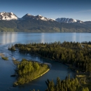
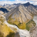
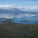
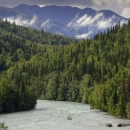
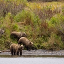
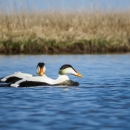
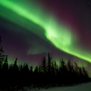
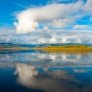
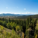
Preserving water quality is one purpose of every National Wildlife Refuge in Alaska. Land cover and use can affect the water quality of rivers, lakes and other surface waters. Potential sources of point- and non point-source pollution, such as communities and resource development projects, can threaten refuges' waters. Baseline water quality data provide a benchmark for identifying and quantifying the degree of contamination or change. On most of Alaska's refuges, there are limited or no water quality data available. Our Water Resources Branch began a water quality program in the summer of 2001 to monitor water chemistry. Field measurements are made of physical parameters at stream gage sites and samples are collected and analyzed for major inorganic ions, nutrients, and trace metals several times each year.

We operate a network of stream discharge gages to quantify the occurrence and distribution of surface water refuges across Alaska and collect stream discharge data continuously over 6 year periods. We analyze preliminary data on an annual basis, and prepare final reports at the conclusion of each 6 year study. Report results support water rights applications to maintain instream flows. 

This collection includes detailed stream flow information at 79 locations in Alaska. Stream flow data are available for 21 gage sites on the Arctic and Yukon Flats national wildlife refuges. Stream flow data from 15 sites on the Kenai Refuge concluded in 2000 and only preliminary data are available at this time. Innoko Refuge stream flow data for 9 sites will be published and available in the near future. Stream flow data are being collected and analyzed for an additional 30 gage sites located on Becharof, Togiak, Kodiak, and Tetlin refuges. Preliminary data for these stations are available on request.

Lake elevation surveys of selected lakes were conducted to determine lake water surface levels to support instream water right applications. Work conducted by contractors used state-of-the-art Global Positioning System technology to determine lake elevations within centimeter accuracy.

Hydrologic investigations have been completed along the Coastal Plain (1002 Area) of the Arctic National Wildlife Refuge and on the Yukon Flats National Wildlife Refuge. Lake bathymetry data are available for 119 lakes and lake elevation data have been reported for 150 lakes on the Coastal Plain, and 63 lakes in the southern portion of the Yukon Flats National Wildlife Refuge. Water quality data collection began on the Togiak Refuge in 2001 (concluded in 2004), on the Kodiak Refuge in 2003 (concluded in 2007), and on Tetlin Refuge in 2005 (continuing).

Programs

A bright blue sky obstructed by fluffy white clouds reflected off of a stream shot from inside a kayak
The U.S. Fish and Wildlife Service manages an unparalleled network of public lands and waters called the National Wildlife Refuge System. With more than 570 refuges spanning the country, this system protects iconic species and provides some of the best wildlife viewing opportunities on Earth.

Facilities

alternative text
Arctic National Wildlife Refuge sustains people, wildlife, and fish in the northeastern corner of Alaska, a vast landscape of rich cultural traditions and thriving ecological diversity. It is located on the traditional homelands of the Iñupiat and Gwichʼin peoples. Approximately the size of...
aerial photo of an undeveloped watery landscape with mountains in background
The Becharof National Wildlife Refuge is a diverse and beautiful place that includes the largest lake in the Refuge system, an active volcano, unusual geological features, historically significant landmarks, and a federally-designated Wilderness. From the windswept Pacific coast to the rugged peaks...
Sunset over the shore of a large river.
From vast stretches of black spruce forest to vernal pools and slow moving rivers, the Innoko National Wildlife Refuge is home to abundant wildlife from the smallest shrew to huge moose and everything in between. Established in 1980, this refuge located in western Alaska on the traditional...
Kanuti Flats aerial view with spotted bodies of water.
The Athabascan name for Kanuti is "Kk'toonootne" which translates to "well traveled river by both man and animals." Kanuti Refuge is about the size of the state of Delaware and straddles the Arctic Circle, with approximately a third of the Refuge above the Circle and two-thirds below it. Kanuti...
A boat heads down a river lined by forests and mountains.
The Dena’ina people call this special place “Yaghanen” - the good land. It's also known as the Kenai National Wildlife Refuge.  From ice fields and glaciers to tundra, forests, and coastal wetlands, the Kenai Refuge is often called “Alaska in miniature." Biodiversity is unusually high for this...
a kodiak brown bear sow with three large cubs stand on the banks of a lake
Homeland of the Alutiiq Sugpiaq peoples, Kodiak Archipelago is located in the Gulf of Alaska, 30 miles from the nearest mainland coast, across the notoriously temperamental Shelikof Strait. Kodiak National Wildlife Refuge spans almost two million acres and covers more than 2/3rds of Kodiak Island,...
a sweeping view of trees in a valley with mountains in the distance
Tetlin National Wildlife Refuge is nestled within the Upper Tanana River Valley, the abundant wetlands and forests of the Refuge welcome thousands of birds and people crossing the border into Alaska each year. The public lands and waters of the Upper Tanana offer opportunity for people to enjoy...
Two small deep blue lakes in a steep, verdant valley with snow-capped mountains in the distance
Dominated by the Ahklun Mountains in the north and the cold waters of Bristol Bay to the south, Togiak National Wildlife Refuge hosts a kaleidoscope of landscapes. The natural forces that have shaped this land range from the violent and powerful to the geologically patient. Earthquakes and...
Male common eiders in the water at Yukon Delta National Wildlife Refuge in Alaska
Alaska's Yukon Delta National Wildlife Refuge is vast and productive. The refuge nestles between Alaska’s largest rivers, the Yukon and the Kuskokwim Rivers, where the tundra meets the Bering Sea. Its diversity of habitats support one of the largest aggregations of waterbirds in the world. The...
a lynx walks warily through the snow between willow shrubs
Yukon Flats Refuge is the nation’s third largest wildlife refuge. With the Brooks Range to the north and the jagged limestone peaks of the White Mountains to the south, this refuge encompasses the so-called "Yukon Flats" - a vast fire-dependent area of wetlands, forest, bog, and low-lying ground...