The U.S. Fish and Wildlife Service has developed and is implementing a strategic plan to help ensure the long-term sustainability of natural resources (i.e., fish, wildlife, plants, and their habitats) under conditions expected from climate change climate change
Climate change includes both global warming driven by human-induced emissions of greenhouse gases and the resulting large-scale shifts in weather patterns. Though there have been previous periods of climatic change, since the mid-20th century humans have had an unprecedented impact on Earth's climate system and caused change on a global scale.
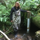
Learn more about climate change and other environmental stressors. To support the strategic plan in the Columbia-Pacific Northwest Region, Service programs (Refuges, Fish and Aquatic Conservation (FAC), and Water Resources) are collaborating to develop and implement a long-term aquatic monitoring program for evaluating effects of climate change at National Wildlife Refuges (NWRs). The goal of the monitoring program is to evaluate evidence of climate change in physical and habitat attributes at NWRs and associated changes in aquatic communities. Specific objectives are to: 1) establish long-term sentinel sites representing NWRs across the range of ecoregions in the Columbia-Pacific Northwest Region; 2) describe how physical and habitat attributes vary through time; 3) describe how biological attributes vary through time; 4) analyze for potential temporal change in attributes by ecoregion; and 5) assess relationships in physical, habitat, and biological attributes by ecoregion.
The project has three stages: reconnaissance; pilot application; and long-term implementation. Reconnaissance consisted of screening and geospatial assessment of streams relative to various factors (e.g., ecoregion, ability to wade, existing information, location and length within a NWR, prevalence of non-climate stressors within the watershed) to assess potential sentinel sites. Sentinel sites were established at five NWRs each representing one of three major ecoregions—Marine West Coast Forest (Muddy Creek at William L. Finley NWR and Omeara Creek at Willapa NWR), Northwestern Forested Mountains (Little Pend Oreille River at Little Pend Oreille NWR and Myrtle Creek at Kootenai NWR), and North American Deserts (Bridge Creek at Malheur NWR).
Pilot application was conducted during 2015–2017 using methods developed by the Environmental Protection Agency. The intent of the pilot application was to assess our ability to consistently generate temperature and stream flow data, to describe variability of four categories of habitat variables and judge their relevance to potential effects of climate change based on annual habitat surveys, and to describe fish assemblage characteristics based on up to three fish surveys during each year of the pilot project. Metrics characterizing fish assemblages included: 1) general descriptors (e.g., species richness among all surveys at a sentinel site); 2) indices of similarity between surveys based on species presence-absence and relative abundance; 3) ecological classification based on species frequency of occurrence and relative abundance among all surveys; and 4) indices of temperature class and tolerance for each survey. Purposes for assessing information from the pilot application were to generate a baseline, which would facilitate comparisons with data collected in the future; and allow evaluation of the performance, logistical constraints, and sustainability of our activities, from which recommendations were developed for long-term implementation.
We generated complete records for air and water temperature at four of the five sites, with air temperature records provided by Water Resources for one. We were unable to generate stream flow records at two sites, however a limited record was generated for one site and Water Resources provided records for two. The stream channel and riparian riparian
Definition of riparian habitat or riparian areas.
Learn more about riparian habitat categories were less variable among years than the substrate and fish cover habitat categories. Although stream conditions precluded conducting some surveys, we successfully characterized fish assemblages at all sites. A total of 30 species were collected, and the majority of assemblage indices indicated substantial similarity in species presence-absence and relative abundance between surveys at most sites. Overall, we concluded that performance and logistical challenges precluded our ability to adequately monitor stream flow at most sites. In addition, consistently high variability in two categories of habitat variables, fish cover and substrate composition, likely limits their utility for long-term monitoring. Although we concluded that the level of effort to continue the pilot application was not sustainable for long-term implementation, the pilot application generated an adequate baseline to which data generated from future surveys conducted at sustainable frequencies and intensities can be assessed.
Recommendations for the third stage, long-term implementation of the monitoring program, are intended to improve the efficiency of monitoring physical, habitat, and biological attributes at sentinel sites, and encourage sustainability of the program. For physical and habitat attributes, recommendations are to: maintain loggers to continuously monitor air and water temperature at each sentinel site; continue using stream flow data generated by Water Resources at two sentinel sites and discontinue efforts to monitor stream flow at three sites; assess ability to make inferences about stream flow at the three ungauged sites based on nearby existing gauge stations; and focus habitat surveys on variables that can be consistently collected and likely most responsive to anticipated effects of climate change (i.e., stream channel and riparian vegetation categories of variables). For habitat and biological attributes, recommendations are to: conduct habitat and fish surveys at one sentinel site per year; establish a rotating schedule so that each sentinel site is surveyed at 5-year intervals; identify conditions that would necessitate surveying more frequently; conduct all surveys with a composite crew representing personnel from all FAC offices to enhance sustainability and encourage continuity in the application of program protocols over time; and personnel from each office would annually update databases and perform analyses.


