


What We Do
Wildlife conservation is at the heart of the National Wildlife Refuge System. It drives everything on U.S. Fish and Wildlife Service lands and waters managed within the Refuge System, from the purposes for which a national wildlife refuge national wildlife refuge
A national wildlife refuge is typically a contiguous area of land and water managed by the U.S. Fish and Wildlife Service for the conservation and, where appropriate, restoration of fish, wildlife and plant resources and their habitats for the benefit of present and future generations of Americans.
Learn more about national wildlife refuge is established to the recreational activities offered to the resource management tools used. Using conservation best practices, the Refuge System manages Service lands and waters to help ensure the survival of native wildlife species.
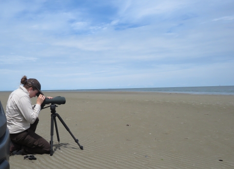
Since this refuge is such an important site for nesting coastal birds, we have an active inventory and monitoring program. Refuge staff use their data and observations to make informed habitat management decisions. The information can also be shared with the broader scientific community to contribute to species research and help partners and other refuges in our shared goal of protecting migratory birds and their habitats. One way to improve habitat on the refuge is through invasive species invasive species
An invasive species is any plant or animal that has spread or been introduced into a new area where they are, or could, cause harm to the environment, economy, or human, animal, or plant health. Their unwelcome presence can destroy ecosystems and cost millions of dollars.
Learn more about invasive species removal. This includes managing phragmities in the marshes and Japanese honeysuckle in the uplands. Invasive, non-native plant species tend to not be as beneficial to animals as native species because they don’t supply the correct fruit or seed type needed by resident wildlife or their fruit comes in at the wrong time of year to benefit migratory animals.
Management and Conservation
- Planning – Comprehensive Conservation Plan
- Habitat Restoration
- Climate Resilience
- Compatibility Determinations
- Education & Outreach
- Invasive Species
- Inventory and Monitoring
- Law Enforcement
- Recreation Management
- Species Research
- Wildlife Health
Comprehensive Conservation Planning
The purpose of a comprehensive conservation plan is to specify a management direction for the refuge for the next 15 years. The goals, objectives, and strategies for improving refuge conditions—including the types of habitat we will provide, partnership opportunities and management actions needed to achieve desired conditions – are all described in this document. Since staff at Eastern Shore of Virginia NWR administers Fisherman Island NWR, the Comprehensive Conservation Plan is a combined document covering the two sites. Please email us to request a copy of this document.
Trapping Occurs on this Refuge
Trapping is a wildlife management tool used on some national wildlife refuges. Trapping may be used to protect endangered and threatened species or migratory birds or to control certain wildlife populations. The U.S. Fish and Wildlife Service also views trapping as a legitimate recreational and economic activity when there are harvestable surpluses of fur-bearing mammals. Outside of Alaska, refuges that permit trapping as a recreational use may require trappers to obtain a refuge special use permit. Signs are posted on refuges where trapping occurs. Contact the refuge manager for specific regulations.
Our Services
At this field station we offer the following public services:
- Special Use Permits
- Recreation
Our Projects and Research
Diamondback Terrapin Crossing Prevention Project
Fisherman island NWR is home to the iconic northern diamondback terrapin (Malaclemys terrapin), a species often seen on roadways in warmer months as the females venture over land in search of suitable nesting sites. Meanwhile, the Chesapeake Bay Bridge-Tunnel, carries Highway 13 directly through Fisherman Island which places terrapins directly in the path of traffic.
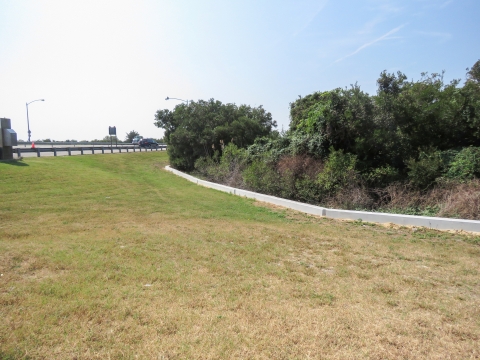
After collecting information about diamondback terrapin road mortality in 2016, refuge staff started an effort to reduce vehicle strikes by trying to keep the animals off the highway. Beginning in 2007, we installed several types of temporary barriers along a portion of the bridge-tunnel that crosses Fisherman Island. Unfortunately, these were mostly ineffective so, in 2020, a longer, permanent concrete barrier was installed. The replacement should reduce barrier maintenance, while further reducing terrapin mortality.
Fifteen remote cameras were placed along 1.5 miles of the new barrier in 2020 to monitor nesting diamondback terrapin activity. Additional monitoring efforts include road surveys to document diamondback terrapin vehicle mortalities and foot surveys to provide real time observations. Thus far, the concrete barrier appears to be an improvement over the previous barriers with fewer mortalities being documented.