Location
States
NebraskaEcosystem
Desert, Mountain, Rural, UrbanIntroduction

The National Drought Mitigation Center (NDMC), based out of the University of Nebraska-Lincoln, created the Drought Impact Reporter (DIR) in 2005 to serve as the Nation’s archive of recorded drought impacts. However, needing multiple ways of interpreting drought data for a variety of users required additional tools to complement the DIR. As a result, the NDMC created the Drought Impacts Toolkit in 2018 to gather information from sources other than media, such as agency reports, citizen-science input, and crowdsourcing, and to display information in a variety of useful ways. The Toolkit now includes access to the Condition Monitoring Observer Reports (CMOR), the Community Collaborative Rain, Hail, and Snow Network (CoCoRaHS), and the Visual Drought Atlas. CMOR and the Visual Drought Atlas allow people experiencing drought to submit photos of drought on the landscape, providing a new way to communicate drought impacts. All these resources help federal and state agencies better compile actionable information for the people they serve.
Key Issues Addressed
Drought impacts manifest in a variety of ways such as crop damage and well level declines. Further, different people and communities have different informational needs depending on the resources they manage. For example, farmers may be more interested in soil moisture data, while a municipal water supplier would be more interested in well-level data.
Climate change has increased the severity of drought impacts. Unlike other natural disasters that result in significant damage with a single event, the impacts of drought occur over time. Documenting continuously changing impacts is challenging because there is often a significant delay between a drought event and its impacts (Smith, et al. 2014). This fact also makes it difficult to determine which actions are most effective in mitigating impacts.
Collecting the variety of data needed to fit these needs is time- and cost-intensive. As such, crowdsourcing and citizen science efforts were needed to rapidly collect on-the-ground data from different sectors, while allowing more spatial coverage.
Project Goals
- To reflect the many ways drought manifests, the NDMC aims to collect data associated with different sectors (e.g., agricultural, municipal) and different organization types (e.g., government agencies, interest groups).
- The NDMC aims to provide multiple ways to display the drought impact information to the user, including visuals and user Tweets, to effectively communicate drought impacts.
- To understand and meet the needs of the Toolkit users, the NDMC strives to build interagency and organization connections to provide information necessary to them.
- The NDMC aims to create a process of continuous tool feedback and improvement so the Toolkit continuously operates effectively.
Project Highlights
Impact to Action: Drought impact data can be used to identify vulnerabilities to improve drought resiliency and reduce environmental degradation.
- By the User, for the User: The Toolkit compiles information provided by individuals experiencing drought.
- Real-Time to Timeline: Cataloging the impacts of drought, especially in real-time through citizen science input, allows researchers to determine a timeline of drought impacts. This information helps inform the timing of mitigation efforts.
- Agency Outputs: The Toolkit is used by a variety of government agencies and organizations to create resources, such as the weekly US Drought Monitor maps.
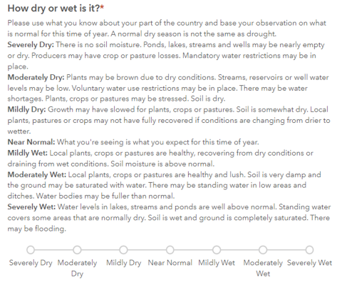
- New Tools for Better Understanding: The NDMC added more tools to the Toolkit to communicate drought impacts in different ways. For example, the Toolkit includes a curation of written reports (post-drought assessments) and regular agency communications (press releases, etc., in emerging impacts); systematic, quantified media searches (Media Drought Index), and Drought Tweets. Another example is the Visual Drought Atlas, which provides a visual display of the impacts drought has on the landscape. Pictures of how the landscape is impacted by drought provide for a more visceral response compared to words on a screen or numbers on a spreadsheet.
Lessons Learned
Accommodating the needs of different sectors experiencing drought requires the collection of a variety of different data, and thus, multiple databases to house this information efficiently.
The Toolkit’s iterative process of integrating user feedback allows it to make continuous improvements. For example, with input from the Oregon Department of Forestry, the NDMC developed a series of forestry-related questions for use in the CMOR to guide observation reporting from the general public. .
The DIR was a custom-built database and web display that was relatively difficult to modify. Now, the off-the-shelf capabilities of the Toolkit’s features, such as Survey123 and ArcGIS Online, make it possible to change user submission forms and maps more easily.
Next Steps
- The NDMC aims to continue to display data differently, such as adding drought statistics to the Toolkit’s Visual Drought Atlas metadata.
- The NDMC plans to combine map layers from several different tools into a single map. The outcome will allow users to cross-validate data and improve efficiency.
- In 2022, the data in the DIR will be displayed as a dashboard and include more contemporary maps.
Funding Partners
- NOAA Sectoral Applications Research Program
- NOAA National Integrated Drought Information System
- USDA Risk Management Agency
- USDA Office of the Chief Economist
Resources
- Wilhite et al. (2007). ”Understanding the complex impacts of drought: A key to enhancing drought mitigation and preparedness.” Water Resources Management 21: 763–774.
- Smith et al. (2021). “Whose ground truth is it? Harvesting lessons from Missouri’s 2018 bumper crop of drought observations.” Weather, Climate, and Society 13(2):227-244. https://journals.ametsoc.org/view/journals/wcas/13/2/WCAS-D-19-0140.1.xml.
- Smith et al. (2014). “Local observers fill in the details on Drought Impact Reporter maps.” Bulletin of the American Meteorological Society 95(11):1659-1662. https://journals.ametsoc.org/view/journals/bams/95/11/1520-0477-95.11.1659.xml.
- Redmond, K. (2002). "The depiction of drought: A commentary." Bulletin of the American Meteorological Society 83.8: 1143-1147.
- Climate.gov
Contact
- Kelly Smith, University of Nebraska-Lincoln, National Drought Mitigation Center: ksmith2@unl.edu
CART Lead Author
- Bryce Carlen, Intern, National Drought Mitigation Center
The DLN is a peer-to-peer knowledge exchange between climate service providers and resource managers, created to gather and share lessons learned from drought events to prepare for future events. The DLN partners with CART to develop Case Studies, with funding from the National Drought Mitigation Center for interns and coordination support from the USDA Southwest Climate Hub.
Suggested Citation
Carlen, B. (2022). “The National Drought Mitigation Center’s Drought Impacts Toolkit.” CART. Retrieved from https://www.fws.gov/project/national-drought-mitigation-center-toolkit.