

Location
States
OklahomaEcosystem
River/streamIntroduction
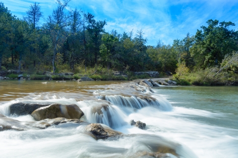
The Arbuckle-Simpson Aquifer, located in south-central Oklahoma, resides in the Red River Basin, and spans more than 500 miles underground. The aquifer provides drinking water for approximately 150,000 residents in towns and cities that overlie the aquifer and are downstream of the discharging springs. Beginning in 2010, the area served by the aquifer experienced an extended drought episode. Below-average rainfall combined with prolonged high temperatures (including the highest annual temperature ever recorded for Oklahoma in 2011) and drought, severely depleted the region’s water resources. Because the aquifer is the only source of drinking water in the region, communities experienced severe water shortages and had to implement unprecedented measures to maintain basic water service. In an effort to mitigate the impact of future droughts, the Choctaw Nation of Oklahoma, the Chickasaw Nation, and the Bureau of Reclamation formed a partnership to develop the Arbuckle-Simpson Aquifer Drought Contingency Plan (DCP) and Task Force. A DCP is a detailed list of mitigation and adaptation strategies that outlines steps to mitigate the impacts of the next drought.
Key Issues Addressed
Oklahoma is in a transitional region between humid eastern and semi-arid western climate zones, making it vulnerable to both short- and long-term droughts. Long-term droughts are generally defined as a deficiency of precipitation over an extended period of time (usually a season or more), resulting in a water shortage. Droughts have become more frequent in Oklahoma and have caused devastating impacts on the state’s social and economic conditions, and on its water resources. The Arbuckle-Simpson Aquifer region experienced a long-term drought from 2010 through 2015, causing significant economic hardship and requiring emergency actions, such as hauling water and drilling emergency wells. The Aquifer is also crucial to sustaining the Chickasaw National Recreation Area, which generates about $20 million annually. Antelope Springs, a major spring within the Recreation Area, stopped flowing resulting in the closure of a popular swimming park and the Lake of the Arbuckles reached record low-levels, further impacting tourism by limiting fishing and boat access. The lowered water table and reduced springflow also severely impacted the agriculture industry (mostly cattle/grazing) as it is mostly dry land agriculture and does not use irrigation. The lack of precipitation damaged crops and reduced plant growth, impacting the agricultural producers financially and putting a strain on the food source for livestock and cattle.
Smaller communities are often poorly equipped to handle the long-term impacts and the uncertainty of extended drought periods. The lack of resources presents additional problems for decision makers and leaders in these communities. Communities’ planning for and response to drought plays an important role in how drought affects one population versus another. There can be difficulty connecting the impacts in a specific area to the drought information needed to make decisions to plan and respond to the impacts of drought. In addition, the physical impacts of drought directly affect multiple economic sectors and place stress on people and their livelihoods.
Drought is not the only water-related challenge in the Arbuckle-Simpson Aquifer region. In 2003, a state-administered water management plan reduced the amount of aquifer supplies available for use per acre of land to one-tenth of the previous amount. While these new limits could help enhance long-term sustainability, it also increases competition for available resources among communities and water users such as agricultural producers. The water management plan was one of the main reasons for developing the DCP.
Drought has impacted agriculture, recreation and tourism, public health, and water resources, leading the Chickasaw Nation and the Choctaw Nation of Oklahoma to pool their resources to mitigate drought impacts.
Project Goals
- Develop effective drought mitigation strategies to prepare for drought impacts
- Identify and implement proactive management strategies to ensure long-term sustainability of the aquifer
- Facilitate and strengthen partnerships between stakeholders
Project Highlights
Exercise in Partnership: Stakeholders’ diverse perspectives were essential in developing a plan that offered numerous strategies and initiatives to mitigate the impacts of future drought events on the Arbuckle-Simpson Aquifer.
- Drought Vulnerability Assessments: The Planning Team surveyed the water uses and demands, as well as the economic roles, of the Arbuckle-Simpson region’s six primary water sectors:
- Municipal/Industrial
- Agricultural
- Energy
- Mining
- Fish and Wildlife
- Recreation/Tourism
The results helped to ascertain the specific, recurring drought vulnerabilities of each sector. Identifying these vulnerabilities informed the selection of preliminary DCP mitigation and response actions submitted for consideration by Task Force members. The Planning Team interviewed 25 water providers who are dependent on Arbuckle-Simpson water. The interviews resulted in water provider summaries that included water system data, vulnerabilities, and preliminary mitigation/response strategies that could strengthen the water reliability of each provider.
- Climate Variability Assessments: The Chickasaw Nation worked with the University of Oklahoma on a project titled, “Impacts of Climate Change on Flows of the Red River Basin.” This study selected three Global Climate Models that performed best for Oklahoma and ran three possible greenhouse gas emission scenarios for each. The results from these models were downscaled to the Red River Basin (which runs from its headwaters near the Texas-New Mexico border to the Mississippi River), where researchers applied results to hydrologic models to understand the potential extent of regional water supply vulnerability.
- Drought Index: The tribes and their project consultants developed a Drought Index using monitoring data from groundwater levels, springflow, lake levels, and the Palmer Drought Severity Index (PDSI, a monthly measure determined by the balance between moisture supply and demand), to alert users when each of two drought stage thresholds are reached. The Task Force established five specific trigger points/thresholds to set in motion pre-determined drought response actions designed to reduce the impacts of impending or ongoing drought episodes among various sectors. These are:
- The water level in Arbuckle Lake drops below 867 feet;
- The depth of water in the USGS Fittstown monitoring well drops below 120 feet;
- Flow in the Antelope Springs drops below 0.5 cubic feet per second (cfs);
- Flow in the Blue River near Connerville drops below 33 cfs; and
- The PDSI for Oklahoma Climate Division 8 drops below -0.4.
Three progressive Drought Stages will be utilized to trigger appropriate actions.
- Drought Stage 1 (Alert) - Any one of the five thresholds is reached.
- Drought Stage 2 (Warning) - All five of the thresholds are reached.
- Local Drought Stage 3 (Emergency) - Dictated by local conditions.
The Drought Index is monitored for implementation of drought response actions and can be found here.
- DCP Administration: The Arbuckle-Simpson Aquifer DCP Task Force is responsible for overseeing the implementation of the DCP. Although the Task Force is not a regulatory authority, members guide the ongoing planning process and assist in identifying and implementing effective drought mitigation and response strategies along with identifying potential sources of funding assistance to enhance DCP implementation. The Task Force is also responsible for continuous monitoring of drought conditions in the region - even during non-drought periods - as well as notifying the stakeholders groups (Tourism & Recreation, Private Landowners, Agriculture, Energy, Local Government, Industry, and Water Providers) and the public of current related status of drought. Information is disseminated through the Drought Index, established with assistance from the Oka’ Institute and Chickasaw Nation.
Lessons Learned

The models from the Climate Variability Assessment predicted higher temperatures in the future for the entire Red River Basin. The western portion of the basin will likely receive less rainfall while more rainfall is anticipated in the eastern portion. However, much of the eastern precipitation will also be subject to increased evapotranspiration due to higher temperatures. While there is considerable uncertainty in predicting future hydrologic conditions, it appears that flows and reservoir levels will be decreased in the western portion of the Red River Basin and, on average, will remain fairly stable in the east over the course of the 22nd century. The Arbuckle-Simpson Aquifer lies in part of the basin where annual precipitation may remain relatively unchanged but higher temperatures and more prolonged drought may increase the pressure on the aquifer in the future.
Vulnerability Assessment Identified Results Summary
- Municipal/Industrial: A number of water provider drought vulnerabilities directly related to establishment, treatment and delivery of public water supply to citizens throughout the region were identified to include:
- Insufficient and/or Unreliable Supply
- Infrastructure Issues (Distribution)
- Insufficient Secondary or Emergency Supply
- Growth and/or Demand Issues
- SB 288 Compliance and/or Insufficient Water Rights
- Infrastructure Issues (Water Tower/Storage)
- Infrastructure Issues (Treatment)
- Firefighting
- Energy: The oil and gas drilling industry provided $37.1 billion of annual economic activity in Oklahoma between 2010 and 2015. Drought may slow or increase the cost of energy development as the nation’s oil industry becomes increasingly dependent on water-intensive hydraulic fracturing. Concerning hydropower production, Lake Texoma possesses significant power and water supply storage. However, when lake levels are low, the amount of water released for hydroelectric power production is reduced. This requires replacement power from more expensive energy sources to meet the region’s electricity needs. Due to drought conditions, 2013 was the lowest generation year at Lake Texoma since hydropower operations began in 1945. Southwestern Power Administration estimates that Texas electricity consumers spent an additional $5 million in 2013 to pay for alternative sources, including electricity from coal-fired and natural gas plants, to mitigate reduced generation from Lake Texoma. Renewable energy development options, such as wind and solar power, also provide an adaptive capacity to drought that reduces associated vulnerabilities of the energy sector.
- Mining: According to the National Mining Association, Oklahoma’s 2015 non-fuel mineral production was valued at $744 million, or 0.95 percent of the U.S. total. Mining production in Oklahoma quarries is expected to continue to grow due to the increasing need for major road repairs and expansion of highway and bridge infrastructure in both Oklahoma and neighboring states. Evaporation from mining pits and recharge basins results in a net loss of groundwater from the aquifer. During drought conditions, evaporation rates are typically higher than average, which increases the consumptive water use of mining operations. Although groundwater supplies are more resilient during times of drought and typically the last water resource to be significantly affected, continued use of groundwater by mining operations during prolonged drought has the potential to impact cities, farms and other water users who are reliant upon the aquifer for water supply. Domestic water users have priority rights to surface water during drought-induced water shortages. As a result, mining operations that rely on surface water rights for supply may find that their surface water supply is no longer available during drought. Some mining operations do not possess groundwater or surface water rights and instead rely upon stormwater capture for their water supply. Because stormwater runoff rarely occurs during drought episodes, mining operations require another alternative supply to maintain operations.
- Fish and Wildlife: Environmental impacts of drought, (including impacts of forest/range fires and soil erosion) include direct damage to plant and animal species, loss of wildlife habitat (wetlands, lakes and vegetation) and biodiversity, and degradation of air and water quality (i.e., through reduced flows). Specific drought impacts and vulnerabilities include:
- Long-term drought may impact the availability of food and water for wildlife. Decreased forage production affects herbivores and grain-eating birds and, indirectly, scavengers and predators.
- Increased disease in wild animals due to reduced food and water supplies.
- Increased wildlife mortality rate and reduced reproduction.
- Migration of wildlife.
- Increased stress on endangered species, or even extinction.
- Loss of wetlands and waterfowl have fewer places to roost and feed.
- Increased diseases and insect problems in forests and reduced forest productivity.
- Poor soil quality and increased wind and water erosion.
- Recreation/Tourism: Recreation and tourism is the third largest industry in Oklahoma and particularly valuable in the Arbuckle-Simpson region. Water-related recreation is often taken for granted until water/lake levels decline, and access is reduced or eliminated. Extended drought conditions expose shoreline and established riparian riparian
Definition of riparian habitat or riparian areas.
Learn more about riparian vegetation. Recreational activities, especially fishing and access to boat ramps and marinas, are negatively impacted. Low water levels directly impact visitation, and the resulting impact on local economies dependent upon recreational facilities and related benefits can be devastating. Reduced license and permit sales (e.g. through hunting and fishing activities) and loss of associated revenue result from drought and decreased visitation to recreational areas. Safety is also an issue for boaters as lake obstructions arise at lake surfaces and for swimmers affected by hazardous water quality and a variety of associated water-borne illnesses.
Next Steps
- Revisit the DCP every five years to incorporate amendments and suggested improvements into a comprehensive update
- Encourage each community to continue planning and implementing drought mitigation strategies
Partners
- Arbuckle Master Conservancy District
- City of Ada
- Aqua Strategies
- Bureau of Reclamation
- Chickasaw Nation
- Choctaw Nation
- Duane Smith & Associates
- City of Durant
- Town of Mill Creek
- Murray County Rural Water District #1
- National Park Service (Chickasaw National Recreation Area)
- Nature Conservancy
- Oka’ Institute
- Oklahoma Conservation Commission
- Oklahoma Department of Environmental Quality
- Oklahoma Water Resource Board
- Town of Roff
- Samuel Roberts Noble Foundation
- Southern Climate Impacts Planning Program
- South Central Climate Adaptation Science Center
- City of Sulphur
- City of Tishomingo
- USDA Climate Hubs
- USDA, Oklahoma Rural Development
Funding Partners
- Bureau of Reclamation Drought Response Program
- The Department of the Interior South Central Climate Adaptation Science Center, managed by the USGS National Climate Adaptation Science Center
Resources
- Oka’ Institute
- Spatial Analysis Of Drought And Its Impacts In The Chickasaw Nation
- Evaluation of Sustainable Water Availability in Drought Prone Watersheds in Southeastern Oklahoma
- Impacts of Climate Change on Water Flows in the Red River Basin
- Arbuckle-Simpson Aquifer Drought Contingency Plan Drought Status Report (Drought Index)
Contacts
- Barney Austin, Aqua Strategies Inc.: baustin@aquastrategies.com
- Kris Patton, Chickasaw Nation: KRISTOPHER.PATTON@chickasaw.net
- Ethan Schuth, Choctaw Nation: eschuth@choctawnation.com
CART Lead Author
- Deanna Morrell, Program Analyst, Bureau of Reclamation: dmorrell@usbr.gov
Suggested Citation
Morrell, D., P. (2021). “Fostering Partnerships to Design and Implement a Drought Contingency Plan in the Arbuckle-Simpson Aquifer.” CART. Retrieved from https://www.fws.gov/project/fostering-partnerships-drought-contingency-plan.
