Santee NWR Map and Information Sheet

Document - application/pdf
Santee NWR Map and Information Sheet

The sheet provides two maps showing refuge units with legends for canoe, bicycle and hiking trails. Information on resource managment, visitor opportunities, and wildlife tips are provided. Prohibited activities are listed.   

Attachments
AttachmentSize
santee-map-tearsheet.pdf2.1 MB2.1 MB
Publication date
Type of document
Map
Facility
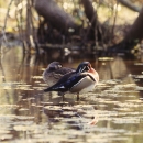
Male and female wood ducks in pond at Santee NWR
Santee National Wildlife Refuge, superimposed on the lands and waters of the 110,600-acre Lake Marion reservoir, protects over 15,000 acres of public lands in four units, Bluff, Dingle Pond, Pine Island and Cuddo. The refuge benefits an abundance of wildlife species in this rich ecosystem of...
FWS and DOI Region(s)