Document - application/pdf

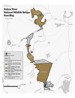
Map showing hunt areas at Oxbow NWR.
Attachments
| Attachment | Size |
|---|---|
| OXB_GIS Hunt Map 10_20 (1).pdf926.31 KB | 926.31 KB |
Type of document
Refuge Map
Facility

Map showing hunt areas at Oxbow NWR.
| Attachment | Size |
|---|---|
| OXB_GIS Hunt Map 10_20 (1).pdf926.31 KB | 926.31 KB |