Habitat Types
Subtidal Habitat
The refuge has four tidal ponds Forrestal, Case Road, 7th Street, and Perimeter that stay underwater all the time. These ponds were built in the early 1990s to replace wetlands lost during the Port of Long Beach’s Pier J project, restoring 116 acres of habitat. Water from Anaheim Bay flows in and out through channels and culverts under nearby roads.
Eelgrass, a type of seagrass, grows in these ponds. It provides shelter for small animals and feeding areas for birds like black brant. Its roots help keep the soil in place, and its blades reduce wave action, allowing fine sediment to settle.
Mudflats in these shallow areas are also important. Tiny creatures like worms, snails, crabs, and small crustaceans live here and recycle nutrients, creating food for fish and other wildlife.
Intertidal Channels and Mudflats
Intertidal habitat is the area between high and low tides. A network of tidal channels moves oxygen and nutrients through the marsh and gives fish and other animals access to feeding areas. Mudflats occur between cordgrass and eelgrass zones. They look bare but are full of life. Microorganisms like algae feed worms and other invertebrates, which in turn feed snails, crabs, and fish.
When the tide comes in, fish, rays, and even sharks move into the mudflats to feed. Some fish live here year-round, hiding in burrows, while others use the flats as nurseries when they are young. These channels are important for species like California corbina and California halibut.
When the tide goes out, shorebirds arrive to eat invertebrates. Each bird species has a bill shape and feeding style suited to a specific zone of the mudflat.
Coastal Salt Marsh
Salt marshes grow in the upper intertidal zone, above the mudflats. They flood during high tides but are exposed most of the time. This is the largest habitat in the refuge, covering about 565 acres.
Salt marshes provide nesting, feeding, and shelter for birds like the endangered light-footed clapper rail and Belding’s savannah sparrow. They also support about 40 fish species and over 100 kinds of invertebrates. Nineteen plant species grow here, with 12 being most common.
- Low marsh: Closest to the mudflats, floods often. Dominated by cordgrass, with pickleweed and saltwort.
- Middle marsh: Higher up, less flooding. Mostly pickleweed and saltwort.
- High marsh: Above the high tide line, floods only during very high tides. Plants include glasswort, pickleweed, salt grass, and sea lavender.
Some high marsh areas occur around Case Road Pond and 7th Street Pond islands. These areas have limited tidal flow and dense pickleweed stands.
At the highest elevations, the marsh transitions to upland habitat. Historically, this zone had native plants, but most have been replaced by non-native weeds. Some areas are being replanted with native species.
Upland Habitat
The refuge has about 65 acres of uplands, most of which were once wetlands but were filled for military and farming use. About 41 acres are now roads, berms, and other structures. The rest includes grasslands, islands, and areas planted with native shrubs.
- Hog Island: Once had native plants, now larger due to fill material. Recently replanted to provide cover for birds.
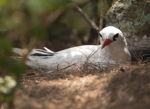
- NASA Island: Built in the 1960s for rocket testing, later converted into nesting habitat for endangered California least terns. Refuge staff maintain it for nesting.
- Non-native uplands: Some areas are dominated by invasive plants like thistle and mustard. Refuge staff work to control these species and restore native vegetation.