Library

Featured

A complex map showing the refuge boundary, roads, and walking trails, colored in purple, green, and yellow to indicate access. For accessibility, please call 252-473-1131.
Access to roads, units, and trails on the refuge may change based on public safety and refuge management requirements. Please follow all signage on the ground and do not enter any places signed "Area Closed."
Coastal North Carolina NWRs Georeferenced Trail Map

This map can be opened in a mapping app such as Avenza in order to display your location on the trail network. Pull up the map on your phone's browser, tap the "share" icon (arrow coming out of a box), and select Avenza from the list of apps.

Alligator River and Pea Island NWR Interpretive Program Schedule

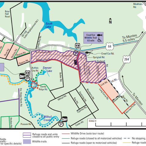
Alligator River and Pea Island National Wildlife Refuges offer a variety of fun and educational seasonal programs. During the summer, programs range from interpretive presentations to tram and canoe tours. During the off season (Sep-May), the refuges host bird walks and special events.