


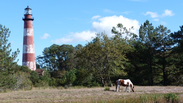
Our refuge is located on the history-rich Eastern Shore of Virginia. Visitors quickly discover cultural treasures nestled among our natural wonders such as the iconic Chincoteague ponies and historic Assateague Lighthouse.
Where might I see the ponies?
Look to the west as you drive Beach Road or try your luck at spotting the ponies from the overlook located along the 1.6 mile Woodland Trail. Our trail map features pony symbols to help you locate the areas. If you are up for a longer walk, you can also try to spot the ponies that live in the northern portion of our refuge by hiking our Service Road. Be aware though that you'll need to walk at least 3.5 miles before you enter the area where you might see the ponies.
How can I view Assateague Lighthouse?
You'll see Assateague Lighthouse as you drive onto our refuge, but you can get a closer look by hiking the 0.25 mile Lighthouse Trail. Parking is available at the trailhead, located at the first right after you enter our refuge. Bugspray is advised!
Lighthouse tours are currently available from 10:00am - 3:30pm on the following days:
Memorial Day - Labor Day: Fridays & Saturdays
Labor Day - Thanksgiving: Saturdays
Visitors who need a more accessible route can drive to the lighthouse by using the service road located across from our visitor center. Take the second right after you enter the refuge (just past the trail parking lot). Then take a right to drive up the hill to the parking lot.
I want to learn more about local history!
The Town of Chincoteague is the gateway community to our refuge. Visitors who want to dive deeper into the cultural history of this area should inquire at the Chincoteague Chamber of Commerce.
