Bats and Transportation Structures Training
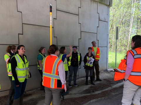
We are proud to now offer an online and audio-described version of the "Bats in Bridges" training! This course is intended to help you understand methods to assess transportation structures for the potential of bat use and occupancy, while providing some basic facts about bats life history and their habitat needs. GAES Biologist Laci Pattavina helped design and run a field-based training opportunity that demonstrates methodology for inspecting bridges and culverts for bats and signs of bat use. This training and other collaboration between the resource agencies and the Georgia DOT Bridge Maintenance Department has created a standard that all bridges and culverts in Georgia be inspected for signs of bat use prior to any construction activities.
- Bats and Transportation Structures Survey Training
- Bats and Transportation Structures Survey Training (Audio-Described Version)
Georgia HUC10 Watershed Reports
Our watershed reports can be used to help assess the potential for endangered and threatened species and include guidance under the Fish and Wildlife Coordination Act for each HUC10 watershed in Georgia.
This tool is intended for use by our transportation partners to help in assessing the potential for endangered and threatened species. Each report includes a list of species found within the state of Georgia and guidance under the Fish and Wildlife Coordination Act for a HUC10 watershed in Georgia. For watersheds that cross the state boundary, please contact the corresponding state's FWS field office and Department of Natural Resources (or their equivalent). Please note that these documents do not replace any requirements for consultation under Section 7 Section 7
Section 7 Consultation
The Endangered Species Act (ESA) directs all Federal agencies to work to conserve endangered and threatened species and to use their authorities to further the purposes of the Act. Section 7 of the Act, called "Interagency Cooperation," is the mechanism by which Federal agencies ensure the actions they take, including those they fund or authorize, do not jeopardize the existence of any listed species.
Learn more about Section 7 of the Endangered Species Act.
These guidance documents will be updated periodically to reflect the current conditions (i.e. to reflect range changes or recommendations for a specific watershed). The date the document was made available on our website is stamped on the bottom of each document. As written in 50 CFR § 402.16 of the Endangered Species Act, obligations under the Act must be reconsidered if a new species is listed or critical habitat is determined that may be affected by the project, or new information indicates that the project may affect listed species or critical habitat in a manner not previously considered. We will continue to update these documents to help project proponents meet their obligations under the Endangered Species Act.
Step 1. Use this interactive map to identify the HUC10 watershed(s) in which your project is located.
Step 2. Reach out to the appropriate transportation biologist for the region to request the HUC10 watershed report for the project area (available as a PDF).
Each watershed report will include lists of the following elements located in that watershed:
- Counties
- Major Waterbodies
- Federally Listed Species
- Federal Candidate, Candidate Conservation, or Petitioned Species
- State Listed or other Species-at-risk
- Watershed-Specific Concerns for Species and Habitat
- Conservation Lands
In addition to the guidance in the watershed reports, below we provide additional Fish and Wildlife Coordination Act and Endangered Species Act considerations (also available as a PDF).
Additional Fish and Wildlife Coordination Act and Endangered Species Act Considerations
The Fish and Wildlife Coordination Act (FWCA) requires federal agencies to consider the effects of their water-related actions (that modify or control natural streams or waterbodies) on fish and wildlife resources. Many of the following recommendations are also specific to endangered or threatened aquatic species protected under the Endangered Species Act. The following may be applicable to proposed project actions.
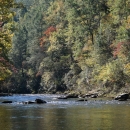
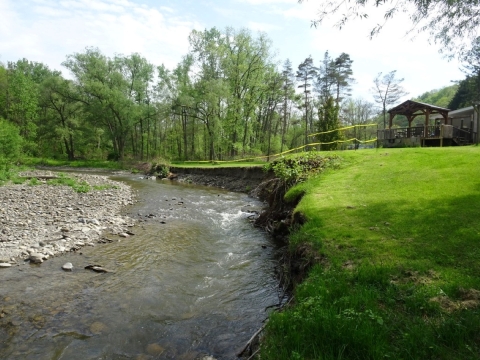
Riparian Buffer, Streambank, and Stream Channel Protection
Minimize disturbance to stream banks and riparian riparian
Definition of riparian habitat or riparian areas.
Learn more about riparian areas during project work. Do not operate equipment in the stream channel or ford the channel during work. Service recommendations for riparian buffer protection are consistent with those of the Metropolitan North Georgia Water Planning District requiring maintenance of a 50 ft. undisturbed buffer and an additional 25 ft. impervious setback on all streams. Any staging areas, the storage of materials and equipment, borrow pits, or waste sites should not occur in buffer areas or other environmentally sensitive areas. Additionally, when impacts to streambanks and/or stream channel occur, the Service recommends a biotechnical approach to streambank and channel stabilization and restoration where feasible. The use of hard armoring of streambanks or channels should be minimized except where necessary for safety or the protection of structures or property.
Wetland Protection
Wetland losses diminish important wetland values including: the provision of habitat which wetland and terrestrial fauna need for reproduction and/or survival, the storage of storm and flood waters with resultant moderation of flow extremes to receiving waters, and the natural filtration processes that enhance water quality. Wetlands along riparian corridors can provide important connectivity for wildlife movement at the landscape-level. Bridge or culvert construction associated with wetland impacts can alter stream hydrology, degrade water quality, create fish passage fish passage
Fish passage is the ability of fish or other aquatic species to move freely throughout their life to find food, reproduce, and complete their natural migration cycles. Millions of barriers to fish passage across the country are fragmenting habitat and leading to species declines. The U.S. Fish and Wildlife Service's National Fish Passage Program is working to reconnect watersheds to benefit both wildlife and people.
Learn more about fish passage barriers, and result in the loss of stream bottom habitat. Measures to avoid and reduce impacts to wetlands and wetland hydrology should be considered during project design.
Water Quality Protection
The Service recommends use of erosion control practices, post construction stormwater management, and other best management practices to protect water quality. The Service’s recommendations can be found below.
Erosion and Sedimentation
Sedimentation from construction sites is regulated through Georgia’s Erosion and Sedimentation Act, which in most cases is administered by local jurisdictions that have been delegated enforcement authority. We recommend all projects ensure compliance with the Georgia Erosion and Sedimentation Act and encourage consistent communication with the local issuing authority or Georgia Environmental Protection Division both in the design phase and during construction.
Stormwater
Post construction stormwater management recommendations are consistent with performance standards for Water Quality protection (WQv) and Channel Protection (CPv) found in the Georgia Stormwater Management Manual, otherwise known as the Blue Book (https://atlantaregional.org/natural-resources/water/georgia-stormwater-…). The Service recommends both the Water Quality and Channel Protection performance standards be met on all projects when applicable under the Blue Book, to minimize impacts to water quality associated with stormwater runoff. For projects that drain to streams or wetlands with federally protected species, we would recommend that additional water quality protection be provided through implementation of the Runoff Reduction performance standard, also found in the Blue Book.
Other Water Quality Protections
For all project types, the Service recommends equipment storage, equipment maintenance, supply storage, and use of pesticides, herbicides, and/or other chemicals not occur within the 100-year floodplain or 200 feet from the stream banks or wetland edge, whichever is greater. All storage and maintenance areas should be protected with secondary containment. Material utilized in, or adjacent to aquatic resources for temporary fill, permanent fill, or bank protection shall consist of suitable material, free from toxic contaminants in other than trace quantities. Materials that contain toxic contaminants, such as used asphalt, pressure treated lumber, and uncured concrete, should not be used because it can alter water quality causing mortality in aquatic organisms and can be harmful to public health. For projects authorized by the U.S. Army Corps of Engineers, please ensure that all permit conditions are followed.
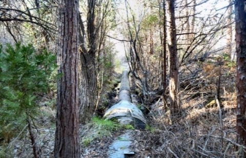
Road Stream Crossings (Bridges, Culverts)

Many road stream crossings, especially where pipe culverts are used, limit aquatic organism passage upstream and downstream, leading to fragmentation of aquatic populations. The construction, repair, and replacement of stream crossings can also increase turbidity and sedimentation downstream of road crossings leading to degradation of aquatic habitat. The Service recommends designs that provide habitat continuity through the crossing by maintaining or recreating natural stream reach geomorphic elements including slope, channel width, bed material, and bedform.
Bridges and arch spans are the preferred option for stream crossings from an aquatic habitat continuity perspective. However, when spanning the stream is prohibitively expensive, use of culverts at stream crossings must be designed and implemented in a way that ensures the structures do not become barriers to aquatic organism passage. Making culverts suitable for aquatic organism passage requires preventing excessive water velocities in culverts at base flow conditions, preventing drops resulting from scour in and around the culvert, and providing adequate depth in the culvert at base flows.
The Service recommends following the U.S. Army Corps of Engineers, Savannah District Regional Conditions for Nationwide Permits when designing culverts. The Regional Conditions contain specific guidelines for designing and constructing culverts to promote the safe passage of fish and other aquatic organisms.
Additional information about regional conditions can be found at the following web address: http://www.sas.usace.army.mil/Missions/Regulatory/Permitting/General-Pe…
For culvert replacements or extensions involving less than 100 feet of all stream impacts in total, FWCA coordination is not required where no federally listed aquatic species occur. When modifying the design of a culvert that was previously consulted on under FWCA (but excluding those previously exempt from past coordination), new consultation would not be required unless stream impacts have been increased by more than 10% or 50 feet (whichever is less), or the change results in modifications to the morphology or flow of the waterbody.
When bridges or arch spans are the chosen construction method, the Service recommends minimizing the number of in-stream piles or structures and aligning them with the natural stream flow. Additionally, the use of bridge scuppers that directly discharge stormwater to streams should be minimized, except where necessary for safety. For bridge construction activities that require the use of temporary in-stream construction access (e.g., jetties, work bridges, barges, etc.), the Service recommends performing all work in a manner that does not inhibit aquatic organism passage, including minimizing river constriction. For situations where river constriction is greater than 25% of the cross sectional area of the critical flow, we would recommend a flow analysis to evaluate water velocity alterations and development of a contingency plan in the event channel scour, bank erosion, or undesirable conditions occur. Upon completion of activities, temporary fills should be entirely removed and the site restored to pre-existing elevation. Equipment should not be stored on any in-stream structure to reduce equipment loss if flows exceed the height of the in-stream structure and reduce contamination from pollutant leakage during off-use times.
Direct all stormwater runoff from road approaches toward floodplains, letting the runoff discharge as sheet flow across the floodplain or into stormwater management structures. When road approaches are composed of unpaved surfaces, consider paving the road approaches to improve the water quality of stormwater runoff around stream crossing locations. If spread footers, containment structures, or other structures require the use of dry or poured concrete, flowable fill, or similar materials and are elected for use in the construction within any waterway, such methods shall be constructed using cofferdams or similar containment structures. If uncured, dry or wet concrete will be used, the water used for curing shall not be allowed into the waterways. The use of uncured concrete in a waterway can raise the pH of the surrounding water causing mortality in aquatic organisms and potential public health concerns.
The Service also recommends incorporating measures to provide connectivity and reduce mortality to terrestrial wildlife species during project design. Opportunities for terrestrial species to cross under road crossings at stream crossing locations exist both within the banks of the stream along constructed benches, as well as, in the floodplain when additional structures are used to pass flood flows.
For more information, please visit Stream Crossings.
Utility Stream Crossings
Construction, relocation, and maintenance of powerlines and other utilities can disturb aquatic systems and affect fish and other populations. To minimize impacts from these activities, use best management practices to control stormwater runoff from the project area during construction. Direct runoff via sheetflow to vegetated areas or stormwater treatment basins and utilize rolling dips or water bars to divert water from the utility right-of-way (ROW) into vegetated areas on slopes to minimize erosion.
Underground Utilities
Directional boring is preferred when a utility line must be installed across a perennial stream that supports federally protected aquatic species. Bore pits should be located as far away from the stream channel as possible.
Dry open trench pipe installation using isolation crossing diversions, such as coffer dams, are preferred for all other perennial stream crossings. The diversions should not dewater downstream reaches or create excessive water velocity that could scour downstream reaches. Wet open trench construction should be avoided in all perennial streams unless no other method is feasible, or if it can be shown that alternative methods would cause greater sedimentation and environmental harm. For both wet and dry open trench installation, stream banks and channels should be restored to their original contours and the banks stabilized with native vegetation (except in areas where permanent road crossings are to be maintained). In-channel stream restoration techniques should be considered to stabilize the channel elevation and protect buried utility lines. In-channel restoration techniques can also effectively prevent downstream scour or upstream head cutting which can result from open trenching.
Wet open trench installation should not be conducted during the sensitive reproductive periods of federally-listed aquatic species, when eggs and newly-hatched larvae are most likely to be buried or harmed by increased turbidity and sedimentation. Only directional boring or isolation crossing methods should be used during these times of year. Please consult the Service for timing of sensitive reproductive periods for aquatic species in this watershed.
Aerial Utilities
Maintain a 100-foot undisturbed riparian buffer within the powerline’s ROW on both sides of all streams with endangered or threatened aquatic species. No crossings, either temporary or permanent, via culverts, fords, or other methods should be constructed and all access roads should end at the buffer’s edge farthest from the streambank. The buffer, where possible, should be retained in or planted with native vegetation of at least shrub size.
Within the powerline’s ROW, maintain a 50-foot riparian buffer on both sides of other perennial and intermittent streams that will be crossed. Some vegetation within these buffer zones may be temporarily disturbed if culverts, fords, or other stream crossings are necessary, but streambanks should be restored to normal contours and stabilized after the crossing is removed.
Impoundments/ Farm Ponds
For proposed impoundments, the Service recommends excavated ponds be constructed where feasible. Though the volume of material requiring excavation is greater to construct an excavated pond, they have fewer problems than dammed ponds, which can be plagued with muddy water, rapid filling with silt, flow rate fluctuations, aquatic weeds, temperature fluctuations, and wild fish invasions.
The Service recommends consulting the county Natural Resources Conservation Service office (https://www.nrcs.usda.gov/wps/portal/nrcs/site/ga/home/) or the Georgia Department of Natural Resources for advice regarding pond construction and avoiding or minimizing downstream impacts from sediment and toxicant input into aquatic systems.
Stream Gage Replacement
If a U.S. Geological Survey (USGS) stream gage will potentially be impacted by a proposed project, the Service recommends assessing what coordination or compensation may need to occur with the USGS related to the disturbance, moving, and recalibration of the gage structure prior to project implementation.