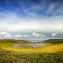
The U.S. Fish and Wildlife Service has a long history of determining the status and trends of the nation's wetland habitats. The national Wetland Status and Trends Study monitors wetland extent and change using a statistically stratified, simple random sampling design, the foundations of which are well documented. The Service acquires and analyses various types of remotely sensed imagery for about 4,500 sample plots throughout the conterminous United States. It is a quantitative measure of the areal extent of all wetlands in the conterminous United States. Our Nation' s wetlands goals have traditionally been based on wetland acreage and the ability to provide a quantitative measure of the extent of wetland area as a means to measure progress toward achieving the national policy goal of "no net loss". The use of remote sensing is an effective tool in this process.
Program

