STE. GENEVIEVE, MISSOURI -- The U.S. Fish and Wildlife Service today announced a newly expanded acquisition boundary for the Middle Mississippi River National Wildlife Refuge in Missouri and Illinois. Authorization of this expansion will allow the Service to acquire up to 90,000 acres of land purchases from interested landowners who are willing sellers within the expanded boundary.
The refuge expansion will provide for the protection and restoration of large, connected areas of floodplain hardwood forest. It also will provide additional important habitat for migratory birds and federal threatened and endangered species, as well as land and river access for hunters, anglers and other outdoor enthusiasts. These priorities all contribute to fulfilling the mission of the National Wildlife Refuge System.
“The Service appreciates the efforts of the Middle Mississippi River Partnership and the more than 22 partner organizations who worked collaboratively to bring this expansion to fruition,” said Acting Midwest Regional Director Chuck Traxler. “This expansion will benefit fish, wildlife and their habitat while improving community resilience and access to nature.”
Increasing access to public lands and waters is a central component of the administration’s approach to conservation, including locally led and voluntary conservation and restoration efforts under President Biden’s America the Beautiful initiative.
The land protection plan that authorized the expansion and identified a new acquisition boundary for the refuge encompasses portions of multiple counties within the historic floodplain of the Mississippi River, between River Mile 195 and 1. This includes Madison, St. Clair, Monroe, Randolph, Jackson, Union and Alexander counties along the Illinois side of the Mississippi River and St. Louis, Jefferson, Ste. Genevieve, Perry, Cape Girardeau, Scott and Mississippi counties along the Missouri side of the Mississippi River.
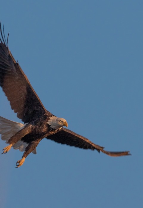
Middle Mississippi River National Wildlife Refuge was originally established as a refuge May 31, 2000. The authorized acquisition area for the refuge at this time consisted of seven island divisions that lie within the open river portion of the Mississippi River below the confluence with the Missouri River and above the Ohio River confluence, where river levels are not regulated by the lock and dam system. These lands provide access to the floodplain for native fish during high water stages and create a corridor of floodplain forest habitat for migratory birds and resident wildlife. Water levels may fluctuate greatly in this open river section of the Mississippi, and frequent flooding occurs on these lands. The refuge was designated as an Important Bird Area in 2008. It is anticipated that future acquisitions facilitated through this expansion will allow for habitat restoration through floodplain connection and side channel creation that will provide nature-based solutions and build climate resiliency.
The National Wildlife Refuge System is an unparalleled network of 568 national wildlife refuges and 38 wetland management districts. There is a national wildlife refuge national wildlife refuge
A national wildlife refuge is typically a contiguous area of land and water managed by the U.S. Fish and Wildlife Service for the conservation and, where appropriate, restoration of fish, wildlife and plant resources and their habitats for the benefit of present and future generations of Americans.
Learn more about national wildlife refuge within an hour’s drive of most major metropolitan areas. More than 55 million Americans visit refuges every year. National wildlife refuges provide vital habitat for thousands of species and access to world-class recreation, from fishing, hunting and boating to nature watching, photography and environmental education.


