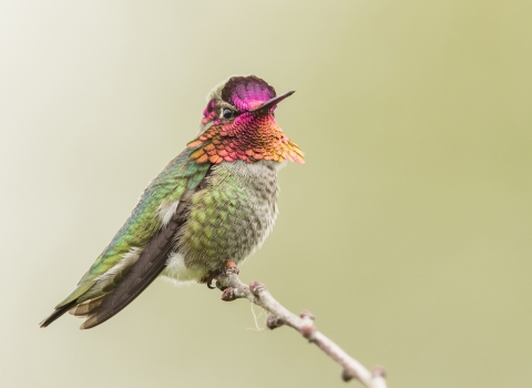
Celebrating the fall migration
Mid-October through late November is an amazing time to see water birds on the Upper Mississippi River! As staff and volunteers share estimates of bird counts on the river, we'll update this page to share the news.
When do the birds arrive?
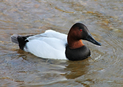
Dabbling ducks and American white pelicans arrive first in late summer and early fall. Diving ducks usually start getting here in mid-to-late October. Tundra swans typically show up in early November. The weather greatly influences when the birds arrive, how long they will stay, and how concentrated they are on the river. Cold temperatures north of the refuge push birds to move south and arrive here on the river. If it's a warm fall, we'll likely see a slower migration. Many birds will stay until it gets cold enough for the Mississippi River to freeze over. When the Mississippi River freezes quickly, we see birds more concentrated in areas where there is still open water. When it freezes more slowly, we still see large numbers of birds, but they may be more spread out over open water. The peak of the tundra swan migration is typically the second or third week of November.
Why do they come here?
The Upper Mississippi River National Wildlife and Fish Refuge lies within the Mississippi Flyway, which is like a superhighway in the sky for birds! As one of the largest bodies of water in the Midwest, the Mississippi River takes longer to freeze than smaller rivers or ponds. It is also easy for birds to see from high above! The refuge offers high quality food sources for wildlife and shelter from the elements.
Recent bird sightings
There are many excellent places to see birds along the river! The following locations are some of the most popular walk-in or drive-in locations where refuge staff and volunteers are regularly able to visit to estimate bird numbers. These sites are visible on the refuge Pool Maps. NOTE: These sites are not all updated on the same dates so some are more current then others.
We will only be updating as staff or volunteer time allows. Please feel free to share your sightings with us as well. You can email your sightings to us at uppermississippiriver@fws.gov.
Pool 5 - Weaver Bottoms
The best place to see swans in the Weaver Bottoms area is from 116th Avenue/service road adjacent to MN Highway 61 near St. Mary's Cemetery. This location is about 17 miles north of Winona, MN.
Updated 11/24/2025
200 Swans- mix of Tundra and some Trumpeter
100 dabbling ducks close to shore, mostly Mallards, a couple Northern Pintail and Shovelers.
1500 dabbling ducks just beyond the emergent vegetation line- Gadwall and American Wigeon
50 Canada Geese
8000 Ring Necked Ducks close in but may be hidden around the corner
4 Bald Eagles
5000 diving ducks far out only barely visible with a spotting scope- Canvasback and Bufflehead
Lake Onalaska Overlook
The Lake Onalaska Overlook is located at W7687 County Road ZB, Onalaska, WI, 54650. There's a small parking lot across the street from the overlook, or it's about a half mile walk from the La Crosse District Visitor Center. The Visitor Center has a large parking lot suitable for bus parking.
Updated 11/14/25
About 1,000 ducks right in front of the overlook, a mix of mallards, northern pintail, American wigeon, gadwall, common goldeneye and a few buffleheads. Pelicans visible to the northwest with the spotting scopes.
Pool 8 - various locations on Lower Pool 8
There are several safe places to pull off of Hwy 35 in WI to see the vast number of divers that use Lower Pool 8, with several of them spaced periodically on the west (southbound) side of the highway. On the east side of the highway, Bergen Bluffs scenic overlook provides a somewhat elevated view of the lower pool while Old Settler's Overlook provides a view from the top of the bluff. Sometimes the birds are close to the shore but oftentimes binoculars or a spotting scope are needed to view them when they're not close to the shore, especially when viewing from Old Settlers Overlook.
Pool 8 - Brownsville Overlook
The Brownsville Overlook is located about three miles south of Brownsville, MN off of MN Hwy 26. There are two spotting scopes available at this overlook. Binoculars are helpful, but birds can usually be viewed from the overlook deck even if you don't have a pair.
updated 11/27/25
- Dabblers: 100-200 ducks including gadwall, mallards, green-winged teal, northern pintail, American wigeon, northern shoveler, American black ducks
- Canada geese: 25-50
- Swans: 150-250 right in front of the overlook, mostly tundra swans but some trumpeter swans. 3,000-5,000 in other areas visible from the overlook, and estimate there are 20,000-30,000 in all of Lower Pool 8.
- Bald eagles: 10-15
Pool 8 - Hwy 26 Overlook
The Hwy 26 Overlook is located about 3.5 miles south of Brownsville, MN off of MN Hwy 26. Binoculars are helpful but birds can often be seen from the deck without them.
Updated 11/27/25
- Dabblers: 800-1,000 ducks including gadwall, mallards, American wigeon, northern pintail, northern shoveler
- Divers: 1500-2500 ducks including ring-necked ducks, common goldeneye, bufflehead
- Canada geese: 100-200
- Swans: 100-200 quite a few of them trumpeter swans
- Bald eagles: 30-50
Pool 8 - Shady Maple Overlook
Update 11/27/25
The Shady Maple Overlook is located a few miles south of La Crosse, WI, off of Hwy 35, about one mile south of Goose Island County Park.
- Dabblers: 6,000-8,000 ducks, including mallards, gadwall, green-winged teal, American wigeon, northern shoveler, northern pintail
- Divers: 100-200 ducks, including ring-necked ducks, hooded mergansers
- Canada geese: 400-600
- Swans: 1,500-2,000 mostly tundra swans but also some trumpeter swans
- Sandhill cranes: heard but not seen
Pool 8 - Reno Bottoms Canoe Access
The Reno Bottoms Canoe Access is located off HWY 26, just east of Reno, Minnesota. This canoe access is managed by the Minnesota Department of Natural Resources and has a small gravel parking lot. Please be cautious crossing the railroad tracks. Visitors can walk out on a narrow dike/spillway that stretches several miles across the river. Please note that in high water conditions, water flows over the spillway and it's not safe to cross. We count birds close to first hundred yards of the spillway that visitors will be able to see with binoculars, but huge rafts of diving ducks are visible if you take a walk further down the spillway.
Updated - no update at this time
Lower Pool 9 - Various Locations
There are several safe viewing locations where Hwy 35 runs along the Wisconsin side of Lower Pool 9. One is called the Leitner Creek Overlook on Google Maps and it is directly across from Leitner Hollow Road, a little less than ½ mile north of the entrance road to the lock and dam. Another location, a little more than ½ mile upstream from the Leitner Creek Overlook, is a highway wayside area with a historical marker about log and lumber rafting on the Mississippi River during the 1800s and early 1900s. Finally, Depot Road is a short, elevated road above the Lynxville boat launch. It has ample pull-off space and is mostly travelled by vehicles pulling boat trailers and sometimes railroad crews. All of these areas provide opportunities to safely park and get out of your vehicle to view the massive flocks of diving ducks using Lower Pool 9 during migration. Sometimes binoculars are sufficient to scan the tens of thousands of ducks in the open impounded area of the pool, other times a spotting scope is the best equipment to use.
Pool 9 - Red Oak Road
Birds can be seen from Red Oak Road, approximately 2.5 miles north of Harpers Ferry, Iowa in Allamakee County. To get there, follow X-52/Great River Road north from Harpers Ferry. Turn right, as X-52 curves left, onto Red Oak Road. Follow the narrow Red Oak Road upriver about 1.5 miles, and look for a cove where the swans gather.
Updated - none at this time
Lower Pool 11 -Grant River Recreation Area
The Grant River Recreation Area is a U.S. Army Corps of Engineers site located southeast of Potosi, Wisconsin (https://maps.app.goo.gl/x6TnVkhdrk87t7gGA). The site offers camping, picnicking, a boat launch, and restrooms, but in the fall there's not much use of it compared to the summer. It overlooks the refuge's Lower Pool 11 No Open Water Hunting Zone which tends to hold lots of diving ducks in the fall, sometimes in the tens of thousands. Because there's not much going on at the recreation area in the fall, the waterfowl can sometimes be found relatively close to the shore and viewing them is fairly easy from the mowed shorelines.
Updated - none at this time
Pool 13 - Spring Lake public use site
This public use site can be accessed by starting at the intersection of Hwy 52 and Hwy 84 in Savanna, IL, then travelling south on Hwy 84 for about 3 miles. Note that this site is about 1 mile south of the Frog Pond public use site. Both the Spring Lake site and Frog Pond site are on the west side of Hwy 84. If travelling north on Hwy 84, it is about 5 miles north of Thomson, IL, and about 1 mile north of Airport Road.
Right at the Spring Lake parking lot there is a set of permanently mounted spotting scopes looking over Lower Spring Lake, as well as a dike separating Lower Spring Lake to the south and Upper Spring Lake to the North. Both areas have a lot of emergent aquatic vegetation that obscures the views of a lot of waterbirds that are using these areas. In spite of that, a lot of waterbirds are visible in areas of open water. Also, there is an elevated wildlife observation deck located a little less than ½ mile north of the Spring Lake parking lot. It can be accessed by walking north on the public use trail located on top of a dike serving as the eastern boundary of Upper Spring Lake.
Updated - none at this time
Pool 13 - Ingersoll Wetlands Learning Center wildlife observation site
This site is right across the road from the refuge's Savanna District office, which also house the refuge's Ingersoll Wetlands Learning Center at 6870 Riverview Rd, Thomson, IL 61285.
Updated - none at this time
Lower Pool 13 - Potters Marsh
Potters Marsh and Lower Pool 13 are good viewing sites accessed by driving south on Hwy 84 from Thomsen, IL, then turning right (west) on Lock Road. Lock Road runs along the south side of Potters Marsh and terminates at a boat landing and elevated parking lot overlooking lower Pool 13.
Updated - None at this time
Voluntary Waterfowl Avoidance Areas
There are few places quite like the refuge to experience the fall migration! Boaters enjoying the river can help keep this a great place for people and wildlife by watching out for special Voluntary Waterfowl Avoidance Areas during the peak of the migration. From October 15 through mid-November, all boaters are asked to avoid these "refuges within the refuge" to give waterfowl a place to rest without being startled off the water. Voluntary Waterfowl Avoidance Areas are marked with either orange-and-white buoys on the water or orange-and-blue Special Regulation Signs posted along area boundaries. These locations are also shown on the refuge Pool Maps. Making this change for about a month of our lives can make a big difference for theirs! Thanks for being part of our conservation community and for playing a role in their survival!