“Something will have gone out of us as a people if we ever let the remaining wilderness be destroyed…”
— Wallace Stegner, American historian, novelist and environmentalist
Whether it’s the sweet echoes of birdsong in an autumn forest, or the triumphant crash of waves against a rocky coastline, the landscapes of our country’s wilderness offer irreplaceable beauty that never ceases to amaze and inspire. Wilderness provides a home to all the plants and animals that bring color to the world and sustain our own lives.

September is National Wilderness Month, as established by a Presidential Proclamation in 2021. The proclamation reaffirms the commitment to protecting America’s wilderness areas — thus carrying on the legacy established by the Wilderness Act of 1964. Congress has set aside more than 100 million acres for protection since passage of the act, which was designed to preserve places “where the earth and its community of life are untrammeled”.
In wilderness, you can hike, fish, paddle or simply find a moment of peaceful solitude. With 80% of Americans living in or near urban communities, strengthening our connections to wilderness is more important than ever for the health and well-being of people and nature.
The U.S. Fish and Wildlife Service manages more than 20 million acres of wilderness in the National Wildlife Refuge System — about one-fifth of all designated wilderness in the nation — and four of those wilderness areas are located right here in the North Atlantic-Appalachian region. We hope you can celebrate Wilderness Month by spending some time in some of our wildest places!
1. Moosehorn Wilderness — Moosehorn National Wildlife Refuge, Maine

Black bears, bald eagles, common loons, and white-tailed deer are just a few of the critters you can expect to find at Moosehorn Wilderness. And yes, moose too — if you’re lucky.
Located in northern Maine near the U.S. — Canada border, Moosehorn is the region’s northernmost designated wilderness. The landscape is varied, with rolling hills, large ledge outcrops, streams, lakes, bogs, and marshes throughout. Peaceful hiking trails in the area weave through majestic stands of spruce, fir, northern white cedar, and old growth pines pushing 200 years old.
Visiting the Moosehorn Wilderness Area
Moosehorn Wilderness is split between three divisions — Edmunds, Baring, and Birch Island — and visitors can access the areas from various trailheads or by boat (see maps below). Because the wilderness is managed with a “hands-off” approach, hikers should prepare for primitive and wet conditions — downed trees and flooding are common along the trails.
The protection of wetlands has afforded wonderful opportunities for kayaking, canoeing, and fishing in clean and quiet waters. A visit to Bearce Lake, especially in the evening hours when the lighting is just right and loon calls echo in the distance, is simply magical.
For more info on the Moosehorn Wilderness Area:
Moosehorn National Wildlife Refuge
Edmunds Division Map
Baring Division Map
2. Brigantine Wilderness — Edwin B. Forsythe National Wildlife Refuge, New Jersey
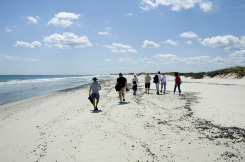
Wilderness areas can be found in the most unexpected of places. Located on the coast of the most densely populated state in the country, Brigantine Wilderness in New Jersey is an example. As part of Edwin B. Forsythe National Wildlife Refuge, the 6,600 acres of salt marsh salt marsh
Salt marshes are found in tidal areas near the coast, where freshwater mixes with saltwater.
Learn more about salt marsh , beach, and dune systems serve as important coastal habitats in an otherwise heavily urbanized place.
Brigantine features one of New Jersey’s largest nesting colonies of piping plovers, and vulnerable species like saltmarsh sparrow and black rail depend upon its salt marshes. In 1977, Congress acknowledged the uniqueness of the Brigantine Wilderness Area by naming it a Class I air-quality area, granting it special protections under the Clean Air Act.
Visiting the Brigantine Wilderness Area
Brigantine has three units: Holgate Peninsula, Little Beach Island, and the Motts-Mullica marsh areas. Holgate is the only area accessible to the public and is open between September 1 and March 15. Brigantine is open for day use only, so extensive preparation is not needed, apart from essentials like water, proper clothing and sun protection. Bring your binoculars and plan to see a tremendous number of shorebirds! Visiting in wintertime also grants the rare opportunity to spot snowy owls along the shoreline.
For more info on the Brigantine Wilderness Area:
Edwin B. Forsythe National Wildlife Refuge
Brigantine unit trail map
3. Great Swamp Wilderness — Great Swamp National Wildlife Refuge, New Jersey
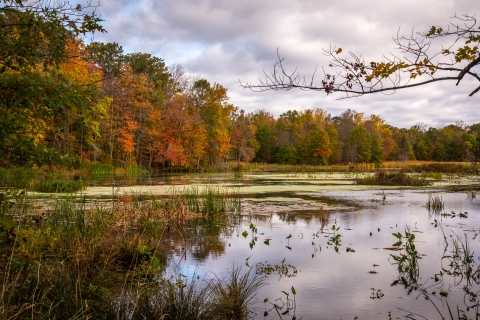
Merely miles away from the urban frenzy of New York City’s Times Square, the Great Swamp Wilderness is a peaceful oasis. Established in the 1960s as part of a grassroots effort to prevent the area from becoming a major metropolitan airport, today Great Swamp’s 3,700 acres serve as outstanding habitat for migratory birds and waterfowl to “nest and rest.” The mosaic of forested uplands and wetlands makes it a haven for dozens of amphibians and reptiles, including the rare bog turtle, spotted turtle, and blue-spotted salamander.
Visiting the Great Swamp Wilderness Area
There are eight miles of designated hiking trails to explore. The more adventurous can stray off the beaten path to discover amazing scenery, but conditions are wet year-round, and hip boots are recommended. The refuge recommends the Blue and Red trail complex (see trail map below), which features vernal pools and amphibians and reptiles galore. Great Swamp is a wonderful way for New Jersey residents to experience wilderness right in their backyard.
For more info on the Great Swamp Wilderness Area:
Great Swamp National Wildlife Refuge
Great Swamp Wilderness map
Great Swamp trail map
4. Monomoy Wilderness — Monomoy National Wildlife Refuge, Massachusetts
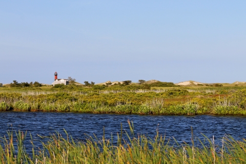
Spanning more than 3,000 acres off the elbow of Cape Cod, Massachusetts, the Monomoy Wilderness within Monomoy National Wildlife Refuge is characterized by a variety of habitats — ocean, salt-and fresh-water marsh, dunes, and ponds.
The wilderness, designated in 1970, serves as important habitat for migratory birds. Dozens of species — including threatened and endangered species like the piping plover and roseate tern — use the wilderness for stopovers, breeding and overwintering. Monomoy also hosts some of the highest concentrations of spawning horseshoe crabs — whose eggs are a vital resource for shorebirds — in the state.
Visiting the Monomoy Wilderness Area
You will need a boat to access Monomoy Wilderness as the area is entirely offshore and spread out over eight miles. Monomoy is wild, remote, and exposed — bring sunscreen, insect repellent, water, and be wary of ticks and poison ivy. For full enjoyment, binoculars and a camera are highly recommended, as Monomoy offers incredible opportunities for birdwatching. Always be sure to give birds space and be respectful of posted areas to keep them safe! Look out for gray seals as well — the area hosts the largest haul-out site for gray seals, with 30–50,000 using the surrounding land and water.
For more info on the Monomoy Wilderness Area:
Monomoy National Wildlife Refuge
Monomoy Wilderness map
During National Wilderness Month, celebrate the natural wonders of our public lands and join us in our commitment to preserving them for generations to come. Check out our page on U.S. Fish and Wildlife Service’s Wilderness areas for more info, and don’t forget to always recreate responsibly by practicing Leave No Trace ethics and principles.