
Photo By/Credit
USFWS
Date Shot/Created
02/25/2025Media Usage Rights/License
Public Domain
Image
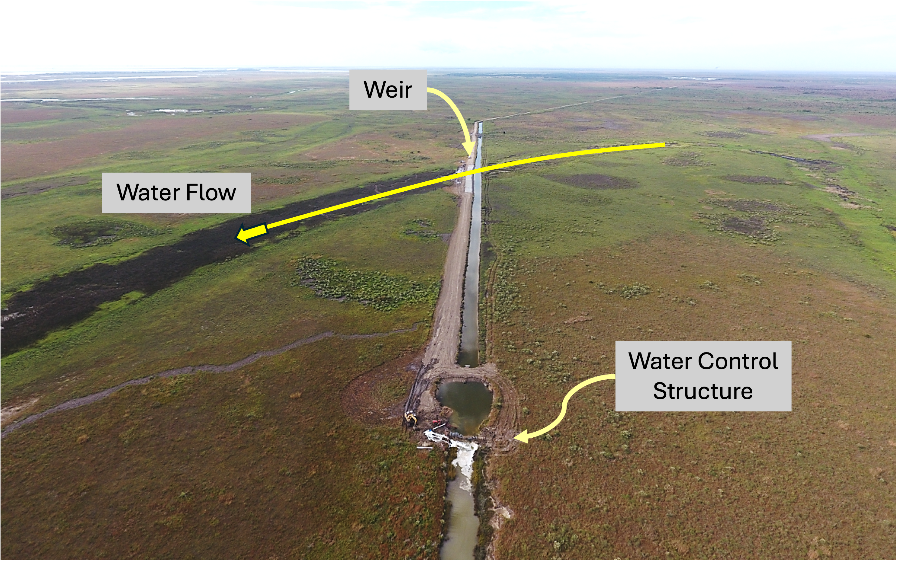
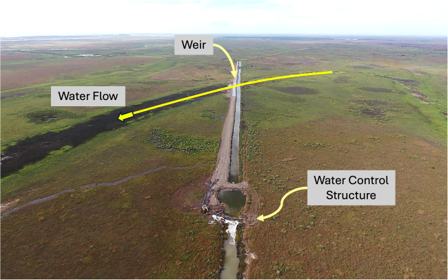
Looking towards the west, the weir will allow rainfall runoff to cross the ditch and flow into the slough (Wharton Bayou). The water control structure raises the elevation of water in the ditch so that flows will travel to the south via the weirs. During extreme flow events, the control structure will allow water to also leave the system and flow into Chocolate Bay directly.