
Photo By/Credit
USFWS
Date Shot/Created
05/27/2022Media Usage Rights/License
Public Domain
Image
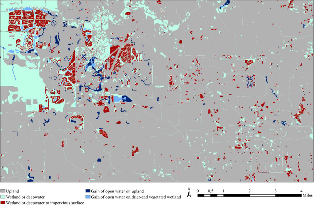
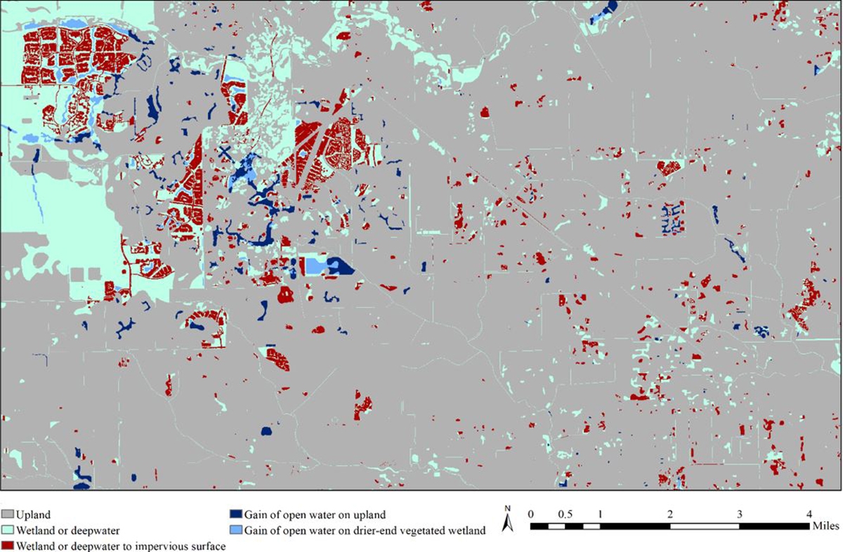
Raster Difference Product for an area near Houston, Texas. Mapped classes highlight areas that have likely experienced land cover change since National Wetlands Inventory Geospatial Dataset production, including loss of wetlands or deepwater to impervious surface (red), gain of open water on upland (dark blue), and gain of open water on drier-end vegetated wetland (light blue). Areas that are likely to have remained upland or wetland/deepwater are shown in gray and cyan, respectively. Pixel scale Difference Products, like this one, can be aggregated to create products at the NWI feature, watershed or census tract scales. Note that a substantial amount of wetlands have likely been lost to development in this geography, and numerous ponds/lakes have been added. This area was last mapped by NWI in 1993 and is an example of an area that could be prioritized for an NWI updates