

Photo By/Credit
USFWS
Date Shot/Created
08/31/2023Media Usage Rights/License
Public Domain
Image
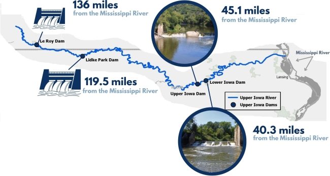
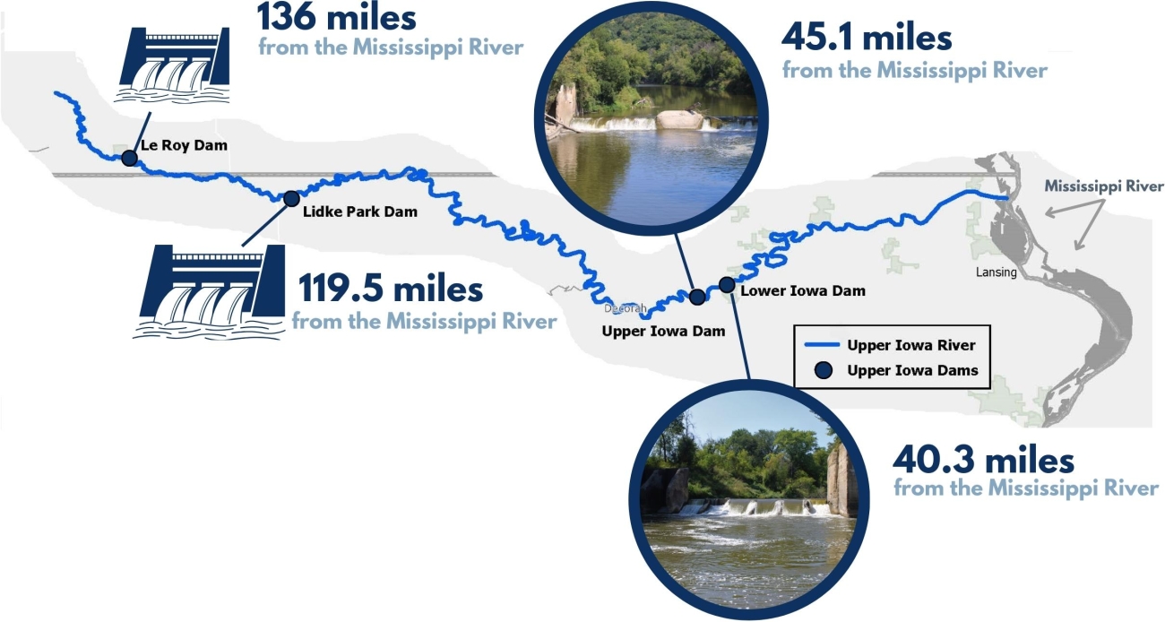
Map shows the distance from each dam to the Mississippi River. It illustrated how many miles would be available for fish to use if the dam was removed or modified to allow for fish passage.
Ecosystem
River/stream