
Photo By/Credit
Roy Hewitt/Map layers from National Geographic, Esri, Garmin, HERE, UNEP-WCMC, USGS, NASA, ES; trails data from NPS
Date Shot/Created
02/14/2022Media Usage Rights/License
Public Domain
Image
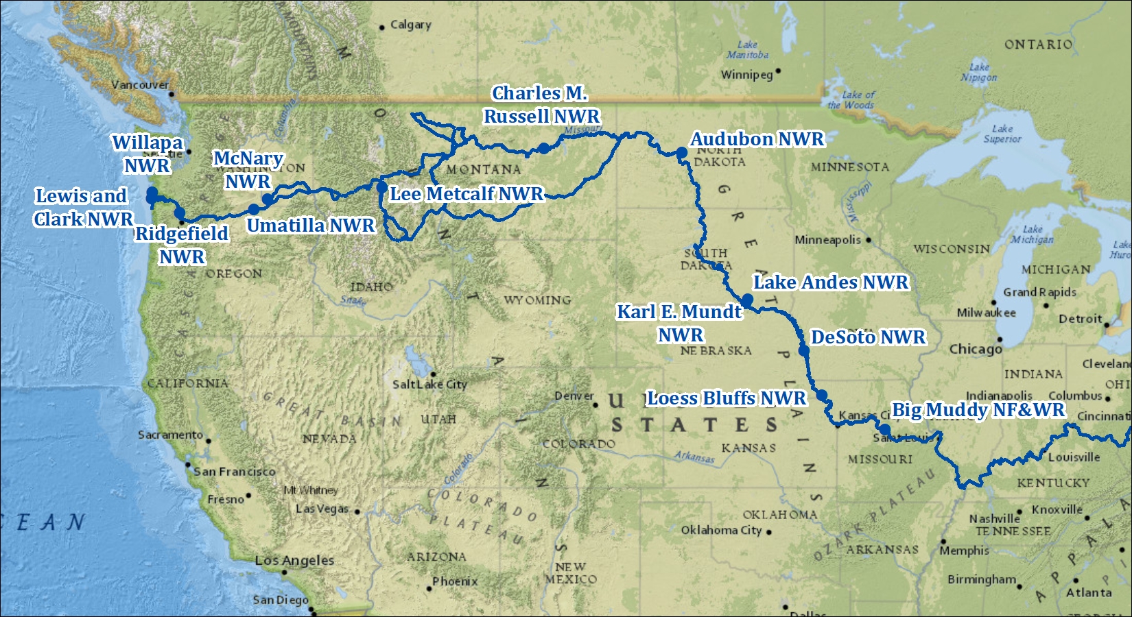
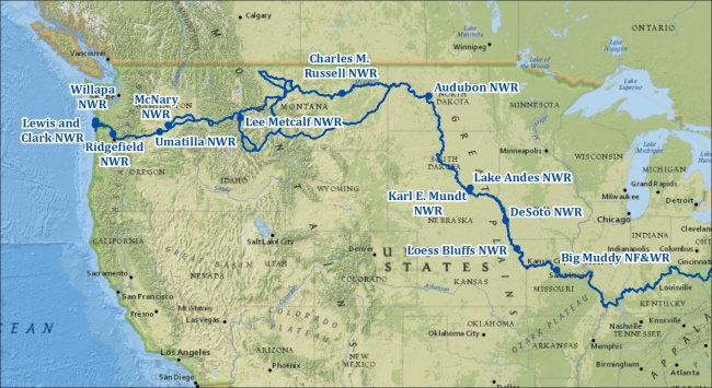
A map of the Lewis and Clark Trail designed to be used with the "National Wildlife Refuges Along the Lewis & Clark Trail" feature story.
Ecosystem
River/stream
Recreational Activity