
Photo By/Credit
USFWS
Date Shot/Created
07/27/2022Media Usage Rights/License
Public Domain
Image
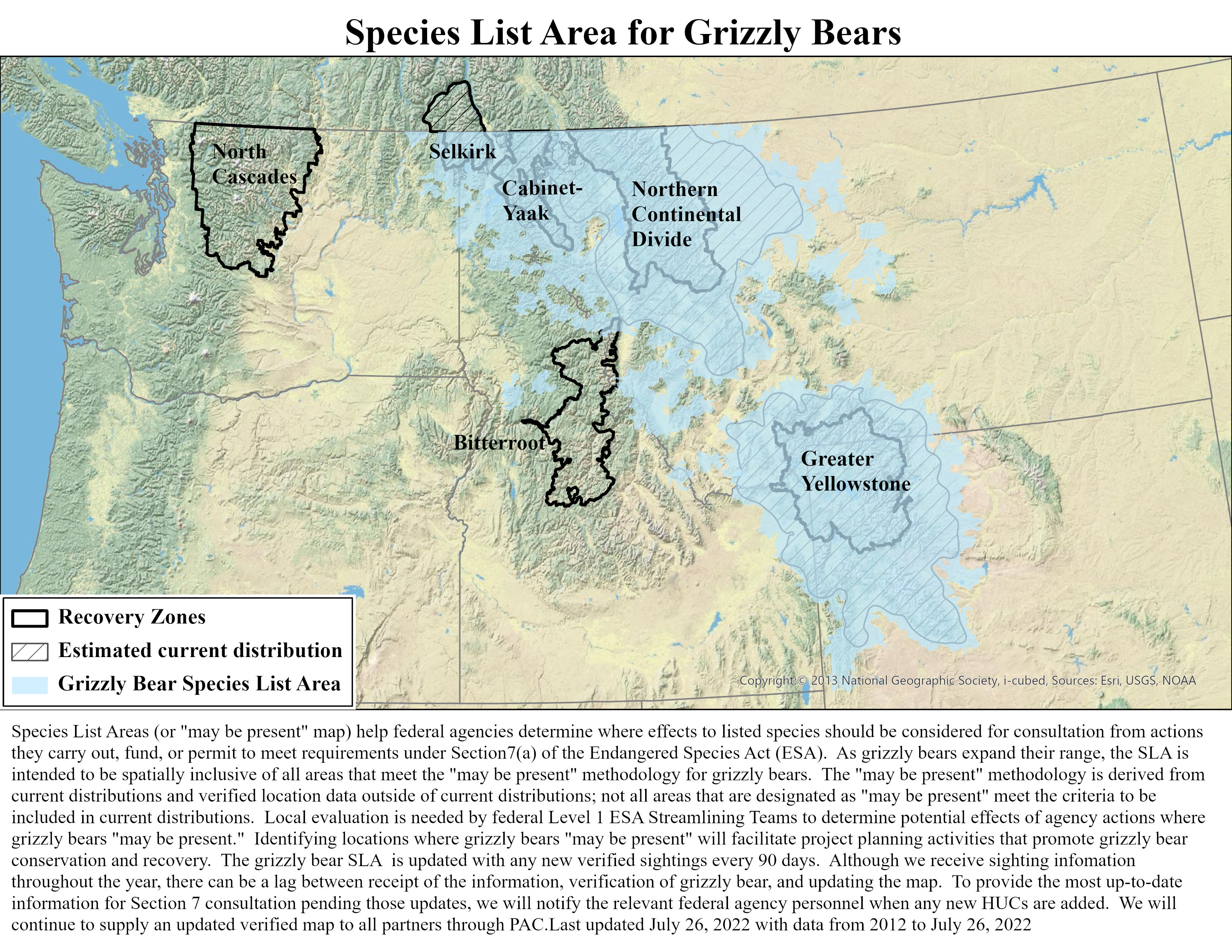
Species List Areas ( or "may be present" map) help federal agencies determine where effects to listed species should be considered for consultation from actions they carry out, fund, or permit to meet requirements under Section7(a) of the Endangered Species Act (ESA). As grizzly bears expand their range, the SLA is intended to be spatially inclusive of all areas that meet the "may be present" methodology for grizzly bears. The "may be present" methodology is derived from current distributions and verified location data outside of current distributions; not all areas that are designated as "may be present" meet the criteria to be included in current distributions. Local evaluation is needed by federal Level 1 ESA Streamlining Teams to determine potential effects of agency actions where grizzly bears "may be present." Identifying locations where grizzly bears "may be present" will facilitate project planning activities that promote grizzly bear conservation and recovery. The grizzly bear SLA is updated with any new verified sightings every 90 days. Although we receive sighting infomation throughout the year, there can be a lag between receipt of the information, verification of grizzly bear, and updating the map. To provide the most up-to-date information for Section 7 consultation pending those updates, we will notify the relevant federal agency personnel when any new HUCs are added. We will continue to supply an updated verified map to all partners through PAC. Last updated July 26, 2022 with data from 2012 to July 26, 2022.
Species