Burney's Trail 1200.pdf

Document - application/pdf
Burney's Trail 1200.pdf

Burney’s Trail

Length: .6 Miles (One Way)

Grade: Gentle to Moderate

Cross Slope: 2.3

Surface: Native

Special Features:

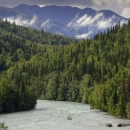
The trail is short and relatively easy with a moderately steep section near its end. This trail passes through aspen and spruce forest. At the end of Burney’s Trail are views of Hidden Lake, Skilak Lake, and the Kenai Mountains. The upper part of Burney’s Trail follows the fires edge of the 2019 Swan Lake Fire.

Attachments
AttachmentSize
Burney's Trail_1200_draft.pdf495.7 KB495.7 KB
Type of document
Refuge Map
Facility
A boat heads down a river lined by forests and mountains.
The Dena’ina people call this special place “Yaghanen” - the good land. It's also known as the Kenai National Wildlife Refuge.  From ice fields and glaciers to tundra, forests, and coastal wetlands, the Kenai Refuge is often called “Alaska in miniature." Biodiversity is unusually high for this...
Program
A bright blue sky obstructed by fluffy white clouds reflected off of a stream shot from inside a kayak
The U.S. Fish and Wildlife Service manages an unparalleled network of public lands and waters called the National Wildlife Refuge System. With more than 570 refuges spanning the country, this system protects iconic species and provides some of the best wildlife viewing opportunities on Earth.