
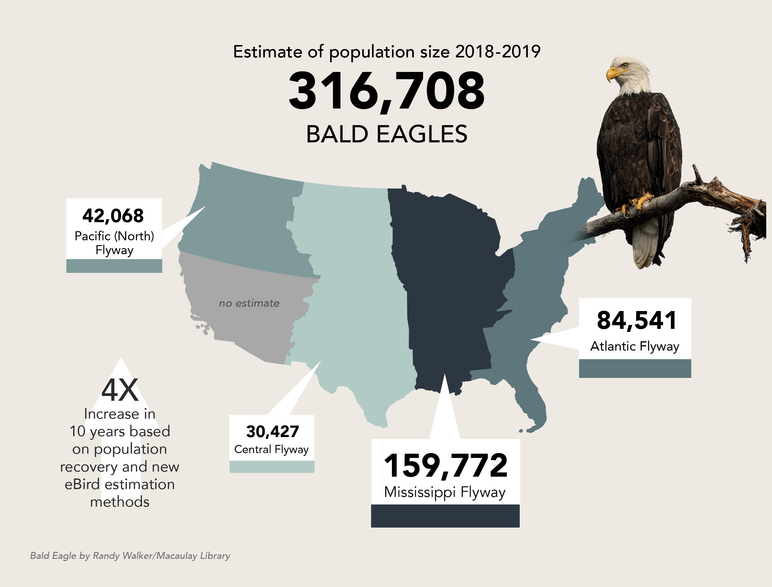
According to the U.S. Fish and Wildlife Service Bald Eagle Population Size 2020 Update report, the population has climbed to 316,700 eagles across the Lower 48 states—quadruple the population estimate in the USFWS 2009 report. Of the four regions included in the estimate, the Mississippi Flyway contains more than half of Bald Eagles. The higher number reflects the conservation success and continuing recovery of Bald Eagles since the 1960s, and also a more accurate estimate made possible by an innovative collaboration with the Cornell Lab of Ornithology. Data scientists at the Cornell Lab of Ornithology created models of eagle population distribution from eBird checklists that were then combined with USFWS aerial surveys. The Cornell Lab's Center for Avian Population Studies developed combined models to generate and provide estimates for the flyway regions, including areas not covered by USFWS aerial surveys.
Publication date