


Trails
Turnbull NWR is an excellent place to visit for those looking to take a leisurely walk, enjoying a hike on one of the several miles of trails, engage in some birding, and bike or drive the scenic auto tour route. Accessible Trails include Pine Lake Loop Trail, Kepple Peninsula Interpretive Trail and Blackhorse Lake Boardwalk.
Restroom facilities can be found at the visitor contact station, across from the Pine Lake Loop trailhead, and along the auto tour route at the East and West Blackhorse trailheads.
Respect wildlife and their habitats by observing and obeying all refuge rules and policies. Do not feed or harass wildlife. If an animal changes its behavior, you’re too close and need to back away. Learn more about Wildlife Watching Etiquette.
For a full list of trails, please stop by the visitor contact station or explore the interactive map. Please remember that all visitors are required to stay on designated trails and roads March 1 through August 15 to reduce disturbance to wildlife and habitats.
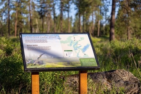
Starting from the east trailhead, northern harriers are often seen soaring above the pine trees and aspen groves. From there the trail follows the edge of 30-Acre Lake, curving through wetland habitat dotted with aspen groves before transitioning to riparian vegetation and Palouse Prairie.
The open prairie provides excellent opportunities to spot wildlife, including deer and moose. Look for footprints and scat on the trail indicating a heavy wildlife presence in the area.
There is limited parking available at both the east and north trailheads.
Trail surface: Dirt and natural surfaces
30-Acre Lake Hiking Trail
Trail surface: Paved with stretches of boardwalk.
Blackhorse Lake Boardwalk
The Blackhorse Trail is a double lollipop loop that traverses the wetlands and forest landscape along Blackhorse Lake, located within the auto tour route. This trail provides visitors with the opportunity to experience the natural beauty and diverse habitats of the area.
Trail Access and Amenities
Trailheads are conveniently located on both sides of the auto tour route. Each parking area is equipped with accessible vault toilets, ensuring comfort for all visitors. The western trailhead shares its parking area with the Blackhorse Lake Boardwalk and features four parking spaces, one of which is accessible.
Rest Areas and Pavilions
As you explore the trail, you will find two covered pavilions that offer rest and shade. The first pavilion is situated near the east trailhead parking area, while the second is located just a short distance from the west trailhead. These pavilions provide ideal spots to pause and enjoy the surrounding scenery.
Trail Highlights
The east loop invites you to stroll through peaceful ponderosa pine forest, offering stunning views of Blackhorse Lake to the north. Meanwhile, the west loop guides you through tranquil marsh habitats, creating excellent opportunities for observing a variety of wildlife.
Connector Segment
A recently opened connector segment links the two loops of the trail. This segment takes you across the southern shore of Blackhorse Lake by way of a water control structure, then beneath a canopy of tall pines. Visitors can enjoy a unique blend of forest, lake, and marsh scenery during their visit.
Blackhorse Trail
Starting at the south trailhead, the route begins as a singletrack path through a seasonally wet marsh with aspen, red-osier dogwood, and cattails. The trail gradually inclines, opening to wide views of grassland habitat before veering sharply north to follow a powerline service road.
Beyond the powerline, the trail continues as a doubletrack, winding through lightly forested ponderosa pine and wetland habitats, providing ample opportunities to spot forest birds, deer and moose. The trail ends at the north trailhead.
Trail surface: Dirt and natural surfaces with sections of gravel. Please note that during spring runoff, sections of the trail may be completely submerged.
Bluebird Trail
The trail begins near the Environmental Education Building and follows the edge of Headquarters Pond, where the forest and riparian habitat meet — creating a prime spot to listen for both wetland and forest songbirds.
Further along, the trail passes several fenced restoration areas, where young aspen and dogwood plants are protected from grazing moose. It then continues past Windmill Pond, a favorite spot for ducks such as pintails and buffleheads. This pond is particularly active during spring and fall migrations.
The trail loops back to the Environmental Education Building via a short stretch of maintenance road.
Trail surface: Dirt and grass with sections of gravel
Headquarters Trail
Depending on the season, visitors can expect to see geese, grebes, and the occasional swan. Intrepid wildlife watchers might even spot one of the many beaver inhabiting the lake.
Trail surface: hard packed dirt and other natural surfaces
Kepple Lake Lookout Trail
About 200 feet in, you’ll find covered pavilion — a perfect spot for a picnic. The shelter overlooks Kepple lake and is encircled by wetland songbirds.
The trail continues to an accessible bird blind overlooking the west side of the lake. From there, you can either return to the parking lot via the paved path or continue to the unpaved section of the Kepple Peninsula Trail to complete the loop through ponderosa pine forest.
Trail surface: Paved with an optional section of dirt single track.
Kepple Peninsula Trail
Trail surface: Gravel
Pine Lake Connector Trail
The lake is home to a variety of wildlife, including several species of duck, trumpeter swans, great blue herons, and beavers. Keep an eye out for lodges and other evidence of beaver activity and listen for red-winged blackbirds, whose songs permeate the lake.
To access the loop, park at the trailhead on Smith Road across from the comfort station where the paved path gently descends into the wetland habitat. The loop is also accessible from a gravel connector path that begins across from the refuge headquarters.
Trail surface: Paved, but please note that natural root growth has caused uneven surfaces in some areas.
Pine Lake Loop Trail
The trail begins at Headquarters Pond in a forested area often visited by moose. About a half mile in, it intersects with the southeast Middle Pine Lake trailhead before continuing toward the loop section. Heading east, the trail opens into vast grasslands dotted with ponderosa pines and mima mounds —small, oval-shaped hills unique to Washington that are famous for their mystery as scientists still debate how they were formed. To the northeast, hikers can take in views of Mt. Spokane.
The path then skirts Stubblefield Lake before entering a lightly forested area. Here, hikers can see scorch marks from prescribed burns, which help improve wildlife habitat and reduce wildfire risk. The trail continues past Lower Pine Lake (Cheever Lake), a prime spot for spotting nesting trumpeter swans, otters, and various duck species. Beyond the lake, the loop reconnects with the main trail.
While some sections may be muddy during spring runoff, they offer rewarding views of wetlands teeming with waterfowl before gradually drying out in summer.
Trail surface: Gravel, dirt, and natural surfaces