Photo By/Credit
USFWS
Date Shot/Created
02/07/2024Media Usage Rights/License
Public Domain
Image
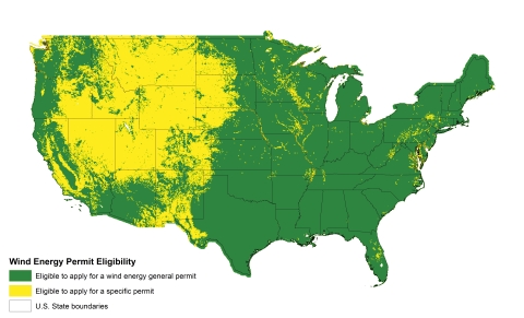
This map of the lower 48 states in the U.S. shows where projects could qualify for general permits or specific permits. Please visit the ArcGIS Online site (https://arcg.is/W8HCH) for a high resolution view of the geographic areas and information on eagle abundance that is used to determine eligibility for general or specific permits. Please note that existing projects that are only eligible for specific permits may be determined to qualify for a general permit upon Service review of their permit application.
