States
MichiganEcosystem
Forest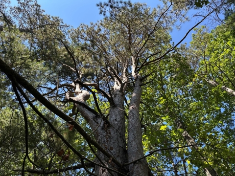
For generations, many species of fish and wildlife in the Great Lakes region flourished as a result of fire-adapted ecosystems. Today, the use of controlled burns can replicate historic habitat conditions, encourage wildlife diversity, help control invasive species invasive species
An invasive species is any plant or animal that has spread or been introduced into a new area where they are, or could, cause harm to the environment, economy, or human, animal, or plant health. Their unwelcome presence can destroy ecosystems and cost millions of dollars.
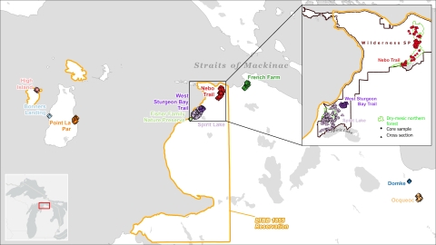
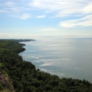
Learn more about invasive species , and prevent larger severe fires. Michigan’s coastal areas along the Straits of Mackinac are an ideal place for scientists to study the history of fire in the area; findings will improve restoration projects and broaden our understanding of fire’s place on the landscape.
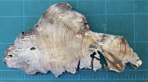
By examining tree rings from living trees and remnant fire-scarred stumps from native red pine (Pinus resinosa), researchers can document evidence of past fires and identify fire dates by comparing them with samples collected from nearby living red pine trees. The samples provide information on the history, frequency and size of fires in these locations and provide valuable insight into how the land was tended by the Indigenous peoples that stewarded the landscape before European colonization and early 20th century fire suppression. This project combines Indigenous Knowledge with Western science techniques to prioritize areas for both cultural fire uses and future invasive species management.
Goals
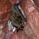
In 2025, the Great Lakes Coastal Program partnered with the Little Traverse Bay Band of Odawa Indians Natural Resource Department, Michigan Natural Features Inventory, Michigan State University and other partners to develop an innovative GIS model that incorporates westernized science and Indigenous Knowledge. While the baseline model has been used to prioritize invasive species control using fire and other methods across state managed lands, the existing model did not include perspective or information from historical analysis or cultural practices carried out by Anishinaabe people. Continuing to develop this model will lead to improved land management actions that will benefit northern long-eared bat, piping plover, black tern, blue-winged teal, Canada warbler and Hine's emerald dragonfly.
Objectives
The Anishinaabe have been living in the Great Lakes Region since time immemorial and have used fire as a tool to steward landscapes as they maintained lifeways and ecosystems for millennia. Indigenous Knowledge that has been shared through oral tradition for generations includes the use of fire to promote forests and blueberry plains. This effort combines Indigenous Knowledge land tending expertise with western science modeling and dendrochronology so that the partners can achieve expand the use of cultural burning practices and fire stewardship for culturally significant locations to restore fire-dependent ecosystems.
Red pine habitat
Naturally occurring red pine trees are typically found in dry-mesic northern forest ecosystems and usually occur in areas that have experienced repeated fires over time. Red pine ecosystems were historically maintained by low-intensity surface fires, with red pines often found alongside hemlock and white pine, as well as various species like oak, maple, birch and aspen trees. In locations that have experienced fire suppression, balsam fir, white spruce trees and red maple are often found in the subcanopy and understory, which compete with red pine trees and hamper red pine reproduction. If left unmanaged, this will lead to red pine trees dying out in these locations. On the ground level, native red pine tree stands are typically dominated by ferns and various species of berry yielding shrubs, including culturally important blueberries and huckleberry.
Timeline
Work began in October of 2024, with sample site selection and preliminary model development. In 2025, the partners focused on literature review and outreach activities with tribes in the region, with modeling development continuing alongside cultural listening sessions and data collection in the summer and fall. The project is expected to finish in between fall of 2026 and fall of 2027.
Modeling a more complete picture
We are working with partners to collect and analyze data at three locations within the 1836 Ceded Territory to further develop this model. Partners from the Little Traverse Bay Bands of Odawa Indians, Michigan Natural Features Inventory, Michigan State University, University of Minnesota and various other groups collected red pine samples from trees and stumps in culturally significant areas within the homeland of the Litte Traverse Bay Bands of Odawa Indians. Fire-scarred remnant samples were cross dated using ring-width chronologies developed from nearby living red pine to determine the exact calendar dates of past fires. This data is then used to build ecological data for input to the modeling efforts.
Our project partners selected culturally important areas with mature red pine trees and stumps because red pine trees produce resin when damaged by fire events. This resin functions as a preservative, which delays decomposition and limits other pathogen activity to the trees to survive damage, including fires, while also preserving the stories contained within the stumps’ tree-rings. These stories are important parts of reconstructing natural and cultural history in the area.
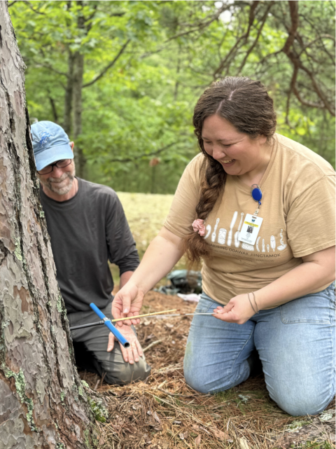
Tree stump samples were removed from fire scarred red pine stumps with a handsaw and core samples were extracted from living trees using an increment borer. In both cases, care was taken not to cause damage to living red pine trees or to historically and culturally important stumps. Tobacco was given at the beginning of each sampling day in recognition of our reciprocal relationship with a landscape that is sharing its stories.
The Setting the Straits on Fire Project is supported by the U.S. Fish and Wildlife Service Coastal Program with matching contributions from the participating partners. Supporting tribal stewardship in the Great Lakes region is a U.S. Fish and Wildlife Service priority.