
Photo By/Credit
USFWS
Date Shot/Created
01/25/2024Media Usage Rights/License
Public Domain
Image
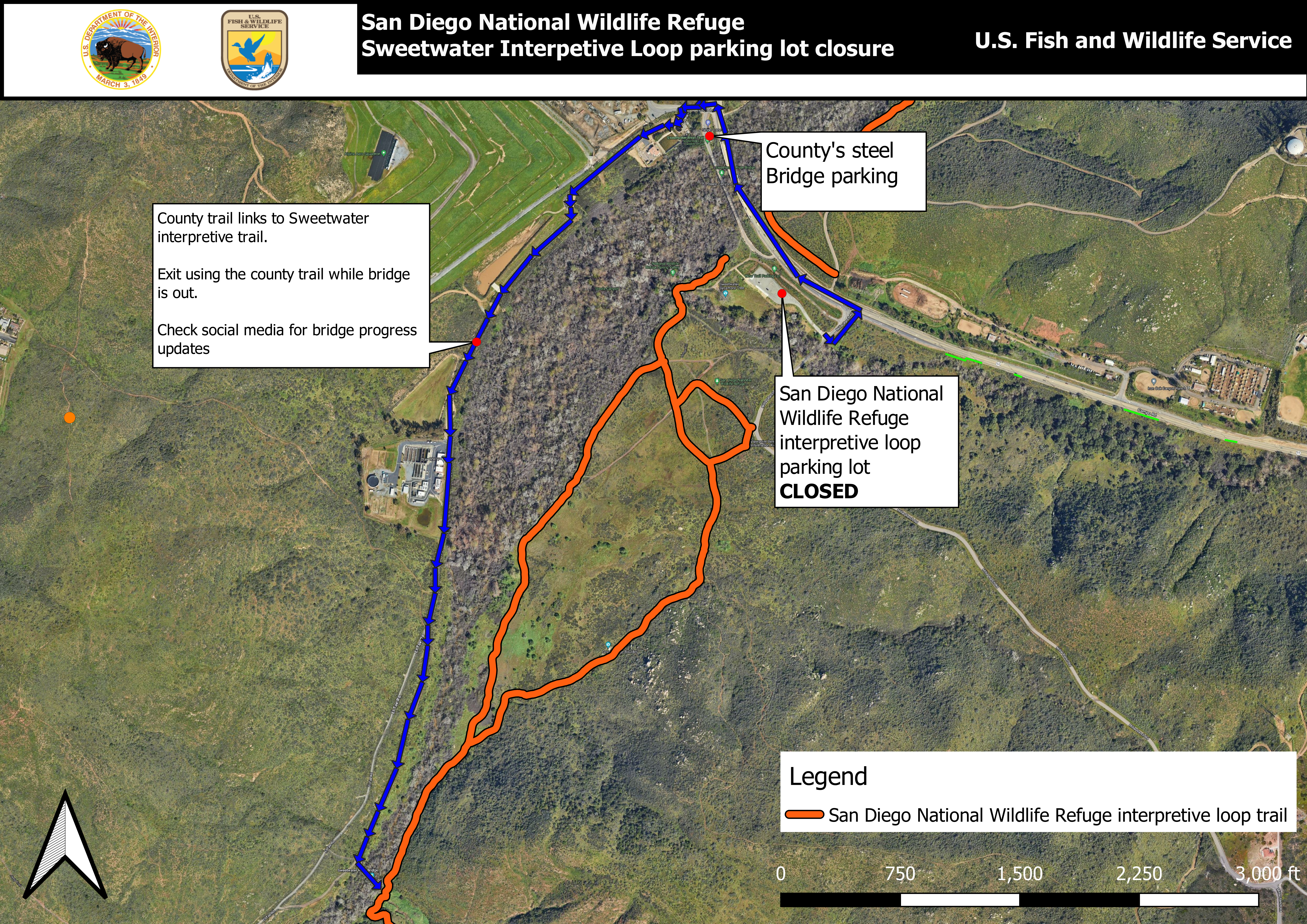
Map of San Diego National Wildlife Refuge Sweetwater Interpretive Loop parking closure. The Sweetwater Interpretive Loop trail is shown in red. The County trail connecting to the interpretive loop is shown in blue. Text bubble for the county trail reads "County trail links to Sweetwater interpretive trail. Exit using the county trail while bridge is out. Check social media for bridge progress updates." Towards the north east of this, a text bubble point the county's parking and just below, a text bubble points to the closed refuge parking lot. The legend is on the bottom right and shows the Sweetwater Interpretive Loop trail in red. For further assistance understanding the map, contact Refuge Manager Dwane Binns 619-385-1190.